Download
1 / 16
160 likes | 186 Views
Presentation on creating a Geospatial Profile for chief architects to enhance geospatial understanding and interoperability.

E N D
Geospatial Community of Practice:Development of an FEA Geospatial Profile Briefing for Chief Architects Forum July 21, 2005 Douglas Nebert U.S. Federal Geographic Data Committee Secretariat
Presentation Outline • Geospatial Profile of the FEA - Introduction • Problem and Solution context • Community of Practice Objectives, Scope, Approach • Status and Timelines • Discussion
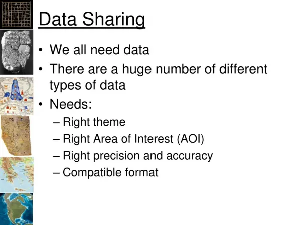
Problem Statement • Geographic information is used in a majority of business settings in and outside of government • Geographic information and services are not addressed consistently within and between organizations • Interoperability among providers and consumers of geographic data and services requires a common understanding of semantics and functional capabilities • Development of common multi-jurisdictional approaches to the use of geographic information and services requires inclusion in Enterprise Architecture
Solution: Creation of guidance for geospatial capabilities in the FEA • Develop a Geospatial Profile document for the FEA to support its cross-cutting nature, along the lines of the Profiles being developed for Records Management and Security and Privacy • Audience: Chief Architects, individuals in the agency CIO office responsible for development for common Enterprise Architectures in the federal and non-federal settings
Geospatial Overlay Shared lines of business Integrated Data and Information “To Be State” DOI USDA Using the FEA-DRM Recreation DOE Natural Resource HHS Health Emission Consumer Safety Public Health Monitoring Consumer Health & Safety Recreational Resource Management & Tourism Pollution Prevention & Control Energy Research
Geospatial Community of Practice • Convened a workgroup of federal and non-federal participants to develop a Geospatial Profile of the FEA • Affiliated with the Architecture and Infrastructure Committee (AIC) of the Federal CIO Council • Ad-hoc Working Group of the Federal Geographic Data Committee – a trans-governmental coordinating body for geospatial practices • Membership includes major federal agencies, state and local members, professional organizations (NSGIC, NACO, NASCIO, GITA)
Geospatial Community of PracticeObjectives: • Encourage communication between participants • Examine and promote awareness of current EA practices • Leverage successful EA work to advance the development of the Geospatial Profile • Identify and pursue opportunities to validate the Geospatial Profile best practices • Identify opportunities to leverage investments
GEA CoP WG Overview: Scope • The development and advancement of a national Geospatial Profile for enterprise architecture • Establishing a cross-cutting guidance document useful to all levels of government • To complement the work of the OMB in advancing the FEA • To promote practical examples and best practices to supplement the Profile
Current Approach • Build consensus on common terminology, concepts, and scope of project from contributed documentation and experience • Create an efficient inter-organizational EA approach with a geospatial perspective • Highlight scenarios (archetypal business processes) that address and justify critical provider and user processes and the data behind them • Create “Geospatial Profile of the FEA” document as guidance to agency architects to include common design patterns for geospatial data and services • Demonstrate geospatial EA touch points through interoperability experiments
DISDI DHS EPA Charlotte, NC USDA FSA Missouri Pennsylvania USFS USGS National Map Kentucky LC NOAA Agency Presentations so far
Status of Geospatial in EA • All participating agencies are developing an EA • Most recognize unofficially the presence of geospatial capabilities • Some agencies highlight geospatial artifacts in data and services • Recognize a need to identify common geospatial patterns for use across government
Relationship to other activities The National Map (USGS) • Geodata.gov Portal Functions: • Search on metadata (M) • Display of integrated maps • Access to data download Geospatial One-Stop Provides nationally consistent maps and data M FGDC Publish metadata about maps, data, and Web services Coordinate common “Framework” geographic data Develops policies for data sharing and access Federal Data Providers State/Local Data Providers M M
Initiative Status, as of July 21, 2005 • Drafted a Charter for a Geospatial WG under the FGDC and CIO AIC • Refined a work plan to create a Profile document • Developed outline for Profile document • Identified an Emergency Management scenario as the context to be followed by examples in the Profile document • Convened writing teams for the Introduction section, and to provide geospatial guidance for each of the relevant FEA Reference Models
Introduction Background Scope Audience Existing policy and drivers (legislation, exec orders, ...) Objectives Geospatial Basics Cross-cutting nature of geospatial Common Scenario Core terminology Geospatial Capabilities in the FEA Reference Models How geospatial interacts with the various RMs Business Reference Model Performance Reference Model Service Reference Model Technical Reference Model Data Reference Model Relationship to other FEA profiles Application of this Profile Common scenario and related use cases Examples Appendix A: References Appendix B: Acronym List Appendix C: Terminology (Glossary) Geospatial Profile Outline
General timelines • July-August: Core Profile development, subgroups for each Reference Model • September: Creation of consolidated document, release for public review • October-December: Refine Profile Version 1.0, initiate operational demonstrations of EA-nominated services and data
Initiative co-leads • Brenda Smith, EPA • Ivan DeLoatch, FGDC For more information contact: Doug Nebert (ddnebert@fgdc.gov)