Download
1 / 38
400 likes | 641 Views
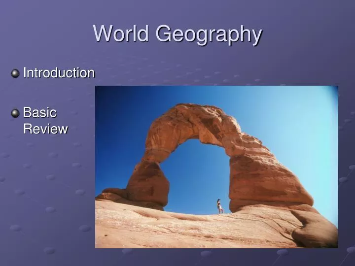
World Geography. Introduction Basic Review. Engage. Pick a place in the world you have visited or studied. What did you see or learn about that place? What is the landscape like? What is the weather like? What are the people like? What is the vegetation or animals like?.

E N D
World Geography Introduction Basic Review
Engage • Pick a place in the world you have visited or studied. • What did you see or learn about that place? • What is the landscape like? • What is the weather like? • What are the people like? • What is the vegetation or animals like?
What is Geography? • Geography is the study of place and space. • Study of human activity, the natural environment, and the relationship between the two (human-environment interactions). • Geographers look at where things are and why they are there.
Physical v. Cultural Geography • Physical Geography is the study of the Natural Landscapeof the Earth • Cultural Geography is the study of the Human Landscape of the Earth.
Maps and Globes – What’s the difference? • Maps – “two dimensional” – usually only show parts of the Earth’s surface. • Globes – “three dimensional” representation of the Earth, shows whole surface.
Who makes maps? • Cartographers are people who make maps.
What is an Atlas? • An ATLAS is a book of maps. • There is an Atlas at the beginning of your textbook. • Knowing how to use it will help you a lot this year!
Parts of A Map • Title – explains the subject of the map • Compass Rose – shows the “Cardinal Directions”, meaning North, South, East, and West • Legend or “Key” - shows and explains the symbols used on the map • Scale – shows the true size of the objects shown on the map
Activity: Identify the Map Parts Number your paper #1-#4. Identify and label each part of the map below, using the terms you just learned.
What main types of maps are there? PHYSICALMAPS POLITICAL MAPS THEMATIC MAPS
Physical Maps • Show natural features such as landforms and physical borders; lakes, rivers, mountain ranges, and things that were around before humans • Physical Borders – Borders defined by a physical feature • Example - Rio Grande River, between USA and Mexico
Activity 2 – Using Physical Maps Use the World Physical Map on p RA4-RA5 of your textbook to answer these questions on your own paper. • What mountain range separates European Russia from Asia? 2. What two mountain ranges run the length of North and South America?
Political Maps Show features on the earth’s surface that humans created. Examples of things on a political map? • Political Borders – are borders created by governments • National and State Borders • City Limits, capitals
Activity 3 – Using Political Maps Use the World Political Map on p. RA6-RA7 of your textbook to answer these questions. • What are the two countries that lie on the Himalayan border between India and China? • What is the name of the largest island in the world? • How many countries share a border with Brazil?
Thematic Maps • Thematic maps can be tricky, there are many different kinds. • They all do the same thing… they show information Some common thematic maps: • Population maps • Weather maps • Resource maps • Topographic maps
5 Themes • Geographers study the world by looking at • Location • Place • Region • Movement • Human-Environment Interaction
#1 LocationWhere is it? Absolute Location • is the exact place on the earth where a geographic feature is found. • 3322 RR 620 South Austin, TX 78738 • LTHS Room J205 • Latitude = 30 degrees, 19.7 minutes North • Long = 97 degrees, 58.2 minutes West Relative Location • describes a place in comparison to other places around it. • Ex. Next door to the Wendy’s
#2 Place – What is it like? • describes the physical features and cultural characteristics of a location.
#3 Region – How are places similar or different? • describes an area of the earth’s surface with similar characteristics, usually more than one.
GEOGRAPHIC REGIONS: What defines a region? • physical (natural) characteristics • landforms, climate, vegetation • human (cultural) characteristics • language, religion, ethnicity, population
Sub-Regions • Further classification of Regions based upon physical features and human characteristics. Examples: The United States is in the North American Region. However, the U.S. has several sub-regions: Northeast, Midwest, South, etc.
#4 Movement • How and why people, plants, animals, and ideas move through time and place?
#5 Human–Environment Interaction • People learn to use what the environment offers them and to change that environment to meet their needs.
How to remember the 5 themes! • M = Movement • R = Region • H = Human Interaction • E = Environment Interaction • L = Location • P = Place
What are important lines on “Geographer’s Grid”? • Equator – Divides the earth between Northern Hemisphere and Southern Hemisphere • Prime Meridian – Divides the Eastern Hemisphere from Western Hemisphere
What is a hemisphere? • One half of the Earth. • North, South, East, West all have hemispheres.
Where are the “The Tropics”? • Tropic of Cancer – 23.5* North of Equator • Sun’s most northern location on June 21st • Tropic of Capricorn – 23.5* South of Equator • Sun’s most southern location on December 21st
Where are the “Polar Circles”? • Arctic Circle – 66.5* North of the Equator • begins the north polar region • Antarctic Circle – 66.5* South of the Equator • begins South polar regions
What is “Latitude and Longitude”? • It is a grid for finding your • location on the Earth. • Like “X and Y” from the grid in math class. • Or like a football field. • Or like the game “Battleship”
What is Latitude? • Run parallel to Equator • Measures North and South • 90 degrees North latitude • 90 degrees South latitude Important lines of Latitude: • Equator • Tropic of Cancer • Tropic of Capricorn 4. Arctic Circle • Antarctic Circle
What is Longitude? • Run parallel to Prime Meridian • Measures East and West • 180 degrees of East longitude • 180 degrees of West longitude • Total = 360 degree circle • All lines meet at North Pole and stretch to South Pole
How do you use Latitude and Longitude to find your way? • Find the right hemispheres (N, S, E, W). • Trace latitude and longitude till they meet. • FOLLOW THE CURVE!
Classwork • Latitude and Longitude Worksheet • Finish 7 Continents and 5 Oceans Map