Download
1 / 24
240 likes | 386 Views
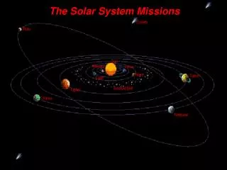
Mars: Sources of Data from the Robotic Missions IV. Geography 494-01 S/07 Dr. Christine M. Rodrigue. Mars: Data from Robotic Missions. ESA Mars Express Orbiter (2003-present) Main objective is to search for sub-surface water from orbit and deploy a lander onto the Martian surface

E N D
Mars: Sources of Data from the Robotic Missions IV Geography 494-01 S/07 Dr. Christine M. Rodrigue C.M. Rodrigue, 2007 Geography, CSULB
Mars: Data from Robotic Missions • ESA Mars Express Orbiter (2003-present) • Main objective is to search for sub-surface water from orbit and deploy a lander onto the Martian surface • Beagle 2 lander crashed in late 2003: It was to look for life signs C.M. Rodrigue, 2007 Geography, CSULB
Mars: Data from Robotic Missions • ESA Mars Express Orbiter (2003-present) • Orbiter instrumentation: • Analyser of Space Plasmas and Energetic Atoms (ASPERA-3) • High/Super Resolution Stereo Colour Imager (HSRS) • Radio Science Experiment (MaRS) • Subsurface Sounding Radar/Altimeter (MARSIS) • IR Mineralogical Mapping Spectrometer (OMEGA) • Planetary Fourier Spectrometer (PFS) • UV and IR Atmospheric Spectrometer (SPICAM) C.M. Rodrigue, 2007 Geography, CSULB
Mars: Data from Robotic Missions • ESA Mars Express Orbiter (2003-present) • Orbiter instrumentation: • Analyser of Space Plasmas and Energetic Atoms (ASPERA-3) • High/Super Resolution Stereo Colour Imager (HSRS) • Originally developed for the Mars 96 mission: The duplicate, since upgraded • 9 CCD line sensors in pushbroom swaths • Each of these arrays has 5184 7 micron pixels (10 m on ground) • Super Resolution Channel telescope with 1024 x 1032 CCD array that results in 2.3 m pixels on the ground • Multispectral visible light to near infrared imaging plus panchromatic imaging by the forward and aft line sensors • Radio Science Experiment (MaRS) • Subsurface Sounding Radar/Altimeter (MARSIS) • IR Mineralogical Mapping Spectrometer (OMEGA) • Planetary Fourier Spectrometer (PFS) • UV and IR Atmospheric Spectrometer (SPICAM) C.M. Rodrigue, 2007 Geography, CSULB
Mars: Data from Robotic Missions • ESA High Resolution Stereo Colour imager • New topographic maps • Contour lines: “first ‘hikers’ maps’ of Mars”! Here’s 1:200,000 C.M. Rodrigue, 2007 Geography, CSULB
Mars: Data from Robotic Missions • ESA High Resolution Stereo Colour imager • New topographic maps • Contour lines: “first ‘hikers’ maps’ of Mars”! Here’s 1:100,000 C.M. Rodrigue, 2007 Geography, CSULB
Mars: Data from Robotic Missions • ESA High Resolution Stereo Colour imager • New topographic maps • Contour lines: “first ‘hikers’ maps’ of Mars”! And 1:50,000 C.M. Rodrigue, 2007 Geography, CSULB
Mars: Data from Robotic Missions • ESA Mars Express Orbiter (2003-present) • Orbiter instrumentation: • Analyser of Space Plasmas and Energetic Atoms (ASPERA-3) • High/Super Resolution Stereo Colour Imager (HSRS) • Radio Science Experiment (MaRS) • Subsurface Sounding Radar/Altimeter (MARSIS) • Ground-penetrating radar (1.3-5.5 MHz) • Deployed from end of 40 m antenna to generate long wl • Radio waves reflect back upward from any surface discontinuity: surface itself, liquid layers underground • IR Mineralogical Mapping Spectrometer (OMEGA) • Planetary Fourier Spectrometer (PFS) • UV and IR Atmospheric Spectrometer (SPICAM) C.M. Rodrigue, 2007 Geography, CSULB
Mars: Data from Robotic Missions • ESA MARSIS • The idea behind ground-penetrating radar C.M. Rodrigue, 2007 Geography, CSULB
Mars: Data from Robotic Missions • ESA MARSIS • Has found crater basin structures buried in Chryse Planitia C.M. Rodrigue, 2007 Geography, CSULB
Mars: Data from Robotic Missions • ESA MARSIS • Has found crater basin structures buried in Chryse – dark ovals C.M. Rodrigue, 2007 Geography, CSULB
Mars: Data from Robotic Missions • ESA Mars Express Orbiter (2003-present) • Orbiter instrumentation: • Analyser of Space Plasmas and Energetic Atoms (ASPERA-3) • High/Super Resolution Stereo Colour Imager (HSRS) • Radio Science Experiment (MaRS) • Subsurface Sounding Radar/Altimeter (MARSIS) • IR Mineralogical Mapping Spectrometer (OMEGA) • Building map of surface composition in 100 m squares • Determines mineral composition through reflected VL & IR (0.5-5.2 microns) • Because reflected surface light must pass through atmosphere, OMEGA can also infer atmospheric composition • Planetary Fourier Spectrometer (PFS) • UV and IR Atmospheric Spectrometer (SPICAM) C.M. Rodrigue, 2007 Geography, CSULB
Mars: Data from Robotic Missions • ESA IR Mineralogical Mapping Spectrometer (OMEGA) • Building map of surface composition in 100 m squares • One focus is water-related/water-affected minerals • Water content of the rocks and clay minerals • Abundance of non-silicate materials (carbonates, nitrates, hydrated sufates), which imply standing water or water alteration C.M. Rodrigue, 2007 Geography, CSULB
Mars: Data from Robotic Missions • ESA IR Mineralogical Mapping Spectrometer (OMEGA) • Building map of surface composition in 100 m squares • Another focus is the carbon dioxide/water composition of the caps • Water does not absorb ~2 microns, and carbon dioxide does • South polar cap shows absorption at 2, implying CO2 (A & B) • Spectrum C shows absorption where A & B don’t ~1.5 microns, indicating more water ice in the mix there C.M. Rodrigue, 2007 Geography, CSULB
Mars: Data from Robotic Missions • ESA Mars Express Orbiter (2003-present) • Orbiter instrumentation: • Analyser of Space Plasmas and Energetic Atoms (ASPERA-3) • High/Super Resolution Stereo Colour Imager (HSRS) • Radio Science Experiment (MaRS) • Subsurface Sounding Radar/Altimeter (MARSIS) • IR Mineralogical Mapping Spectrometer (OMEGA) • Planetary Fourier Spectrometer (PFS) • Another spectrometer, overlapping part of OMEGA’s spectrum but also including spectra far deeper into the infrared: 1.2-5 microns and then 5-45 microns • This spectrometer focusses more on the atmosphere’s temperature and composition, rather than the surface • UV and IR Atmospheric Spectrometer (SPICAM) C.M. Rodrigue, 2007 Geography, CSULB
Mars: Data from Robotic Missions • ESA Planetary Fourier Spectrometer (PFS) • Vertical temperature structure of Martian atmosphere C.M. Rodrigue, 2007 Geography, CSULB
Mars: Data from Robotic Missions • ESA Planetary Fourier Spectrometer (PFS) • Optical thickness of Martian atmospheric dust (with surface elevation below the reading also shown) C.M. Rodrigue, 2007 Geography, CSULB
Mars: Data from Robotic Missions • ESA Planetary Fourier Spectrometer (PFS) • Water vapor abundance • Concentrated in Arabia Terra, Elysium Planum, Arcadia Memnonia C.M. Rodrigue, 2007 Geography, CSULB
Mars: Data from Robotic Missions • ESA Planetary Fourier Spectrometer (PFS) • Detection of methane (CH4): the little down blips ~3018 wn/cm • There are also 3 water lines at 3003.5, 3022, and 3026 • There are 2 solar lines at 3012 and 3014 • Methane (and formaldehyde or CH2O) may indicate either life or recent vulcanism, either of which would be really interesting news C.M. Rodrigue, 2007 Geography, CSULB
Mars: Data from Robotic Missions • ESA Mars Express Orbiter (2003-present) • Orbiter instrumentation: • Analyser of Space Plasmas and Energetic Atoms (ASPERA-3) • High/Super Resolution Stereo Colour Imager (HSRS) • Radio Science Experiment (MaRS) • Subsurface Sounding Radar/Altimeter (MARSIS) • IR Mineralogical Mapping Spectrometer (OMEGA) • Planetary Fourier Spectrometer (PFS) • UV and IR Atmospheric Spectrometer (SPICAM) • Yet another spectrometer, this one collecting spectra in the UV as well as the IR tp study atmosphere and ionosphere • 0.118 - 0.32 in the ultraviolet • 1.1 - 1.7 in the serial infrared (what wireless devices use) C.M. Rodrigue, 2007 Geography, CSULB
Mars: Data from Robotic Missions • ESA Mars Express Orbiter (2003-present) • UV and IR Atmospheric Spectrometer (SPICAM): • Has detected an aurora on Mars for the first time, in the Terra Cimmeria region of Mars' southern hemisphere • This is one of thelocalized and intense magnetic anomalies, what’s left of Mars’ global magnetic field C.M. Rodrigue, 2007 Geography, CSULB
Mars: Data from Robotic Missions • ESA Mars Express Orbiter (2003-present) • UV and IR Atmospheric Spectrometer (SPICAM): • Has detected ozone, especially above the higher latitudes C.M. Rodrigue, 2007 Geography, CSULB
Mars: Data from Robotic Missions • ESA Mars Express Orbiter (2003-present) • UV and IR Atmospheric Spectrometer (SPICAM): • Has confirmed what was long suspected: There is water ice on the south polar cap • Could be a thin veneer of water ice above the CO2 ice • Could be a large slab under the CO2 ice visible through “Swiss cheese” holes in the CO2 ice C.M. Rodrigue, 2007 Geography, CSULB
Mars: Data from Robotic Missions • ESA Rosetta Mission • To orbit Comet 67 P/Churyumov- Gerasimenko as it comes into the inner solar system and put a lander on its surface • Did a gravity-assist swing-by Mars on 25 February • Carries the OSIRIS camera system (wide angle and narrow angle) C.M. Rodrigue, 2007 Geography, CSULB