Latin America
320 likes | 478 Views
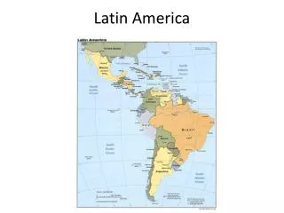
Latin America. Geography. Rio Grande. Rio Grande del Norte 1,885 miles long San Juan Mts. in Colorado to the Gulf of Mexico Mostly too shallow to navigate. Andes Mountains. Entire western edge of South America World’s longest continuous range Reach 22,000 feet – second tallest in world

Latin America
E N D
Presentation Transcript
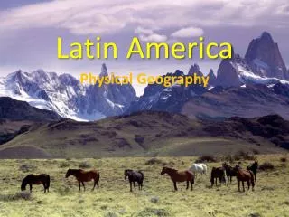
Latin America Geography
Rio Grande • Rio Grande del Norte • 1,885 miles long • San Juan Mts. in Colorado to the Gulf of Mexico • Mostly too shallow to navigate
Andes Mountains • Entire western edge of South America • World’s longest continuous range • Reach 22,000 feet – second tallest in world • Aconcagua – highest mountain in the western hemisphere
Sierra Madre Occidental • Western part of the main mountains of Mexico • Start in Arizona • 1,000 miles long • Steep canyons • mining
Plateau of Mexico • 700 miles long • Enclosed by the Sierra Madre • 4000 - 8000 ft. high • Several drainage basins
Guiana Highlands • Mountainous Plateau • Between the Orinoco and Amazon River basins • Waterfalls! • Mineral rich area
Lake Maracaibo • Major transportation route • Enclosed by mountains • Largest lake in South America • 5,100 sq. miles
Orinoco River • Guiana Highlands to the Atlantic Ocean • 1,600 miles • Ending in a marshy delta • Divided into two parts by “cataracts”
Yucatan Peninsula • Coast separated by the Gulf of Mexico and Caribbean Sea • Hardwood forests • Henequen farming
Amazon River • Starts in the Andes • 3,900 miles to Atlantic • Carries 1/5 world’s fresh water • Crosses the largest rainforest in the world
Sierra Madre Oriental • Eastern part of the Sierra Madre • Begins just south of the US border • 700 miles long • Mexico’s highest peak at 18,700 ft.
Lake Titicaca • Located in the Andes • 12,500 above sea level • Water maintains a constant 52 degrees • Traditional birthplace of the Inca
Gran Chaco • Lowland plain • 250,000 square miles • Dry land • Swampy during rainy period • Oil!
Patagonia • 300,000 square miles • Wide plateau • Gradual increase in elevation ending in dramatic cliffs • Sheep herding!
Pampas • Grassy Plains • 300,000 sq. miles • Agriculture! • Cattle grazing since 1550’s!
Atacama Desert • Bordered by Andes and Pacific Mts. • 600 miles • No vegetation • No rainfall in some places, ever. • Mining!
Amazon Basin • Covers 35% of South America • Funnels water to the Amazon River • Vegetation here produces ½ of the worlds oxygen supply
Lake Nicaragua • Largest lake in Central America • 3,089 sq miles. • Was once part of the Caribbean Sea • Volcanoes, small islands • Adapted Fish
Rio de la Plata (silver) • Estuary – unique ecosystem formed by the meeting of fresh and salt water sources • Formed by the Parana and Uruguay Rivers • 170 mi. long • 120 mi. wide at ocean
Tierra del Fuego • Archipelago – chain of islands • Strait of Magellan • 28,476 sq. mi. area • Sheep herding and Oil
Isthmus of Panama • Isthmus – a narrow strip of land that connects two larger land masses • 40 miles wide • Makes up the country of Panama