ESPON DATABASE PROJECT
320 likes | 487 Views
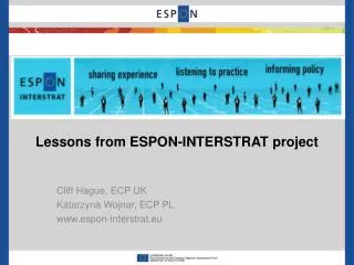
ESPON DATABASE PROJECT. TIGER MEETING Nicolas Lambert, Ronan Ysebaert UMS 2414 RIATE. Why is ESPON Database Project here today?. YOU ARE IN ESPON, YOU HAVE TO FOLLOW SOME BASIC RULES…. Data Metadata Creation of maps Guidelines in cartography.

ESPON DATABASE PROJECT
E N D
Presentation Transcript
ESPON DATABASE PROJECT TIGER MEETING Nicolas Lambert, Ronan Ysebaert UMS 2414 RIATE
Why is ESPON Database Project here today? YOU ARE IN ESPON, YOU HAVE TO FOLLOW SOME BASIC RULES… • Data • Metadata • Creation of maps • Guidelines in cartography BUT YOU ARE NOT ALONE! ESPON DATABASE WILL HELP YOU… • Existing information in ESPON • Last developments of ESPON DB Project (new indicators) • Advices for structuringyour data and metadata
Maping Guide + Guidance paper Starting package Deliveredat the beginning of the project MapKits Basic indicators
Starting package 1/3: DATA – NUTS Registration (Login & Password) FULL ACCESS http://database.espon.eu/database
A user friendly query system Xls file
Starting package 1/3: DATA – WORLD ESPON Data available in the DVD-ROM produced in June 2010 ESPON 2013 DATABASE Project: • Listing of countries of the World accordingdifferent classifications • Someindicators (agepyramid, HDI index, CO2 emissions…) ESPON 3.4.1 Database: • Flowsmatrixes(trade, passengers…) • Distance matrixes (table of belonging, distances…) • Country profile (Demography, GDP…)
Starting package 2/3: MAPKIT 3 formats: ArcGis, Philcarto, Quantum Gis For 5 types of study areas: World Can be improved on your demand !!
Starting package 2/3: MAPKIT 3 formats: ArcGis, Philcarto, Quantum Gis For 5 types of study areas: World, Euromed Can be improved on your demand !!
Starting package 2/3: MAPKIT 3 formats: ArcGis, Philcarto, Quantum Gis For 5 types of study areas: World, Euromed, ESPON Area Can be improved on your demand !!
Starting package 2/3: MAPKIT 3 formats: ArcGis, Philcarto, Quantum Gis For 5 types of study areas: World, Euromed, ESPON Area, ESPON Area+ CC and Western Balkans Can be improved on your demand !!
Starting package 2/3: MAPKIT 3 formats: ArcGis, Philcarto, Quantum Gis For 5 types of study areas: World, Euromed, ESPON Area, ESPON Area+ CC and Western Balkans Case studies (LAU2) Can be improved on your demand !!
Examples of layout World city network, 2010 Discontinuities of GDP per capita, 2008
Examples of layout Structural types of rural areas, 2006 Unemployment rate, 2010
Examples of layout Population change, 2001-2006
Starting package 3/3: MAPPING GUIDE, & GUIDANCE PAPER MAPPING GUIDE: CONTENTS 3 PARTS Maps and ESPON 2013. This part presents the content of the map-kit tool (“European, local and global”). All the elements that have to be necessarily represented on each map are described. • Enhancing information. This part explain how to symbolize ESPON 2013 data with the good rules of graphic semiology. • Maps are tool for communication. This part insists on the fact that a map has to deliver a clear message.
Starting package 3/3: MAPPING GUIDE, & GUIDANCE PAPER GUIDANCE PAPER • Sent by ESPON CU at the beginning of the project • Will be prabably improved in a near future with some technical issues for managing data and metadata.
Interaction with the ESPON DB project ronan.ysebaert@ums-riate.fr & nicolas.lambert@ums-riate.fr
Possible evolution in a near future (in the phase II of the project) FAQ, FORUM, FILES, …. WEB PLATFORM
Deliveries of DATA, METADATA &MAPS (1) the datafilesfilled in the good way Attribute data and eventuallygeometries (2) the metadata file Inspire compliant Currently: xls fileSoon: web form (3) A list of your 10 best indicators Will beenhanced in the database interface (4) Yourmaps in a vector format eps, ai, svg, …
Example of data file Fields that have to befilled: Id Geographicallevel Version Validity_start Validity_end Indicator1 Label1 Indicator2 Label2 …
Metadata specifications The rules to keep in mind: the information defined at one level can be refined at the lower level. The content of the metadata file and the data file are strongly linked
Metadata specifications (extends Inspire spec, iso19115) The metadata information has been organized at three different levels establishing a mechanism of specialization and refinement for the information, specially the quality information: dataset, indicator and value. Inheritancemechanism General information More specialized & more refined
Example of metadata (dataset level) = Dataset information (name, date) & Decription of the point of contact (name, email, role, ….)
Example of metadata (dataset level) ESPON 2013 Database Delivery June.xls
Example of metadata (indicator level) Code of the indicator Name Units Abstract Methodology Classification ….
Example of metadata (value level) Label Lineage Reliability constraints
Thankyou! Questions? ronan.ysebaert@ums-riate.fr & nicolas.lambert@ums-riate.fr