Download
1 / 20
200 likes | 313 Views
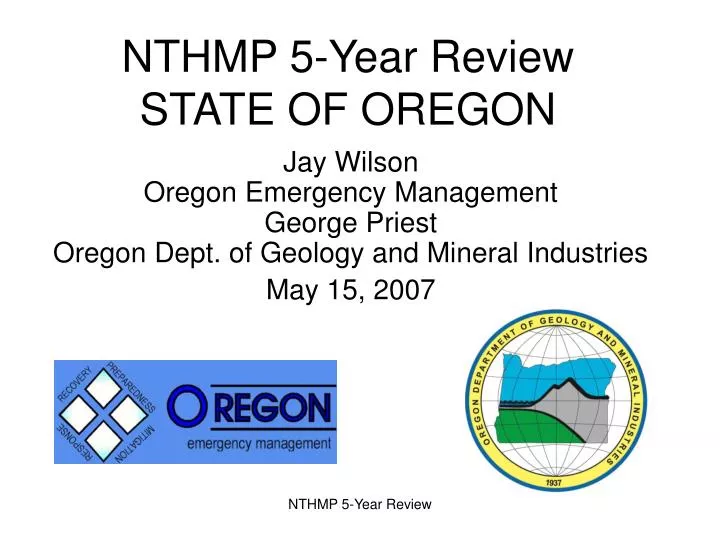
NTHMP 5-Year Review STATE OF OREGON. Jay Wilson Oregon Emergency Management George Priest Oregon Dept. of Geology and Mineral Industries May 15, 2007. CASCADIA Priority is the Local Tsunami a “Sumatra-Level” Hazard. Cascadia Subduction Zone Fault Line (yellow) Oregon Coastline

E N D
NTHMP 5-Year Review STATE OF OREGON Jay WilsonOregon Emergency Management George PriestOregon Dept. of Geology and Mineral Industries May 15, 2007 NTHMP 5-Year Review
CASCADIAPriority is theLocal Tsunami a“Sumatra-Level”Hazard Cascadia Subduction Zone Fault Line (yellow) Oregon Coastline (light blue) 620 miles Last Cascadia Event = AD 1700 NTHMP 5-Year Review
Which community members are in the tsunami hazard zone? NTHMP 5-Year Review
OREGON ACCOMPLISHMENTS – LAST 5 YEARS • Majority of evacuation brochures done. • Inundation mapping technology updated; 3 maps with old technology + 4th using the new technology (Cannon Beach). • Template for door-to-door outreach – Seaside Outreach Project. • Legislation: Guidelines for warning system standards + preparedness for lodging facilities, state parks, & camp sites • New Historical marker sign – Coastal Tribe format. • Cascadia catastrophic exercise – Pacific Peril • Legislature and Governor buy in – 2005 Tsunami Summits. • Tsunami Warning Standards Work Team – Draft Standards • Numerous talks and meetings – outreach, networking at grass roots level. • Technology improvement: more accurate inundation mapping. • Partnered for Cannon Beach Recovery Planning Workshop (CREW, OEM, ONHW, USGS) NTHMP 5-Year Review
OREGON NTHMP CHALLENGES/DEFICIENCIES • Loss of TIME Center (support for DEM’s + archive and distribution of numerical models and output). • Inundation map review process needed. • TsunamiReady program revision needed. • NOAA warning mission overshadows other priorities (Better balance of priorities between warning, assessment, and outreach/mitigation). • Improved program management and engagement with states from NOAA/NWS and other federal agencies • Sumatra lessons: Revisit all Cascadia inundation and evacuation maps. New sources for S. Cascadia. • Accelerate inundation mapping. • Increase regional coordination for Casacdia event planning • Improve understanding of tsunami/EQ vulnerability NTHMP 5-Year Review
DRAFT DATA FOR RESEARCH IN PROGRESS How many visitors could be in the disaster zone? • Libraries • Shopping centers • Parks • Historical places • Museums • Theaters • Casinos • Amusement parks • Zoos/Aquariums • Festivals • Sporting events • Houses of worship NTHMP 5-Year Review
OREGON ASSESSMENT MILESTONES • 1995: SB379 - publication of the “tsunami line” • 1995-1997: 3 inundation maps(Lincoln City, Newport, Seaside). • 1997: NTHMP started (support from Senator Mark O. Hatfield) • 1997-2001: 3 inundation maps(Gold Beach, Astoria, Warrenton) • 2002-2006: 3 inundation maps(Coos Bay, Waldport, Florence) • 2004: Sumatra tsunami (25-35-m run-up; Cascadia analogue) • 2006-2007: Cannon Beach inundation map - NEW APPROACH. • New models: hydrodynamic (Y.J. Zhang, OHSU); fault sources (Kelin Wang, PGC) • Parametric analysis of Cascadia source earthquakes (Chris Goldfinger, OSU) • Ground truthwith paleotsunami deposits(Rob Witter, DOGAMI + Curt Peterson, PSU) • Extreme events larger than previously thought: (new extreme run-up = 20-28+ m; old extreme run-up = 15-20 m) • Revise previous maps; complete new maps; accelerate map production. NTHMP 5-Year Review
CANNON BEACH, OREGON Model Tsunami Inundation versus Tsunami Sand Extent Oregon Dept. of Geology and Mineral Industries (DOGAMI) preliminary map of tsunami Inundation and inland extent of tsunami deposits in the Cannon Beach area.Inundation data is from Y. Joseph Zhang Oregon Health & Science University; paleotsunami data interpretation is from Rob Witter, DOGAMI, all information depicted is subject to revision upon review and acquisition of additional data. NTHMP 5-Year Review
Tsunami Inundation Map Completion • Tsunami Inundation Maps: • 10 of Target 35 Communities in 19 Pop. Centers Have Maps • Each Map Requires Bathymetry & Computer Simulation Model • Funding From NOAA NTHMP • Florence Inundation Map Complete. • Cannon Beach & Pacific City Work In Progress • City of Cannon Beach Funding Paleo-Tsunami Sand Deposit Field Work • Schedule is To Complete Maps For 35 Target Communities by 2019 NTHMP 5-Year Review
OREGON INUNDATION MAPS Sumatra Tech. Review NTHMP 5-Year Review
OREGON AWARENESS MILESTONES • 1995: SB378 - School evacuation drills mandated • 1995: Public hearings on SB379 “tsunami line” • 1995-1997: Outreach + 3 grade-level school curricula + signs • 1997-2001: Evacuation brochures - 12% done; video produced. • 2003: Highway 101 “Entering” and “Leaving” signs • 2004-2005: Sumatra tsunamis and earthquakes (2004 and 2005): • Tsunami Summits (emergency officials; legislators) • Congressional hearings • CREW Cascadia Scenario released • SB557- lodging facilities legislation • Lodging facilities CD released • Seaside outreach report released • Began production of 1964 tsunami video • 2006: Evacuation brochures – 75% done Pacific Peril exercise Four Tsunami workshops with NWS • 2007: Annual Coastal Fire Chiefs Conference NTHMP 5-Year Review
Tsunami Evacuation Map Brochure Completion • Tsunami Brochures: • 30 of Target 40 Communities in 19 Pop. Centers Have Brochures • High Interest Following Sumatra EQ • 210,000 Re-printed in 2006 • Florence Map Completed 2006; To Be Published 2007 NTHMP 5-Year Review
OREGON EVACUATION MAPS NTHMP 5-Year Review
Oregon TsunamiReady Communities • Cannon Beach • Manzanita, Wheeler, and Nehalem • Rockaway Beach • Lincoln City • Tillamook County • Coos County Lincoln City, March 2005 NTHMP 5-Year Review
Unified Tsunami Warning Standards SB-557 Multi-agency work team to recommend Administrative Rules • Type, Duration, Volume and Location • Duration – 3 minutes, continuous • Pitch: Steady === or Wavering ~~~ • Instructions for public • Tune in for emergency information? • Go to high ground immediately? • Re-entry/Cancellation Notification • Monthly Testing procedure • Use of Blue Strobe Beacon • Coordination with revised FEMA Outdoor Warning Standards • National and International interest NTHMP 5-Year Review
OREGONFUTURE NTHMP ACTIVITIES FUNDING SHORTFALLS • Accelerate map production - newinundation and evacuation maps • Updated to “Sumatra-level” sources(NOTE: N. Calif. + Washington affected by this update) • Inundation maps include teletsunami. • ~$2.4 million (NTHMP is ~$2 million short over the next 5 yrs). • Door-to-door outreach in 19 population centers – ~$2.85 million (NTHMP is ~$2.8 million short). • “All-city” evacuation drills for 19 communities • Tsunami warning system standards/rules • Evacuation planning for Lodging facilities + visitors • Outreach + evacuation maps for coastal parks. • NOAA weather radios in all coastal businesses NTHMP 5-Year Review
OREGON Contact Information If you have additional questions during the review period, you may contact • Jay Wilson – 503-378-2911 x 22237 • George Priest – 541-574-6642 Thank You! NTHMP 5-Year Review