Download
1 / 11
110 likes | 234 Views
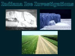
Indiana Ice Investigations. Standard. 4.3.5 - Explain how glaciers shaped Indiana's landscape and environment. Activity: http://www.indianastandardsresources.org/files/soc/ss_4_3_6.pdf. Vocabulary. Glacier: Massive bodies of ice that slowly move across the landscape.

E N D
Standard 4.3.5 - Explain how glaciers shaped Indiana's landscape and environment. Activity: http://www.indianastandardsresources.org/files/soc/ss_4_3_6.pdf
Vocabulary Glacier: Massive bodies of ice that slowly move across the landscape. Landform: A specific geomorphic feature on the surface of the earth, ranging from large-scale features such as plains, plateaus, and mountains to minor features such as hills, valleys, and alluvial fans. Ice Age: A times of widespread glaciation. Glaciation: The process of covering the earth with glaciers or masses of ice.
Background Information The purpose of this lesson is for you to be able to explain how glacial periods shaped Indiana’s landscape and environment. You must first must understand that there are various landforms and shapes on Earth. You also need to know that even Indiana has different surfaces in different parts of the state. For example, the northern part of the state is flat, where the southern part of the state is made up of more hills.
Materials • For the teacher: transparency of Black Line Master (BLM) Glacier • Gliders, overhead projector, small hand rake • For each student: copies of BLMs Glacier Gliders and Glacier Gliders • Questions • For each group of students: plastic flower “flat” tray full of potting soil, • block of ice, old towel or plastic sheet, 6" long piece of 2" × 4" board
Pre-Activity Preparation • In the box, you will find: • One long metal tray • One small block of ice • A bag of soil • A bag of sand • Directions • Worksheets
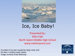
Activity: Cold As Ice Does anyone know what a glacier is? A glacier is a huge sheet of ice and the debris that it scoops up as it moves across the soil. During the Ice Age, ice covered much of Indiana; during the last glaciation, known as the Wisconsin glaciation, ice covered most of the state. The Wisconsin glaciationended about 10,000 years ago. Now we will look at the worksheet titled “Glacier Gliders.” The ice sheet came down from the north to the area where Martinsville is and extended farther south along the western edge of the state.
Activity: Cold As Ice Theportion of state that was covered by glaciers was flattened out and the rich soil that had been gathered by the glaciers was left behind as they melted. The melting glaciers also left behind many natural lakes and ponds, particularly in northern Indiana, but that the hills of southern Indiana were left undamaged by the glaciers. Instead, water from the melting glaciers increased soil erosion in southern Indiana. Point to these areas on the transparency of the Glacier Gliders worksheet.
Activity: Make Your Own Glacier You should have a tray, a block of ice, a bag of potting soil, and a bag of sand. Take the plastic fork and loosen the dirt so that it is not packed down. Put a book under the sand end of the tray. Place a towel or piece of plastic sheeting under the tray. Now we are going to do an experiment to see how glaciers formed Indiana’s landscape. The portion of the tray containing sand represents Canada and Michigan, the top part of the soil represents northern Indiana, the bottom of the soil represents southern Indiana, and the ice block represents a glacier.
Activity: Make Your Own Glacier Place the block of ice in the top part of the tray. Push the blocks firmly into the soil and then gradually slide them down the tray about three-fourths of the way. This movement represents how the glaciers advanced to the area around Martinsville. Leave the block there for 15 minutes, and then slowly slide it back up to the top of the tray to let it melt a little more. Now you each need to get a copy of the worksheets titled “Glacier Gliders” and “Glacier Gliders Questions” out of the box. You may answer the questions individually or as a group.
Resources http://www.indianastandardsresources.org/files/soc/ss_4_3_6.pdf http://www.athropolis.com/links/glacier.htm http://www.kidskonnect.com/subject-index/15-science/81-glaciers.html http://nsidc.org/glaciers/