Download
1 / 60
600 likes | 680 Views
Explore watershed impacts of land cover change on runoff, erosion, water quality using KINEROS and SWAT modules. Develop landscape assessment tool for land managers. Investigate historical changes and hydrologic processes. An in-depth look at hydrologic modeling in GIS with emphasis on DEM preprocessing and surface parameters.

E N D
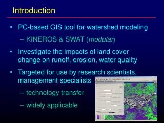
Introduction • PC-based GIS tool for watershed modeling • KINEROS & SWAT (modular) • Investigate the impacts of land cover change on runoff, erosion, water quality • Targeted for use by research scientists, management specialists • technology transfer • widely applicable
Objectives of the Research • Develop landscape assessment tool for land managers using indicators • Advance scientific understanding of principles governing watershed response to change • land cover changes in the US and associated impacts on runoff volume, water quality • Investigate historical changes using repeat imagery (San Pedro, Catskill/Delaware) • Investigate spatially distributed hydrologic processes using single scenes (Las Vegas) • Forward looks with simulations
Hydrologic Modeling in GIS The Shape and characteristics of the earth’s surface is useful for many fields of study. Understanding how changes in the composition of an area will affect water flow is important! What happens when residential development occurs? How does this affect the watershed? How can these affects be mitigated? Best Management Practices (BMPs) Introduction
Introduction Topographic Maps
Outlet Point Introduction Traditional watershed delineation had been done manually using Contours on a topographic map. A watershed boundary can be sketched by starting at the outlet point and following the height of land defining the drainage divides using the contours on a map.
Introduction: Terminology • Drainage system- The area upon which water falls and the network through which it travels to an outlet. • Drainage Basin- an area that drains water and other substances to a common outlet as concentrated flow (watersheds, basins, catchments, contributing area). • Subbasin - That upstream area flowing to an outlet as overland flow • Drainage Divide- The boundary between two basins. This is an area of divergent flow.
GIS Background • Raster Data Structure • Much of the data we will use in this class will be “Raster” data. • Raster formatted data is much more suitable for many types of landscape modeling, including hydrologic analysis. • Inputs such as elevation can only be processed as a raster data set • Raster is Faster, Vector is Corrector
GIS Background Raster Vector Real World
GIS Background: DEMs • Digital Elevation Models (DEM) • A DEM is a digital representation of the elevation of a land surface. • X,Y and Z value • The USGS is the major producer of DEM’s in the Nation
GIS Background: DEMs • DEM’s consist of an array of data representing elevation sampled at regularly spaced intervals Y ELEVATION VALUES X
GIS Background: DEMs • Two Scales of DEMs Available • 1:24,000 Scale • Level 1 - 30 meter spacing • Errors up to 15 meters inherent in data • Developed using automated methods from air photos • Systematic errors evident as banding • Not appropriate for hydrologic modeling • Level 2- 30 meter spacing • Matches map accuracy of 1:24,000 scale quads • Developed by scanning published quads • Appropriate for hydrologic modeling • 1 Degree (~250,000) scale - 93 meter spacing • Appropriate for regional analysis (not for AGWA)
GIS Background: DEMs • Preprocessing DEMs • DEMs typically require some type of preprocessing prior to hydrologic modeling to remove errors inherent in the data. This type of processing can greatly increase the accuracy of a DEM.. • Primary error found in DEMs are “Sinks” • A sink is an erroneous depression created by the DEM interpolation routine • Sinks are usually small and cause drainage basins to be incorrectly delineated
GIS Background: DEMs An example Sink 100 100 100 100 100 Stream 100-meter Elevation contour 100 97 96 95 100 Sink Area 100 98 99 100 100 Cell Elevation 100 100 100 100 100 101 Cells containing the contour are assigned the value of the contour, all other cells are interpolated. Sinks are always possible in areas where contours converge near a stream.
GIS Background: Surface Parameters • Generating Surface Parameters • Flow across a surface will always be in the steepest down-slope direction • Known as “Flow Direction” this is the basis of all further watershed modeling processes. • Once the direction of flow is known it is possible to determine which and how many cells flow into any given cell! • This information is used to determine watershed boundaries and stream networks.
GIS Background: Flow Direction • Generating Surface Parameters - Flow Direction • In ArcView Spatial Analyst, the output of a Flow Direction is a grid whose values can range from 1 to 255 based on the direction water would flow from a particular cell. The cells are assigned valued as shown below. 32 64 128 16 1 TargetCell 8 4 2
GIS Background: Flow Direction • Generating Surface Parameters - Flow Direction • If a cell is lower than its eight neighbors, that cell is given the value of its lowest neighbor and flow is defined towards this cell. • If a cell has the same slope in all directions the flow direction is undefined (lakes) • If a cell has the same slope in multiple directions and is not part of a sink the flow direction is calculated by summing the multiple directions
Original Surface Flow Direction Surface 100 100 100 100 94 2 2 2 1 128 100 1 97 96 95 1 1 128 100 64 100 98 99 100 100 128 128 128 64 32 100 100 100 100 101 128 64 64 32 80 GIS Background: Flow Direction
GIS Background: Flow Accumulation • Generating Surface Parameters - Flow Accumulation • If we know where the flow is going then we can figure out what areas (cells) have more water flowing through them than others. • By tracing backwards up the flow direction grid we can figure the number of cells flowing into all cells in a study area • Accumulated flow is calculated as the accumulated number of all cells flowing into each downslope cell.
GIS Background: Flow Accumulation • Generating Surface Parameters - Flow Accumulation • For an accumulation surface the value of each cell represents the total number of cells that flow into an individual cell • Cells that have high accumulation are areas of concentrated flow and may be used to identify stream channels.
0 0 0 0 18 2 2 2 1 128 0 3 8 15 1 1 1 128 0 64 0 2 2 0 0 128 128 128 64 32 0 0 0 0 0 128 64 100 32 80 GIS Background: Flow Accumulation Flow Direction Surface Flow Accumulation Surface
GIS Background: Flow Accumulation DEM Flow Direction Flow Accumulation Flow Accumulation Surface
Objectives of AGWA • Integrated with US-EPA Analytical Tool Interface for Landscape Assessment (ATtILA) • Simple, direct method for model parameterization • Provide accurate, repeatable results • Require basic, attainable GIS data • 30m USGS DEM (free, US coverage) • STATSGO soil data (free, US coverage) • US-EPA NALC & MRLC landscape data (regional) • Useful for scenario development, alternative futures simulation work.
Land Cover & Hydrologic Response Natural Condition Land cover change Degradation Urbanization Woody plant invasion Decreased Vegetation infiltration interception evapotranspiration surface roughness Increased Runoff Increased Velocity soil moisture flood hazard groundwater recharge Increased Erosion Decreased Water Quality
Navigating Through AGWA Generate Watershed Outline Subdivide Watershed Into Model Elements SWAT KINEROS Intersect Soils & Land Cover generate rainfall input files • Thiessen map from… • Gauge locations • Pre-defined continuous record • Storm Event from… • Pre-defined return-period / magnitude • “Create-your-own”
Navigating Through AGWA, Cont’d… prepare input data Subwatersheds & Channels Continuous Rainfall Records Channel & Plane Elements Event (Return Period) Rainfall Run The Hydrologic Model & Import Results Display Results • For subwatershed elements: • Precipitation (mm) • Evapotranspiration (mm) • Percolation (mm) • Surface Runoff (mm) • Transmission Losses (mm) • Water Yield (mm) • Sediment Yields (t/ha) • For Plane & Channel Elements: • Runoff (mm, m3) • Sediment Yield (kg) • Infiltration (mm) • Peak runoff (mm/hr, m3/sec) • Peak sediment discharge (ks/sec)
Suggested File Structure for AGWA AGWA directory – primary tables, AV project file, and model executables Simulation input/output – Separate directories for each simulation Spatial data – primary coverages and grids ArcView working directory – secondary or temporary coverages , grids, and tables
Hydrologic Modeling & AGWA AGWA Assumptions Runoff Erosion GIS Data Rainfall
runoff time Conceptual Design of AGWA PROCESS PRODUCTS STATSGO Build GIS Database NALC, MRLC USGS 7.5' DEM Discretize Watershed f (topography) Contributing Source Area Characterize Model Elements f (landcover, topography, soils) • Gravelly loam Soil • Ks = 9.8 mm/hr • G = 127 mm • Por. = 0.453 Derive Secondary Parameters look-up tables Build Model Input Files 10-year, 30-minute event intensity View Model Results link model to GIS time runoff, sediment hydrograph
Land Cover Forest Oak Woodlands Mesquite Woodlands Grasslands Desertscrub Riparian Agriculture Urban Water Barren / Clouds N 0 5 10 km • Upper San Pedro Basin, SE Arizona GIS Data Layers for AGWA 1992 NALC Hillshade DEM STATSGO
Note channel initiation Point changing with CSA N • the influence of CSA on watershed complexity Automated Watershed Characterization CSA: 2.5% (6.9 km2) 44 watershed elements 29 channel elements CSA: 5% (13.8 km2) 23 watershed elements 15 channel elements CSA: 20% (55 km2) 8 watershed elements 5 channel elements CSA: 10% (27.5 km2) 11 watershed elements 7 channel elements 0 5 10 km
6 4 1 4 1 1 2 1 7 4 8 4 2 4 9 4 4 4 3 4 4 1 3 1 5 4 5 1 Watershed Configuration for SWAT • channel and subwatershed hydrology Abstract Routing Representation 14 to channel 64 11 channel 14 pseudo- channel 11 N 0 10 20 km
7 4 7 3 7 2 73 74 7 1 72 N 0 5 km 71 Watershed Configuration for KINEROS • upland, lateral and channel elements in cascade Abstract Routing Representation
Characterizing the Watershed complex topography land cover soils high spatial variability complex watershed response
Characterizing the Watershed • Homogeneous planes • Hydrologic parameters represent • intersections of topo., cover, soil • Information loss as f (geometric • complexity) • Scaling issues Watershed modeling relies on condensing spatial data into appropriate units for representing processes leaves plenty of room for error!
73 74 72 71 KINEROS ParameterLook-Up Table BEGIN PLANE ID = 71, LEN = 1303.0, AREA = 10783378.3 SL = 0.029, MAN = 0.052, X = 593519.0, Y = 3505173.5 CV = 0.92, PRINT = 1 KS = 7.94, G = 118.14, DIST = 0.3, POR = 0.459, ROCK = 0.43 FR = 0.49, 0.33, 0.17, SPLASH = 24.42, COH = 0.006, SMAX = 0.93 INTER = 2.56, CANOPY = 0.133, PAVE = 0.00 END PLANE BEGIN PLANE ID = 72, LEN = 765.0, AREA = 4357163.9 SL = 0.043, MAN = 0.054, X = 591637.8, Y = 3507025.3 CV = 0.93, PRINT = 1 KS = 7.77, G = 116.95, DIST = 0.3, POR = 0.459, ROCK = 0.43 FR = 0.49, 0.33, 0.16, SPLASH = 24.61, COH = 0.006, SMAX = 0.93 INTER = 2.85, CANOPY = 0.112, PAVE = 0.00 END PLANE BEGIN PLANE ID = 73, LEN = 945.0, AREA = 7405044.9 SL = 0.038, MAN = 0.052, X = 593864.3, Y = 3507560.5 CV = 0.95, PRINT = 1 KS = 8.19, G = 114.97, DIST = 0.3, POR = 0.459, ROCK = 0.43 FR = 0.5, 0.33, 0.16, SPLASH = 24.91, COH = 0.006, SMAX = 0.93 INTER = 2.6, CANOPY = 0.137, PAVE = 0.00 END PLANE
Curve Number From MRLC • Higher numbers result in higher runoff NLCD Land cover A B C D Cover High intensity residential (22) 81 88 91 93 15 Bare rock/sand/clay (31) 96 96 96 96 2 Forest (41) 55 75 80 50 Shrubland (51) 63 77 85 88 25 Grasslands/herbaceous (71) 80 87 93 70 Small grains (83) 65 76 84 88 80 CURVE NUMBER Hydrologic Soil Group
N Watershed ID: 7 Area: 11.8 km2 Slope: 3.7 % Cover: 12.8 % Ks: 18.1 mm/hr CN: 71.8 Soil Hyd. Group: B Multiple Soil Horizons Sample Watershed Configuration - SWAT STATSGO ID: AZ061 Grassland & desertscrub Moderate relief Contributing Source Area: 2000 acres - ~5% of total watershed area 20 subwatershed elements 19 channels
Watershed ID: 73 Area: 7.45 km2 Slope: 3.53 % Width: 945 m Length: 7876 m Interception: 2.60 mm Cover: 13.70 % Manning's n: 0.052 Pavement: 0.00 % Splash: 24.91 Rock: 0.43 Ks: 6.67 mm/hr Suction: 115 mm Porosity: 0.459 Max saturation: 0.93 Cv of Ks: 0.95 Sand: 50 % Silt: 33 % Clay: 17 % Distribution: 0.30 Cohesion: 0.006 N Sample Watershed Configuration - KINEROS STATSGO ID: AZ061 Grassland & desertscrub Moderate relief Contributing Source Area: 2000 acres - ~5% of total watershed area 33 planes - 7 upland elements - 25 lateral element 19 channels
0 1 2 3 5 rainfall depth (mm) N 0 5 km Rainfall Characteristics in SE Arizona Summer convective storm August 11, 2000 high spatial variability high temporal variability difficult to characterize flashy runoff response short duration (45 min) Winter frontal storm January 13, 2001 low spatial variability low temporal variability lead to little or no runoff long duration (3 hours)
What Could Possibly Go Wrong?? • SYSTEMIC ERRORS • These are “hidden” & include: • Poor conceptual model • Programming errors • AGWA, SWAT, KINEROS • Poor process representation • Errors in GIS data • Land cover, soils • Assumptions in the look-up tables • PROCESSING ERRORS • These are “visible” & include: • Errors in GIS data • DEM • Lack of input data • GIS, rainfall • AGWA fails to characterize watershed
# # # # # # # # # # # # # # # # # # # # # # # # # # # # # # # # # # # # # # # # # # # # # # # # # # # # # # # # # # # # # # # # # # # # # # # # # # # # # # # # # # # # # # # # # # # # # # # High Density Watershed Walnut Gulch Exp. WS 148 km2 89 rain gauges # # # # # # # # # # # # # # # # # # # # # # # # # # # # Spatial Distribution of Rain Gauges Typical Distribution Upper San Pedro Basin 6100 km2 15 rain gauges
** Data reduced “on the fly” for watershed area 160 100-year, 60-minute 120 Intensity (mm/hr) 80 10-year, 60-minute 40 5-year, 30-minute 0 0 20 40 60 Time (min) • after Osborne et al., 1985** Sample Design Rainfall Events for KINEROS Design Storms stored in AGWA 5 yr 30 min 10 yr 30 min 100 yr 30 min 5 yr 60 min 10 yr 60 min 100 yr 60 min “create your own”
Limitations of GIS - Model Linkage • Model Parameters are based on look-up tables • - need for local calibration for accuracy • Subdivision of the watershed is based on topography • - prefer it based on intersection of soil, lc, topography • No sub-pixel variability in source (GIS) data • condition, temporal (seasonal, annual) variability • MRLC created over multi-year data capture • No model element variability in model input • averaging due to upscaling • Most useful for relative assessment unless calibrated
AGWA Gone Awry • when good software goes bad • Problems Running AGWA • - DEM pre-processing • sinks • indeterminate boundary • converging flow • lack of defined flow path (big flat area) • - User error • clicking on hill slope • - Data coverage • no overlap in GIS data • suitability of GIS data f (scale, model)
10m DEM improved - filtered using high filter - filled to remove 222 sinks - no sinks at the end - good drainage pattern - watershed succeeds; good boundary smoothing Watersheds Generated From Different DEMs 30m DEM – Level I USGS - unfiltered, unfilled - contains many sinks - has poor drainage - watershed delineation fails 10m DEM from Air Photos - still contains some sinks - exhibits better drainage - boundary is correct - there are still internal failures
Streams Generated From Different DEMs Same points, tolerances, settings note differences in results 30m DEM Sinks interrupt flow Parallel channels affect drainage 10m DEM


