Download
1 / 35
350 likes | 461 Views
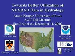
Towards Better Utilization of NEXRAD Data in Hydrology. Anton Kruger, University of Iowa AGU Fall Meeting San Francisco, December 11, 2006. UCAR/Unidata. National Climatic Data Center. The University of Iowa. Princeton University. The University of Iowa (Lead) W.F. Krajewski (PI)

E N D
Towards Better Utilization of NEXRAD Data in Hydrology Anton Kruger, University of IowaAGU Fall MeetingSan Francisco, December 11, 2006 UCAR/Unidata National Climatic Data Center The University of Iowa Princeton University
The University of Iowa (Lead) W.F. Krajewski (PI) A.A. Bradley, A. Kruger, R.E. Lawrence, R. Goska, B. Seo, C Gunyon Princeton University J.A. Smith (PI) M. Steiner, M.L.Baeck National Climatic Data Center S.A. Delgreco (PI) UCAR/Unidata Program Center M. K. Ramamurthy (PI) W.J. Weber Project Participants
Project Goal …to provide the science community with ready access to the vast archives and real-time information collected by the national network of NEXRAD radars. The main focus is on radar-rainfall data for use in hydrology, hydrometeorology, and water resources.
UI UI Data Archive Web Services (SOAP) Metadata Archive Program Library Metadata Archive User/Client’s View “Find all the 2002 storms over the Ralston Creek watershedwith mean arealprecipitation greater than X mm, and with a spatial extent of more than Z km2, with a duration of less than N hours. I want the data in GeoTIFF” Connect and query “Find all the 2002 storms over the Ralston Creek watershed with mean arealprecipitation greater than X mm, and with a spatial extent of more than Z km2, with a duration of less than N hours. I want the data in GeoTIFF” User/Client Get URIs Get data HTTP
Color-coded with metadata Browse Metadata
Ready To Go You Will Be Sent an e-mail When Job Is Done
CUAHSI HIS Data Archive Compute Engine Metadata Archive NCDC Data Archive Unidata Injects NEXRAD Data Metadata Archive Internet Request Request University A University B Extreme Events Runoff Model
Some Statistics • Total size of radar data: 130 TB • 8,492,580 files • Mosaics 34559 • Metadata Rows in Database:4,319,990 • Radars: 33 • Radar-years: 84: • For KMLB: 2 years • KTLX: 9 years • KDVN: 6 years • KVTX: 2 years
Thank You A Comprehensive Framework for Use of NEXRAD Data in Hydrometeorology and Hydrology NSF Sponsored, Award ATM 0427422


![Better Data, Better Science! [ Better Science through Better Data Management ]](https://cdn3.slideserve.com/6850091/better-data-better-science-better-science-through-better-data-management-dt.jpg)