Weather mapping
Weather mapping . Kathmandu Universoty Dhulikhel, Kavre, Nepal. Department of Civil and Geomatics Engineering. Kapil Aryal, Suman Baral, Sumeer Koirala, Suresh Shrestha. Introduction. Weather map meteorological features Temperature Humidity &relative humidity Wind speed and direction


Weather mapping
E N D
Presentation Transcript
Weather mapping Kathmandu Universoty Dhulikhel, Kavre, Nepal Department of Civil and Geomatics Engineering Kapil Aryal, Suman Baral, Sumeer Koirala, Suresh Shrestha
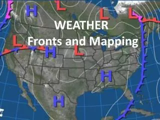
Introduction • Weather map • meteorological features • Temperature • Humidity &relative humidity • Wind speed and direction • precipitation • Of particular area & time • On map • Need of weather map.
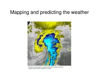
Rationale • Earlier in the form of form or database • Visualization of weather in map • Which place – what is the condition or weather?
Objective Main Objective • To create the web map showing the weather condition. Supplement Objective • to access requirement of end users. • to design the system according to need of users. • to implement the design using interface and database. • to extract Google map to show weather condition on it.
Scope • Prototype of real weather map on web. • Using Google map as the base map
HOW PHP WORKS Map server
Data Storing in MySql My S-Q-L officially, but also called My Sequel is the world's most used open source relational database management system (RDBMS) that runs as a server providing multi-user access to a number of databases.
Future Prespective • Uploading this map on web server. • Creating real time map, from weather Sensor.
Conclusion Finally, the project of weather mapping is completed in required time frame. We are successful in showing the weather data on pop-ups form in map from the data entered in user interface. Thus the final Dynamic Weather web mapping has been done successfully.
Acknowledgement We would like to express our sincere thanks to -Project supervisor Er. SashishMaharjan -Project supervisor Er. PrashantGhimire -Program Co-ordinatorEr. SubashGhimire -Er. Ganesh Dhakal -Mr. NawarajShrestha And to all friends.
References • http://www.accuweather.com/en/us/national/weather-forecast-maps • http://www.mfd.gov.np/index.php • http://www.bom.gov.au/australia/charts/viewer/index.shtml • http://www.metoffice.gov.uk/weather/uk/uk_forecast_weather.html • http://www.weathermap.co.nz/forecast-maps • http://www.weathercity.com/in/gangtok/ • http://geochalkboard.wordpress.com/2009/03/30/reading-xml-files-with-the-google-maps-api/ • http://www.brainbell.com/tutorials/XML/Google_Maps_Customization_Basics.htm • https://developers.google.com/maps/ • http://www.w3schools.com/js/
DEMO CLICK HERE