Download

1 / 48
480 likes | 654 Views
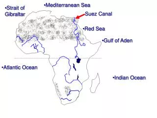
Inter-comparison and development of SST analyses over the Mediterranean Sea B.Buongiorno Nardelli , C.Tronconi, R.Santoleri, E.B öhm. Istituto di Scienze dell’Atmosfera e del Clima – sezione di Roma Via del Fosso del Cavaliere, 100 – 00133 Roma. bruno@gos.ifa.rm.cnr.it.

E N D
Inter-comparison and development of SST analyses over the Mediterranean Sea B.Buongiorno Nardelli, C.Tronconi, R.Santoleri, E.Böhm Istituto di Scienze dell’Atmosfera e del Clima – sezione di Roma Via del Fosso del Cavaliere, 100 – 00133 Roma bruno@gos.ifa.rm.cnr.it
GOS involvement in national and international projects/programmes Mediterranean Forecasting System Adricosm Medspiration Mersea PRIMI GODAE Global High Resolution SST Pilot Project (GHRSST-PP)
15 nations involved, 48 institutions MFSTEP (mar. 2003- feb. 2006) Mediterranean Forecasting System Toward Environmental Predictions RT Observing System satellite SST, SLA,VOS-XBT, moored multiparametric buoys, ARGO and gliders Upgrade of present basin scale operational system New model and assimilation Ecosystem Models Validation/calibration of Coupled physical and biochemical numerical models Marine forecast downscaling Regional and shelf models nesting Meteorological forecast downscaling 10 km LAMs and 4 km N.H. mesoscale models End-User applications Development of modules for oil spill monitoring, ICZM and fishery management
Sub-regional models at 3 km Shelf models at 1.5 km MFSTEP sub-regional and shelf systems MFS supports sub-regional (3 km) and shelf models (1 km) nesting: weekly forecasts are produced for ALL the sub-regional models and some shelf models
ECMWF FC ECMWF AN Wed Wed Thu Fri Sat Sun Mon Tue Thu Fri Wed Thu Fri Wed J SLA J-7 J-5 J-4 J-3 J-2 J-1 J+1 J+2 J+7 J+8 J+9 J-14 FORECAST RELEASE XBT SST ARGO Data are disseminated througha Web/ftp service (www.bo.ingv.it/mfstep) The present day MFS (SYS3) weekly forecasting system
The MFS SST system MF AVHRR acquisition Atlantic buffer zone + west Med ISAC AVHRR acquisition Entire Mediterranean Night-time SST using MF algorithm Cloud detection Night-time SST using Pathfinder algorithm Cloud detection SST daily composite binning on model grid (1/16x1/16) SST daily composite binning on model grid (1/16x1/16) Data merging ISAC Data quality control Optimal Interpolation Data delivery on the GOS-ISAC web-site
CLOUD detection algorithms • Cloud detection is an essential step to provide “high quality” SST fields for data assimilation • Cloud detection requires a compromise between maximization of coverage and minimization of cloud contaminated pixels • Cloud detection in MFSTEP is now performed at various steps: • On original images, before the composite is performed: ISAC: building a reference SST and fixing a threshold on the base of the histogram of the differences to this reference (as already described last year by E. Böhm) • Before selecting SST data in the optimal interpolation algorithm:comparison to the nearest analysis available (if interpolation error is lower than a fixedvalue)
SST INTERPOLATION ALGORITHM Basic theory Given n SST observations Φobs at the locations xi(both in space and time) and their associated measurement error εi (assumed to be zero mean and uncorrelated with the signal), the Gauss-Markov theorem states that the optimal least square estimate of the SST at the location x can be obtained as a linear combination of the observations Φobs: where Cxirepresents the covariance between the quantity to be estimated and the ith observation: Aij represents the covariance matrix of the observations:
SST INTERPOLATION: practical limitations • Any method described as OPTIMAL necessarily becomes strongly SUB-OPTIMAL when implemented to interpolate high resolution satellite data, due to: • Volume of data • Computational limitations • Different scales to be considered in the interpolation • Any scheme needs to be built with strongFLEXIBILITY
SST INTERPOLATION: operational implementation • Some details about the scheme adopted… • The data used to interpolate at a certain time-space location are selected within a limited sub-domain, close to the interpolation point • The most correlated observation is selected first, while all successive data are selected only if they are found along a new direction in the space-time (until n observations are found). • The scheme drives a ‘multi-basin’ analysis to avoid data propagation across land, from one sub-basin to the other.
The Global Ocean Data Assimilation Experiment (GODAE) high-resolution sea surface temperature pilot project aims to develop a new generation of global high-resolution (<10km) SST data products to the operational oceanographic, meteorological, climate and general scientific community, in real time and delayed mode
L2P data products provide satellite SST observations together with a measure of uncertainty for each observation in a common netCDF format. • L4 gridded products are generated by combining complementary satellite and in situ observations within Optimal Interpolation systems.
Gap free high resolution maps (L4) Direct observations (L2P) High-resolution diagnostic datasets Match-up database (MDB) MEDSPIRATION Project • European RDAC for the GHRSST-PP • Delivery of real-time high quality SST data, matching the GHRSST-PP specification [GDS v1.5] • Operational and sustained production • Generic and scalable system • Products :
ESA/DUEO.Arino Project management,Ian S.Robinson, SOC L2P productP.Le Borgne, Météo-France Project management/quality,J. Rickards, Vega Expertising (L4 product)L.Santoleri, B.Buongiorno Nardelli, CNR L2P, L4 productsL.Santoleri, B.Buongiorno Nardelli, CNR L2P productsS.Eastwood, MetNo Archive, dissemination,MDB and L4 processingJ.F.Piollé, IFREMER L4 productG.Larnicol, CLS HR-DDS D.J.Poulter Project organisation Medspiration consortium core members system design, implementation, operations support Test users L2P processing softwareA.Coat, Avelmor
CNR contribution to MERSEA SST activities General Objective: Conduct R&D activities to improve the quality of SST products used by MERSEA modeling and assimilation centers and produce global, Atlantic and Mediterranean Sea analyzed SST fields needed for MERSEA regional and global models • Specific CNR work: • Inter-comparison and validation of MEDSPIRATION L4 and MFSTEP SST products • Tuning of Medspiration L4_processor • Improvement of MFSTEP analyses
Inter-comparison and validation of MEDSPIRATION L4 and MFSTEP SST products REMARKS: Medspiration L4 is at 2 km res., MFS is at 1/16° Different input -MFS: only AVHRR (CNR+CMS) -Medspiration: L2P (AATSR,AVHRR(CMS+Navoceano), SEVIRI…) Different data editing and selection -account for bias between sensors -selection of valid input (confidence values, temporal window…) Different OI algorithm configurations -spatial influential radius (‘bubble’) -strategy for the selection of influential observations within the bubble
Inter-comparison and validation of MEDSPIRATION L4 and MFSTEP SST products. Methods: Evaluation of processor performance: -qualitative -quantitative Comparison of SST L4 against quality controlled in situ XBT data acquired within MFSTEP Test performed: MFS at 1/16°AVHRR by CNR+CMS merging MFS data and SEVIRI/AATSR L2P only L2P (all infrared) original configuration Medspiration L4 at 2 kmresampled at 1/16° L2P original configuration Medspiration L4 at 1/16° (hereafter Medspiration1/16 L4) L2P different configurations starting from parameters similar to MFS ones MFS XBT data
Inter-comparison and validation of MEDSPIRATION L4 and MFSTEP SST products MEDSPIRATION L4 subsampled at 1/16° MFS (only AVHRR)
Inter-comparison and validation of MEDSPIRATION L4 and MFSTEP SST products MFS and Medspiration L4 original configuration MFS (only AVHRR) MEDSPIRATION L4 subsampled at 1/16° MBE=-0.11 °C Rms=0.52 °C MBE=-0.16 °C Rms=0.55 °C
MERSEA L4_processors configuration • MFS processor modified to include all infrared sensors (L2P) • Medspiration scheme tuned on the base of MFS processor : - similarspatial and temporal influential radius (‘bubble’)… - same correlation function - same grid/resolution • However the two processors have different data editing and selection criteria/strategies -bias between sensors MFS: adjustment to a reference sensor Medspiration: adjustment through OI (error covariance matrix) -selection of valid input (confidence values, clouds) -selection of influential observations within the bubble number of observations data reduction temporal selection
The Mediterranean GOS L4 SST productsf l o w c h a r t MF AVHRR acquisition Atlantic buffer zone + west Med ISAC AVHRR acquisition Entire Mediterranean Night-time SST using MF algorithm Cloud detection Night-time SST using Pathfinder algorithm Cloud detection SST daily composite binning on model grid (1/16x1/16) SST daily composite binning on model grid (1/16x1/16) Data merging ISAC L2P GHRSST Products Data quality controll Optimal Interpolation Data delivery on the GOS-ISAC web-site
MFS L4 (Single-sensor vs multi-sensors) Single sensor Multi sensors
Medspiration L4 (old vs new configuration) OLD Config. New config.
MERSEA L4_processors configuration (GOS) Medspiration (new configuration) No Bias correction MFS (L2P in input) MBE=-0.26 °C Rms=0.52 °C MBE=-0.11 °C Rms=0.46 °C
THE SENSOR BIAS ISSUE: background • MFS: • Reference sensor ”merged files” • Interpolation uses in input ‘merged’ files (1 SST map per day) • Merging procedure selects valid pixels using the sensor sequence below: • AATSR NAR17 AVHRR17_L SEVIRI NAR16 AVHRR16_L • Before adding data to the merged map, the bias between each new image and the pixels that have already been merged is estimated and removed • (only if sufficient co-located pixels are found) • Medspiration: • No preliminar adjustment performed”collated files” • Data reduction in time (through OAN_KEEP_ALL_MEAS parameter) • Selection of best value for the same sensor: • SELMS_LIST > NAR17_SST AVHRR17_L NAR16_SST AVHRR16_L • BIAS adjustment within the OI algorithm: • The error covariance is calculated as • for points i, j , where b2, ELW are the variance of the white measurement noise and the bias error coming from a given SSES_Bias_error, respectively.
Example of evaluation of SENSOR BIASES (for existing L2P) SEVIRI MBE=-0.07 °C Rms=0.51 °C AVHRR16 MBE=-0.56 °C Rms=0.76 °C NAR17 MBE=-0.002 °C Rms=0.49 °C NAR16 MBE=-0.18 °C Rms=0.64 °C
MERSEA L4_processors configuration (GOS) Main results: MFS (L2P in input) Medspiration Bias correction – Original signal variance rms similar to MFS, higher bias vs in situ Medspiration Bias correction (1 to 3 times the estimated MBE for each sensor) Lower signal variance (1-5 °C) improved rms, bias always there! MBE=-0.11 °C Rms=0.46 °C MBE=-0.21 °C Rms=0.47 °C MBE=-0.22 °C Rms=0.41 °C
Last steps, future work: • Inter-comparison and validation of MEDSPIRATION L4 and MFSTEP SST products. concluded • Tuning of Medspiration L4_processor • -identified possible evolutions/problems in the L4_processor code • -started tests on 2-step interpolationstopped due to software licence issues • Improvement of MFSTEP analyses • -Run MFS L4_processor only with L2P • -Update MFS format to standard GHRSST conventions • -install and configure THREDDS, create catalog • -include MODIS data in the analyses • -Implement new MFS-L4 production in the operational chain • -test on 2-step interpolation (at 2 km resolution)
Evaluation of SENSOR BIASES (MODIS data) MODIS Terra (11micron) MBE=-0.21 °C Rms=0.38 °C MODIS Aqua (11 micron) MBE=-0.34 °C Rms=0.55 °C MODIS Terra (4 micron) MBE=-0.04 °C Rms=0.33 °C MODIS Aqua (4 micron) MBE=-0.16 °C Rms=0.54 °C
The warm summer 2006 The 2006 SST anomaly was monitored in near real time by the GOS SST Processing system daily SST anomaly respect to the 1985-2004 climatology Time series of SST mean in the West Med
MERSEA • organization • SEA SURFACE TEMPERATURE organization • Near Real Time (NRT) - SST INTERPOLATED MAPS organization • Delayed Time (DT) - SST INTERPOLATED MAPS organization • OCEAN COLORorganization • work in progress….. According to Thomas.Loubrieu (ifremer) specification, we set up our Thredds Data Server CNR THREDDS CATALOG STRUCTURE
CNR THREDDS CATALOG STRUCTURE • MERSEA • organization • SEA SURFACE TEMPERATURE organization • Near Real Time (NRT) - SST INTERPOLATED MAPS organization • Delayed Time (DT) - SST INTERPOLATED MAPS organization • OCEAN COLORorganization • work in progress…..
SST DATA PRODUCT • For what concerns the SST product you can find 4 different SST products: • NRT-v0: Optimal Interpolation SST dataset from AVHRR data only processed in near-real-time mode (http://www.mersea.eu.org/html/information/catalog/products/GOS-MED-L4-SST-NRTv0-OBS.html) • NRT-v1: Optimal Interpolation SST dataset from all infrared L2P processed in near-real-time mode. (http://www.mersea.eu.org/html/information/catalog/products/GOS-MED-L4-SST-NRTv1-OBS.html) • DT-v0: Optimal Interpolation SST dataset from AVHRR data only processed in delayed-time mode. (http://www.mersea.eu.org/html/information/catalog/products/GOS-MED-L4-SST-DTv0-OBS.html) • DT-v1: Optimal Interpolation SST dataset from all infrared L2P processed in delayed-time mode. (http://www.mersea.eu.org/html/information/catalog/products/GOS-MED-L4-SST-DTv1-OBS.html)
SST DATA PRODUCT • Two different types of time organization: • NOT AGGREGATED • AGGREGATED
SST DATA PRODUCT • Two different types of time organization: • NOT AGGREGATED • AGGREGATED
XML THREDDS CATALOG FILES This structure is done with 13 configuration xml catalog files mersea.xml sst_init.xml, sst_NRT.xml nrt_v0.xml, nrt_v0_aggr.xml, nrt_v1.xml, nrt_v1_aggr.xml, sst_DT.xml dt_v0.xml, dt_v0_aggr.xml dt_v1.xml, dt_v1_aggr.xml ocean_init.xml Updated daily for V1 (NRT, DT) data, and weekly for V0 (NRT, DT) data
CNR THREDDS CATALOG STRUCTURE • MERSEA organization • SEA SURFACE TEMPERATURE organization • Near Real Time (NRT) - SST INTERPOLATED MAPS organization • Single Sensor AVHRR(v0) product • From 2004-05-19 to 2007- 04 -16 (last Monday) • Not Aggregated:1062 single downloadable nc files view • Aggregated: 1062 single nc files collated in a single nc file view • weekly updated: every tuesday • Multi Sensor (v1) product • From 2006-07-01 to current data • Not Aggregated:294 single downloadable nc files view • Aggregated:294 single nc files collated in a single nc file view • daily updated • Delayed Time (DT) - SST INTERPOLATED MAPSorganization • Single Sensor AVHRR(v0) product • From 2005-12-01 to 2007-04-06 (10 days before last Monday) • Not Aggregated: 476 single downloadable nc files view • Aggregated: 476 single nc files collated in a single nc file view • weekly updated: every Tuesday • Multi Sensor (v1) product • From 2007-07-01 to 2007-04-13 (10 days before this Monday) view • Not Aggregated: 287 single downloadable nc files view • Aggregated: 287 single nc files collated in a single nc file view • daily updated
SST DATA ACCESS AND DOWNLOAD You can access these data in two different ways: 1) Directly from our Thredds catalog page: http://fe4.sic.rm.cnr.it:8080/thredds/catalog.html Free access and free download You can download data clicking directly on the files link, for example for NRT-V0 aggregated data, you have to click on Access: OPENDAP: http://fe4.sic.rm.cnr.it:8080/thredds/dodsC/sst_nrt_v0_aggr/GOS-MED-L4-SST-NRTv0_aggr as ASCII DATA or Binary Data, choosing the variables to download and for each variable the time period you are interested in. 2) From Ifremer link: http://www.ifremer.fr/thredds3/ Free access and free download You can search and download data use the Mersea THREDDS browser