Download
1 / 27
270 likes | 488 Views
European Commission. GALILEO. The European project on satellite navigation. September 2002. What is Galileo?. The European satellite radionavigation programme.

E N D
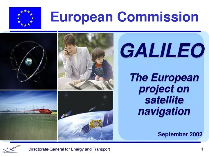
European Commission GALILEO The European project on satellite navigation September 2002
What is Galileo? The European satellite radionavigation programme Galileo will enable everyone equipped with a receiver, for example built into their mobile phone, to receive signals from several satellites and thus determine their exact position in time and space at any given moment. Galileo is based on a constellation of 30 satellites placed in orbit and continuously covering the entire surface of the earth. How far is Galileo? The definition phase has already been completed. Development and validation phase 2002-2005 Deployment phase 2006-2007 Commercial operation phase From 2008
Illustration “In the same way that no one nowadays can ignore the time of day, in the future no one will be able to do without knowing their precise location.” 30 satellites around the earth safety of life general public Local element Users commerce
A major challenge.. Technological Like other major European projects such as Airbus or Ariane, Galileo represents a technological revolution comparable to that sparked off by the mobile phone. Economic Galileo heralds the development of a new generation of services: automated vehicle guidance systems to reduce traffic jams and cut the number of accidents, oil prospecting, conservation of the ecosystem, management of scarce resources such as water, financial transactions, and safety of persons and property. Political Satellite radionavigation will set off such a revolution that the European Union needs to have control of this technology vital to running the society of tomorrow.
Galileo/GPS: competing & complementing Galileo is the only alternative to a monopoly for GPS The existing systems - GPS (American) and GLONASS (Russian system) - were both designed as military systems. Galileo: a universal service • higher degree of precision than the GPS : around 1 to 5 m • more reliable than GPS : coverage more homogeneous • continuity of service guaranteed : 95 % of every urban area covered, instead of 50 % today, at any time without interruption Galileo and GPS are complementary Coordinated use of both infrastructures offers greater precision and greater security. Users will receive both GPS and GALILEO signals on the same receiver.
Galileo: the criticism is unfounded GPS is free, but Galileo has to be paid for? Like GPS, Galileo will be free of charge to basic users. Some applications will have to be paid for - those requiring a quality of service which GPS is unable to provide. The GPS of the future could perhaps offer such services too, but there is no guarantee that they will be free, least of all if GPS holds a monopoly! Galileo: the security conditions are satisfactory An appropriate security framework is specifically required.All services provided by Galileo will be monitored by the authorities. U.S. concerns that Galileo could cause interference with the military GPS have been taken into consideration in the form of flexible solutions on use of the radiofrequency spectrum.
Unquestionably economically viable It is not expensive Development and deployment costs are put at €3.4 billion. That is the price of 150 km of semi-urban motorway or of just one track of the main tunnel for the future high-speed rail link between Lyon and Turin. Highly economically viable Benefit/cost ratio: 4.6 over 20 years, taking air and sea transport alone. No other infrastructure project in Europe can match a ratio like that. Jobs created: > 100 000 Market created: €9 billion/year Society as a whole will benefit, not just investors in the programme. For example, improving air traffic control will save passengers time and airlines money and cut pollution by emissions from aircraft.
No need for contributions from national budgets The €1.1 billion needed has already been set aside in the Community and the European Space Agency budgets (each will pay equal amounts). Development phase (2002-2005) Deployment phase (2006-2007) Funding will be provided for in the next forward plan for the Union’s budget. Allowance will be made for a financial contribution from private-sector participants in the project. Public participation will gradually decrease until 2015 and will be covered by the Community budget. During this commercial phase this public funding will be offset by revenues to the operator ranging from value-added services to the exploitation of intellectual property rights on chipsets. Operation phase (starting in 2008)
The development phase has finally been launched On 26 March, the Transport Council agreed on the Regulation governing the statutes of the Joint Undertaking... • Commission to establish the Joint Undertaking in the coming weeks together with ESA • Private sector participation possible at a later stage …and on the release of the remaining € 450m to fund the development phase • € 450m as Trans-European Network project with the Joint Undertaking as beneficiary (in addition to € 100m already released and € 550m ESA contribution) • annual payments from 2002 to 2005
The Joint undertaking An original solution For the first time ever this form of company provided for under Article 171 of the Treaty is being set up. It will allow a single effective management body for Galileo combining public and private funding. Role • To supervise the development of the space and ground segments to be carried out by ESA. • To foster the development of applications and services. • To prepare the following phases of the programme. • To ensure an optimum integration of EGNOS into GALILEO. Structure Set up: 2002-2005 Seat: Brussels Founder members: Community, European Space Agency Members: • European Investment Bank • at a later stage, any business subscribing €5 million or more (€250,000 for SMEs)
Private sector participation welcome The Joint undertaking provides the opportunity to enlist private sector support for the project This is a business oriented programme. Private sector involvement ensures proper market approach and service-oriented infrastructure development. Conflicts of interest to be avoided Private sector can become Member of the Joint Undertaking once the call for tenders with a view to selecting the future operator has been finalised (at the latest by end of 2003).
Joint Undertaking: How it works Founding Members Possible Future Members European Community(Commission) EuropeanSpaceAgency European Investment Bank Private companies Third countries Supervisory Board(EU Member States) ESA Pb-Nav(ESA Member States) Administrative Board Joint Undertaking Executive Committee Director Subcontracting Infrastructure (ground / space) Application development Preparation of deployment and operation
European Commission EGNOS First step to GALILEO European Commission Directorate General for Energy and Transport
Role of EGNOS in GALILEO • EGNOS is the first step to Galileo and part of the European Satellite Navigation Strategy. It will become operational in early 2004 and is partially funded by air traffic services providers. • EGNOSwill pave the way and reduce the risks for GALILEO in different domains: • Technical aspects (i.e. integrity). • Operational experience. • Certification process. • Institutional framework…..
EGNOS (European Geostationary Navigation Overlay Service) EGNOS makes US military-based GPS useable for safety-critical civil applications EGNOS provides Integrity signal through independent Ground Control Segment EGNOS is being implemented in parallel with US WAAS and Japan MSAS
WAAS (US) & EGNOS & MSAS (Japan): first step towards service guarantees EGNOS: Complement to GPS and GLONASS with 2 Inmarsat / 1 Artemis Transponders First step towards GALILEO Interoperable with WAAS and MSAS GPS-type (Ranging) Signal Correction signals Integrity higher availability meter accuracy service guarantee
2000 2003 EGNOS AOC Development EGNOS Operations GALILEOOperations EGNOSAOC EGNOS + Development Galileo Definition GALILEO DEVELOPMENT 2008 Full Capability EGNOS and GALILEO Integration Overview
EGNOS partnership L V S V L T P R A INDUSTRY EUROPEAN TRIPARTITE GROUP ESA ATSOs AENA DFS DGAC ENAV NATS NAV-EP swisscontrol EGNOS CNES NMA
ALCATEL SPACE INDUSTRIES L V S V L T R P A EGNOS Industrial Consortium DASA, IFEN, DLR AIRSYS - ATM MAN DEUTSCHE TELECOM ALENIA AEROSPAZIO SPACE ENGINEERING LABEN VITROCISET TELESPAZIO SPACE SW ITALIA INESC EDISOFT MARCONI PORTUGAL GMV INDRA ESPACIO SENER RACAL VEGA LOGICA SCIENCE SYSTEMS AIRSYS-ATM UK BRITISH TELECOM NATS DNV GSS NORTEL NLR SEXTANT AVIONIQUE SRTI SYSECA FRANCE TELECOM SEATEX NMA SIEMENS AUSTRIA CONTRAVES TEKELEC OSCILLOQUARTZ NOVATEL
GALILEO for toll collection Electronic Fee Collection Systems for the future Toll, be opened !
GALILEO for toll collection • New charging policy under definition in the EC • New requirements from the Member States and at local level : • fight against traffic congestion • better demand management • internalize external costs • the result : new charges proportional to kilometers driven on primary road network are in the air
GALILEO for toll collection How to compute a charge proportional to the kms driven with no complicated equipment ? GALILEO allows to know on time where the vehicle is with an accuracy better than 5 meters, 95% of the time
GALILEO for toll collection • This is the basis of the GNSS / CN solution, first to be implemented in Germany, later on in UK (?) and some other countries : • will start with GSP • then commutes to GALILEO • mobile communications used to download payment data to the central billing system • enforcement thru DSRC or IR
GALILEO for toll collection • The advantages : • no need for large infrastructures • no need for expensive roadside equipment • fits to all kind of zone : urban, motorway, countryside • onboard equipment can be used for other services
GALILEO for toll collection • Remaining questions : • first real scale system implemented in Germany in 2003 for trucks • enforcement of offences • cross-border interoperability at European scale (DSRC systems)
GALILEO for ITS • GALILEO can facilitate the development of other ITS services for the vehicle of tomorrow : • automatic emergency calls with location : possibility to know also the direction of the vehicle • road safety and ADAS systems • freight and fleet management • traffic surveillance • route guidance