Download
1 / 45
600 likes | 1.09k Views
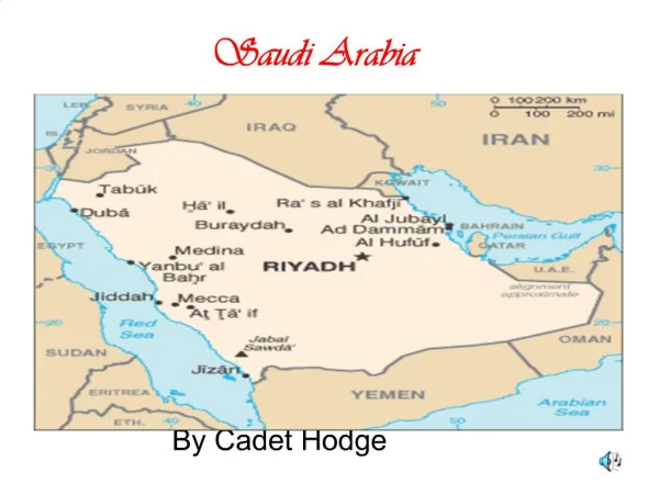
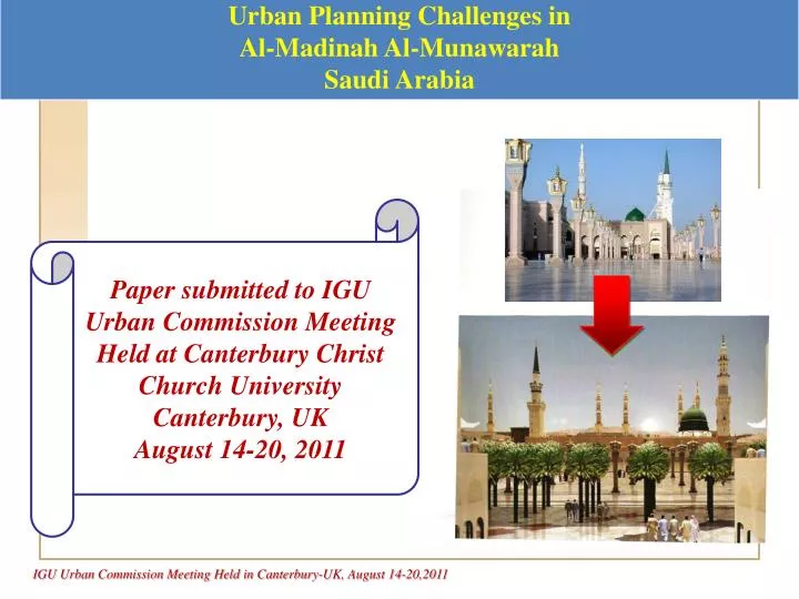
Urban Planning Challenges in Al- Madinah Al- Munawarah Saudi Arabia. Paper submitted to IGU Urban Commission Meeting Held at Canterbury Christ Church University Canterbury, UK August 14-20, 2011. Prepared by Dr. Mohamed A. Ali. Professor of Urban Geography

E N D
Urban Planning Challenges in Al-Madinah Al-Munawarah Saudi Arabia Paper submitted to IGU Urban Commission Meeting Held at Canterbury Christ Church University Canterbury, UK August 14-20, 2011
Prepared byDr. Mohamed A. Ali Professor of Urban Geography (Urban and Regional Planning & GIs Scientific Advisor for Tiabah University Institute For Research and Consulting (TURCI) Al-Madinah Al-Munawarah Saudi Arabia Email : dralgawad@yahoo.com
Urban Planning Challenges in AlmadinahAlmunawarah, Saudi Arabia By Mohamed A. Ali Abstract: AlmadinahAlmunawarag, Saudi Arabia is the Holy City where the Prophet Mohamed was buried and is now distinguished by the Prophet Mohamed Mosque. Its unparalleled characteristics stem from the fact that its central functions serve both its permanent residents as well as pilgrims and visitors from all over the Muslim World whose number exceed the permanent population each year. The necessary expansion of the Holy Prophet Mohamed Mosque to accommodate the accelerating numbers of pilgrims and visitors takes place through a process of horizontal expansion and is usually accomplished by costly demolition of adjacent buildings and areas. Consequently, urban form, social structure, commercial functions and transportation and service networks in several sections of the city are badly affected. Increasing economic and commercial development in the areas immediately around the Mosque have caused pressures that have resulted in a dense accumulation of buildings with height that surpasses that of the Minarets of Prophet Mohamed Holy Mosque.
Abstract: These new developments have overwhelmed not only the Great Mosque's architectural characteristics, but also diminish its divine and spiritual presence. In order to solve this dilemma and these rather complex multi-dimensional urban problems this paper attempts to explore some comprehensive objectives and provides a variety of urban-spatial planning solutions. Key Words: Almadinah, Saudi Arabia, Prophet Mohamed Mosque, Pilgrims, Urban Spatial Planning.
Holy cities worldwide are limited in numbers: • Display unique urban characteristics. • Theories of city growth and Urban spatial laws and development are partially • rather rarely applicable nor compatible to Holy Cities. • They have unparallel characteristics: • Ancient Historical Origin, Holy and religious roots. • Traditional growth and preservation. • Seasonality. • Central functions to serve worshipers and visitors whose member in many • cases surpasses the permanent inhabitants. • All of the above caused critical planning issue in MakkahAlmukarama and • AlmadinahAlmunawarah in Saudi Arabia (needs for housing services and public utilities…... Transportation…. etc.) • Prophet Mohamad's Mosque (PBUH)) • Have considerable bearing to the increasing number of pilgrims because of : • Visiting Prophet Mosque is essential ritual. • The visit is usually done yearly by 99% of pilgrims. Introduction: (* ) (PBUH): Means Peace be upon Him, Muslim must say these words whenever the name of Prophet mentioned. (In Arabic : Salla Allah AlihiWasalm).
Introduction: • Historical continuous expansion of the Prophet Mosque: • Continued from Prophet's Time till contemporary era. • To accommodate increasing number of visitors. • Usually is horizontal expansion. • On expenses of adjacent areas (Central Area of AlmadinahAlmunwarah). • Costly demolishing operations. • Shrinking central surrounding area around the Prophet Mosque. • Which on other hand experience continuous pressure by dense and huge development and proposed investment projects. • Complications by traffic and transportation problems.
Problem: • Finding the balance between the necessity of horizontal expansion of the Mosque to accommodate million of visitors and pilgrim, and its surrounding shrinking central area consider to be critical problem that need spatial planning proposals , alternatives and solutions.(Figure -1) Introduction: Figure-1: Expansion Options within Shrinking Crowded Area Source : DCM,2010
Research Questions: • (1)What are the major historical/spiritual deeply rooted principals that the vision for the necessity of Prophet Mosque expansion can be build upon? • (2) What are the main elements (spatial –non spatial) of the existing Holy site which houses the Prophet's Mosque; • Physical character. • Visual appearance. • Integration with its immediate surrounding areas: the central area, and the city as a whole? • (3) What is the required future area of expansions for the Prophet's Mosque and what is the need and necessity for such expansion? • (4) What are the main existing constraints that affect the proposed spatial organization and the spatial reorganization (or spatial new order) of the Haram(*) area? • (5) How the integration between the Prophet's Mosque and the city central area can be achieved and ensured? • (6) What are the possible scenarios (options/alternatives) for directions and features of expansion? (*) Haram : Means the immediate surrounding area closely attached around the Prophet's Mosque. Haram from word "Haraam", means it should be kept away from any harmful act or say or sins..etc, should be clean, safe, secure and peaceful.
Research Objectives: • The Major Goal : for searching for alternatives to the horizontal expansion of the Prophet Mohammad's Mosque is to bring up new spatial order, or spatially reorganizing the main features in the immediate surrounding area around the Mosque called: "Haram Plaza". This should be done in a way that maximizes spirituality of the place, and safeguard its divinity. This rather spiritual major goal requires: • Creation of a well defined spiritual precinct around the Prophet's Mosque. • Finding out ways allowing for greater pedestrian accessibility into the spiritual precinct. • Indentifying civic space connected to the spiritual precinct and Prophet's Mosque. • Establishing cultural and civic precinct that reinforces the connection between the city especially the central area and the Holy site.
Research Objectives: • (B) Specific Objectives: In order to achieve the above major exploratory rather spiritual goals, more specific investigative objectives that suggest alternatives for expansion were set, these are: • Define the required future area of expansion for the Prophet's Mosque and identify the need for expansion. • Propose scenarios for directions and features of such expansion. • Ensure spatial and functional integration with the Mosque's surrounding. • Identify the major existing constraints that affect the proposed spatial organization. • Recommend Geo-informatics (Geomatics) strategy or methodology as a spatial basis for integration and analysis.
Research Methodology: • The study follows descriptive analytical spatial approach. • Study data sources : • (A) Reports: • Growth and development Plan. • Structure Plan. • Land use Planning Strategies. • ( B) Cartographic materials : • Maps with various scale. • Air-photo. • Modern Current Satellite images and Maps from Google Earth. • (C) Extensive Arabic Literature()on AlmadinahAlmunawarah (*) Bibliographic sources mention that no city in the world have such written voluminous material and accumulated literature such as that of been written on Makka and Madinah.
Research Methodology: • (D) Intensive Field work: • Observation. • Recording notes. • (3) Study Procedures: • Building the theoretical conceptual framework. • Examining and analyzing the existing condition in Haram's Plaza (area) . • Attempting to create a spatial data base for the study element. • Analyzing the Data. • Answering the study posed questions. • Introducing some proposal, suggestions and spatial solutions.
Research Methodology: • (4) Spatio-Temporal Determents: • The Expansion of Prophet's Mosque is controlled by three determents, have sensitive nature to the spatiotemporal factors, which have been affected by qualitative (subjective) and quantitative (objective) factors: • Transportation: regarding worshipper's movements to, from and around the Prophet's Mosque at certain seasons (Hajj, Umra(), other peak times) • Population: Assumptions and projection of population (inhabitants and visitors) growth help identify future worshipper peak periods during Ramadan (Holy month of fasting) , Hajj , Umra and Friday weekly prayer. • Open Space Strategy: Integration of the central area strategies with city wide initiatives ensure connectivity of the Prophet's Mosque with surroundings neighborhoods and provide link to various historic sites as well. (*)Umra: means conducting partial religious duties during visiting Makka such TAWA'AF (walking around Ka'aba seven times) and SA'I (marching between little remains of two mountains called Safa and Marwa where Hajar (Ibrahim wife ) with her child (Ismail) son of Ibrahim were searching for water.
Spatial Analysis of Prophet's Mosque Expansion: • Vision of Expansion: • (A) Based on History of Islam: • The journey of Prophet Mohamad called Hijra (from Makka to Madinah) . • All Muslims welcome and encourage to pray there. • All should have equal opportunity to be accommodated. • Ensured a spiritual and spatial quality around the Mosque. • Ensure a fulfilling religious and Civic experience. • Secure basic needs of all visitors and residents. • Accommodate the expansion pressures placed on Madinah's C.B.D.(Central Area). • (B) Duel Planning Problem: • Spatial and spiritual quality of the Prophet's Mosque in order to: • Meet the worshipers basics needs. • Achieve self actualization and oneness with GOD. • 2) Spatial Planning and its modern tools: • Enables cities to identify, prescribe, and deliver beneficial and preferred features for urban space.
Spatial Analysis of Prophet's Mosque Expansion: • (C) Four Explorative Options for Expansion of Haram Plaza: • The options: • Surrounding the Prophet's Mosque with Ruwaaq() or Perimeter Prayer Buildings. • Redefining Northern Edge of the Haram Plaza with Prayer Buildings. • Enclosing the Haram Plaza with Ruwaaq or Perimeter Prayer Buildings. • Option has been developed based on feedback on the most successful elements of the above three options. • Each of these Options: • Developed by various agencies , Government, Consultant, people and public opinion. • Accommodate future expansion pressure on the Prophet's Mosque. • Have clear strategy and rationale. • Ensure the sanctity of the Prophet's Mosque and Haram Plaza. (*) Ruwaaq: Arabic word means open space, huge in area for people to meet, socialize and rest.
Spatial Analysis of Prophet's Mosque Expansion: • (D) History of Expansion: • Early Nuclei and Origin: • The Prophet's Mosque is situated on the site of the Prophet's former house, whose courtyard was the first social and religious centre of the early Muslim community. • From its modest beginnings, the house grew into a mosque and the mosque became the centre of a community. • Its growth spanned fourteen centuries, with over a millennia of that time without much significant change to its design (Figure-2) • It is only in the last century that there has been a rapid and systematic expansion, no doubt brought on by the pressure placed on the Prophet's Mosque by a significant increase in visitors facilitated by modern transportation. Figure-2: Historical Expansion of the Prophet's Mosque
Spatial Analysis of Prophet's Mosque Expansion: 1970 1910 1960 1978 1990 1983 2010 Figrue-3: Recent Expansion of the Prophet's Mosque (For Last Hundred years). Source: Various Historical Sources and (DCM, 2010) with modification
Spatial Analysis of Prophet's Mosque Expansion: • 2) Stages and Condition of Each Expansion: • Figure-3 outlines the expansions in conjunction with progressive clearance of the historic fabric of Central Madinah, and successive urban interventions around the Mosque, over the past century (1910 to 2010). Shown are conditions around: • (1910), with the newly constructed avenue leading to the gate, of Bab Salaam; • (1960), after the construction of the new Saudi mosque and various provisions for vehicular traffic, including new access to Bab Salaam from the south; • (1970), after clearance of part of the historic fabric west of the Haram; • (1978), after further clearance due to the construction of temporary prayer sheds; • (1983), after a fire which destroyed the left portion of the Aghawat district; • (1990), after total clearance of the Aghawat district; • Currently (2010-2011), after a second, much larger Saudi expansion to the Prophet's Mosque, the clearing of an even larger area around the Mosque and its subsequent redevelopment as a hotel district serving the Prophet's Mosque. This current Central Area is firmly defined and bound by the oval of the 1st Ring Road (Figure-4).
Spatial Analysis of Prophet's Mosque Expansion: Figure-4: Madinah Central Area Development Plan, bounded by the oval the 1st Ring Road (2001). Source: Al-Madinah Municipality.
Spatial Analysis of Prophet's Mosque Expansion: • (3) Previous Studies and Proposals for Expansion and Spatial Reorganization Trails: • King Fahd Expansion Project (1985) : • Arosed major concerns regarding Almadina Central Areas . • Preparation of Almadinah Central Area Plan (Comprehensive) • Central Area Executive Committee (1989); its main objective is: • Regulate the development projects in CBD • Enforce regulation of the plan. • Develop Almadinah central area action plan: • Seeks better integration of neighboring urban fabric with 1985 expansion; • Faced with problems of narrow streets and Paths; which in turn: • 1. Created problems for accessibility and circulation. • 2. impeded traffic flew and highlighted congestion levels. • The plan sought to minimize the walking distances to the Holy Mosque.
Spatial Analysis of Prophet's Mosque Expansion: • Called for : • The development of public parking lots beneath the central area. • Underground public transportation station beneath the expanded area of the Prophet's Mosque eastern Plaza. • Upgrading the 1st Ring Road with intersections and pedestrian underpasses, that would help to: • Reduce the conflict between pedestrian and vehicular movement. • Enable designated and unimpeded locations for pedestrian access to the C.B.D. • Other Pressing Issues: • Conflict between use of public transit system. • Employment of auto oriented strategies (personal private public use) • Failure of Plans to clearly outline (identify) the hierarchy of the transport networks (Figure-5).
Spatial Analysis of Prophet's Mosque Expansion: Figure-5: Madinah Public Transport Network (Existing Hierarchy and Proposed Additional Links) Source: DCM, 2010
Spatial Analysis of Prophet's Mosque Expansion: • Dramatic Changes as a result of the Plan: • Historic buildings stock was deteriorated : • Unable to handle growing demand for larger capacities. • Lacking the provision of necessary public service. • Utilities network largely obsolete. • Final Result/ Conclusion: • In order to meet the growing demand for visitor's accommodation in the central area, virtually all of the original building stock has now been replaced. • (4) Challenging set of Objectives for the Central Area Development Plan: • Present Plan Objectives: • Maximization of capacity for accommodations; • Minimization of walking distances to the Holy Mosque; • Improvement of pedestrian circulation; • Enhancement of vehicular flows; • Implementation of unique building design and construction codes that would improve the safety, comfort and the urban image of buildings in the central area.
Spatial Analysis of Prophet's Mosque Expansion: • Plan Intent: • The Plan's intent was to provide the Central Area 14.000 retail shops, 100.000 new rooms, urban open space amounting to 65% of the Central Area, and occupancy of 3000 people with in the Central area. • Existing Context of Central Area and its Components : • Prophet's Mosque surrounded by Haram Plaza; • Al Baqee Cemetery; • Al Ghamama Mosque; • Abu Baker AS Sidique Mosque; • Umar Bin Al Khatab Mosque; • Ali Bin AbiTalib and Othman Mosque and Al Ijab Mosque.
Spatial Analysis of Prophet's Mosque Expansion: • Prophet's Mosque Capacity: • The existing Prophet's Mosque capacity is estimated to be 300,000 worshippers. The Haram Plaza surrounding the Prophet's Mosque is a large (250,000m2) pedestrian accessed space capable of accommodating 255,000 worshippers. It is divided into a 168,500m2 prayer space area and an 81,500 m2 non-prayer area. The total worshipper capacity for the Prophet's Mosque and the Haram Plaza currently stands at 555,000 worshippers. • Road Networks Around the Prophet's Mosque: • Beyond the Haram Plaza connecting to, and extending beyond the 1st Ring Road. • Function as additional prayer space at peak religious events. • But their prioritizing of motor vehicle traffic, makes them problematic for the large volumes of pedestrians that passes through there regularly. Along with inconveniently located ramps to parking levels underneath the Haram Plaza, these are the issues that pose the greatest constraints for controlled and functional movement of worshippers to and from the plaza.
Spatial Analysis of Prophet's Mosque Expansion: • Constraints: • Poorly managed traffic, crowd and vehicular flow (result in dangerous conflicts between car and pedestrians) • A general shortage for worshipper accommodations at peak prayer times. (due to extensive road and ramp infrastructure presently distributed around the Prophet's Mosque). • The above condition as a result of Car focused strategies of Almadina Central Area development Plan which call for : • Improving vehicular and pedestrian flow. • Development of Public Parking Lots beneath the Central Area in order to resume impediments to movement at ground level. • Integration of an underground Public transportation station beneath the expanded area of the Eastern Plaza of the Prophet's Mosque. (figure-7)
Spatial Analysis of Prophet's Mosque Expansion: Figure-7-1 : 1st Ring Road and Radial Roads in the Central Area Source : DCM, (2010).
Spatial Analysis of Prophet's Mosque Expansion: Figure7.2: Central Area Traffic Volumes (vehicles per hour)-2009. Source : DCM, (2009) and land use plan strategy of Madinah Municipality.
Spatial Analysis of Prophet's Mosque Expansion: • d. All of the above caused influx of motor vehicles (infrastructure road and ramps has created barriers and conflicts with the majority of pedestrian movements). • e. The primary function of providing access for pedestrian is being impacted by the traffic that uses the 1st Ring Road as a through arterial for travelling cross the city. • Consequently, the pedestrian domain never clearly addressed in integrated manner in Development Plan. • Available space normally allocated for parking rather than pedestrian space. • Several bottlenecks around the Haram Plaza caused by underground level parking entrances for vehicles occurring at most of the entry point to the Plaza. (Figure-8)
Spatial Analysis of Prophet's Mosque Expansion: Figure-8f: Plan of Existing Conditions/ Constraints to Pedestrian Flow Source: DCM, 2010.
Spatial Analysis of Prophet's Mosque Expansion: • Fences and gates that surround Prophet's Mosque Plaza stand as a physical barrier. • Additional congestion . • Slow the worshipper's movement before and after prayer. • Very narrow pinch point passage at the south –eastern edge of the Prophet's Mosque between the fence and Al Baqee Cemetery causing congested crowd flow. • Shortage of space for worshipers during the peak prayers times (Hajj, Umra season, Ramadan and weekly Friday prayer). • (D) Proposed Options of Extension: • (1) Open Space Strategy: • To release and ease the pressure. • Down grade the 1st Ring Road. • Create intermediate Ring Road further out . • Include expansion of the Haram Plaza, pedestrian boulevards and urban Plaza.
Spatial Analysis of Prophet's Mosque Expansion: • (2) The Open Space Strategy will: • Expand the Haram Plaza into pedestrian boulevards along the Central Area's major access points; • Allow worshippers to pray in a number of appropriate open spaces along the major access points, allowing for the absorption of excess worshippers during peak seasons; • Allow visitors to gather in civic open spaces aimed at supporting the religious and civic functions of the city. • (3) Expansion Alternatives: • (a) Expansion Concept (1) : Al-Ruwaaq and Haram Plaza (Religious Plaza), (Figure-9) • Space around the Prophet's Mosque. • Consider to be a hub for visitors not only for prayer, but also to rest, socialize and contemplate during non-prayer times. • Will increase the capacity for prayer without necessary requiring extensive expansion beyond the existing Plaza.
Spatial Analysis of Prophet's Mosque Expansion: • (b) Expansion Concept (2): New Manakha Plaza ( Civic Plaza), (Figure-10) • To utilize the space south of Imam of the Mosque when it can't be need during the prayer. • How to utilize this space? • Creation of civic Plaza to the south of Prophet's Mosque . • The space filled with shade and sounds of flowing water. • Grove Palm tree arranged like a grand colonnade, making reference to the historic Palm Groves of Prophet's Nabawi era. • All of the above offer the visitors the reassuring feeling of having arrived after long journey. • New Manakha Plaza is historical site for centuries as had been a primary entry and arrival point for visitors arriving to Madinah and Prophet's Mosque (arrival square, assembly point for incoming and deporting Caravans). • New Manakha Plaza is a meeting place for social interaction and enjoyment. • The simple composition of tree, water and the Mosque will evoke sentiments of serenity and represent the basic elements and needs of life.
Spatial Analysis of Prophet's Mosque Expansion: Figure-9: Al Ruwaaq Expansion Alternative.
Spatial Analysis of Prophet's Mosque Expansion: Figure-10: Al Manakha Expansion Alternative. Source: DCM, (2010)
Spatial Analysis of Prophet’s Mosque Expansion: • (E) Transport Challenges in Central Areas: • Traffic conflict on the 1st Ring Road : • Existing conditions: • Encircles the Central Area. • Its functionality is not successful. • Provide Multi conflicting roles for vehicular and pedestrian access to Haram Plaza via redial roads. • Host major pedestrian crossings. • Carries significant regional through traffic. • Proposal & Solutions: • Provision of municipal sidewalks on both sides of every road leading to Central Area. • Introducing efficient public transport network system, to reduce vehicle use. • Proposing strategic location space for transportation links with Central Area to avoid bottlenecks situation.
Spatial Analysis of Prophet's Mosque Expansion: • Conclusion: • This Study; • Presented an overview of existing condition and examined options that address the need for expanding capacity of the Prophet's Mosque. • Recommended options for future expansion of the Prophet's Mosque and Haram Plaza that establish the Holy Site physical character, visual appearance, as well as its integration within its immediate context and the city as whole. • Attempt to recommend solution that address the growth of Al-Madinah for years to come. (Figure-11-12-13) • Finally AlmadinahAlmunwarah badly needs introducing Geometics techniques, methods and applications in many aspects of its urban life. It should also seek to be smart city. Should benefit to from Globalization era in order to be back again to its glorious past of Prophet Mohamad enlightening era when knowledge, science and noble teachings spread out from this holy spot.
Spatial Analysis of Prophet's Mosque Expansion: Figure-11: Map overlay: Historic Madinah. Source: DCM, (2010)
Spatial Analysis of Prophet's Mosque Expansion: Figure-12: Urban limits and Proposed land use Patterns upto Twenty Years to Come (2030). Source: MOMRA , 2006
Spatial Analysis of Prophet's Mosque Expansion: Figure-13: AlmadinahAlmunawarah Key Sites at Present. Source: Google Earth, With Modification (DCM,2010)
References: • Ali, Mohamed, (2005), An Integrated Futuristic Urban Planning Model for AlmadinahAlmunawarah Based on Early Traditional Model (Prophecy – Nobowa Era) and Modern GIS Technology, In: Cities in Global Perspective: Diversity and Transition, Proceeding of IGU Conference of Commission: Monitoring Cities of Tomorrow, Rikko University, Tokyo, Japan, August 2005. • Ali, Mohamad, (2011), Estimation of Probable Exposition of AlmadinahAlmunawarah to the Global Climatic Change: Informational Technology Study for its Valleys System and their Hazards Critical Points, Centre of Gulf and Arabian Peninsula, Kuwait University , Kuwait. • Development Commission of MakkaAlmukarama, AlmadinahAlmunawara and AlmashaerAlmuqaddsa, (2010), Comprehensive Plan, (DRAFT).
References: • DCM, (2009-2010), Various Reports, (2009-2010). • MOMRA, (2004) Urban limits of AlmadinahAlmunawarah, Development and Renovation of Urban Fabric in AlmadinahAlmunawarah, AlmadinaAlmunawarah Municipality. • MOMRA, (2006), Growth and Development Plan, AlmadinahAlmunawarah Municipality. • MOMRA, (2004), Structure Plan, AlmadinahAlmunawarah Municipality. • MOMRA, (2004), Land Use Plan Strategies, AlmadinahAlmunawarah Municipality. • Many Internet Websites has been Explored and Utilized to Obtain Scientific Information, Maps, Figures, and Satellite Images from Google Earth.