
Earth’s Internal Structure
Earth’s Internal Structure. Earth’s internal layers defined by Chemical composition Physical properties Deduced from Seismographs of Earthquakes Meteorites lend support Layers defined by composition Crust Mantle Core . Iron-Nickel Meteorite. Evidence: Density of Earth’s Layers.

Earth’s Internal Structure
E N D
Presentation Transcript
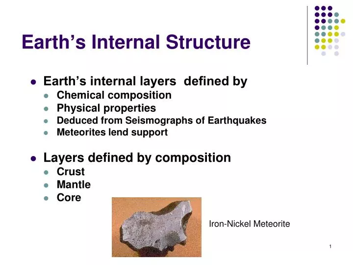
Earth’s Internal Structure • Earth’s internal layers defined by • Chemical composition • Physical properties • Deduced from Seismographs of Earthquakes • Meteorites lend support • Layers defined by composition • Crust • Mantle • Core Iron-Nickel Meteorite
Evidence: Density of Earth’s Layers • “Three centuries ago, the English scientist Isaac Newton calculated, from his studies of planets and the force of gravity, that the average density of the Earth is twice that of surface rocks and therefore that the Earth's interior must be composed of much denser material. “ http://pubs.usgs.gov/gip/interior/
The S-Wave Shadow Zone http://en.wikipedia.org/wiki/Richard_Dixon_Oldham Since Shear (S) waves cannot travel through liquids, the liquid outer core casts a larger shadow for S waves covering everything past 103 degrees away from the source.
The P-Wave Shadow Zone http://www.amnh.org/education/resources/rfl/web/essaybooks/earth/p_lehmann.html P-waves through the liquid outer core bend, leaving a low intensity shadow zone 103 to 143 degrees away from the source, here shown as the north pole HOWEVER, P-waves traveling straight through the center continue, and because speeds in the solid inner core are faster, they arrive sooner than expected if the core was all liquid. Inge Lehmann Behavior of waves through center reveal Earth’s Interior
Earth’s internal structure • Main layers of Earth are based on physical properties including mechanical strength • Outer layers mostly Silicate Minerals: Crust and Mantle • Lithosphere (behaves like a brittle solid) Crust and uppermost mantle • Asthenosphere “weak sphere” Rest of Upper Mantle Heat softened, plastic solid • Lower Mantle Solid due High Pressures • Inner Layers Core Iron and Nickel, • outer above melting point - liquid, • inner solid due to high pressures
CRUST 1_8 Continental crust (least dense) Upper mantle Oceanic crust MANTLE 0 km Lithosphere ~100 km Lower mantle Asthenosphere ~350 km CORE (most dense) Outer ~2900 km core ~5155 km Inner Earth’s center is 6371 kilometers below the surface, 1 mi = 1.61 km. Equals ~ 3957 miles, or about 4000 miles radius core
Harry Hess: Mid-ocean ridges are spreading apart due to flow in the mantle. Crust moves apart as if on conveyer belts.
1_20 Mid-ocean Ridge Origin of new Ocean Floor At the Mid-Ocean Ridge • Mantle material is moved near the surface. • Lithosphere (Crust + Upper Mantle) bulges into a mid-ocean ridge. • It cracks, exposing the mantle to low pressures • Some of the Mantle minerals are unstable at atmospheric pressures • The unstable minerals melt forming lavas, and cool into basalt, the main rock of ocean lithosphere.
How can we test the hypothesis? • Fred Vine: How about geomagnetic reversals? • Earth's magnetic field periodically reverses polarity – north magnetic pole becomes south magnetic pole, and vice versa • Dates when polarity of Earth’s magnetism changed were determined from lava flows
Magnetite crystals align with magnetic field Away from equator and poles they dip toward the North or south poles When the Earths polarity switches, new lavas adjacent older, point in opposite directions
Paleomagnetic reversals recorded by new lava rock at mid-ocean ridges This lava rock is called “Basalt”
Test 1: Princeton PostDoc Fred Vine So, they checked. NOT FALSE
Test 2: Oceanic Crust youngest at ridges Hess model prediction: youngest at ridges, oldest at trenches Also NOT FALSE
95% of energy released by earthquakes originates in narrow zones that wind around the Earth These zones mark of edges of tectonic plates Broad are subduction zone earthquakes, narrow are MOR. Lead to recognition of plates
Structure of three Plates Youngest at ridges, oldest at trenches NOT FALSE Three boundary types, divergent, convergent, and transform
Plate tectonics: The new paradigm • Earth’s major plates • Associated with Earth's strong, rigid outer layer • Known as the lithosphere • Consists of uppermost mantle and overlying crust • Overlies a weaker region in the mantle called the asthenosphere. The Asthenosphere is hot and plastic, and sheds heat via convective currents.
Mantle circulations are an example of convection, heat transfer by moving fluids This example shows transfer of core heat to the upper mantle and crust
Convergent plate boundary Divergent plate boundary Transform plate boundary 180º 90º 0º 90º 180º 1_15 Mid-Atlantic Ridge 45º 45º NORTH EURASIAN AMERICAN PLATE JUAN DE PLATE PACIFIC FUCA PLATE PLATE ARABIAN PLATE PHILIPPINE CARIBBEAN PLATE PLATE AFRICAN COCOS 0º 0º PLATE PLATE FIJI SOUTH PLATE AMERICAN PLATE INDIAN- PACIFIC NAZCA AUSTRALIAN PLATE PLATE PLATE Mid-Atlantic SCOTIA Ridge PLATE 45º 45º ANTARCTIC PLATE ANTARCTIC PLATE 180º 90º 0º 90º 180º • Plates move relative to each other at a very slow but continuous rate • Average about 5 centimeters (2 inches) per year • Cooler, denser slabs of oceanic lithosphere descend into the mantle Seven major lithospheric plates Seven or so smaller ones. Plates are in motion and change in shape and size Largest plate is the Pacific plate Several plates include an entire continent plus a large area of seafloor
1_22a Plate Tectonics Concept caused revelation. Yes, revelation. Earth’s many features were all caused by the same process. CONTINENTAL PLATE CONTINENTAL PLATE Oceanic lithosphere being subducted Water driven out of ocean lithosphere Water hits mantle, which partially melts. Forms a deep basaltic magma (a)
Plate boundaries Each plate bounded by combination of all three boundary types: divergent, convergent, transform Edges marked by Earthquakes
Divergent boundaries are located mainly along oceanic ridges
The East African Rift The rift valley collects river and lake sediments. Land animals are preserved as fossils instead of being eroded away
Continental Rift into Ocean Basin Rift Valleys and Oceans are the same thing
Convergent plate boundaries • On the other side of a plate, opposite the diverging margin, a converging margin is usual. • Three different types, formed from pushing together of ocean floors and/or continental plate
Types of Convergent Boundaries Define: Density, Buoyancy, Gravity Ocean-Continent Yields Continental Volcanic Arc Descending convective cell this side Ocean-Ocean Yields Volcanic Island Arc Descending convective cell this side Continent-Continent Yields Collision Mtns. Alps, Himalayas, Appalachians Descending convective cell this side
1_22a 1. Ocean - continent convergence A volcano forms as magma reaches the surface CONTINENTAL PLATE CONTINENTAL PLATE Oceanic lithosphere being subducted A Subduction Zone (a) • As plate descends into the Subduction Zone, partial melting of mantle rock makes magmas • (Molten Rock) These are buoyant, and rise. • Volcanic mountains associated with subduction are called volcanic arcs. • Andes and Cascades mountains are continental volcanic arcs
Types of convergent boundaries: • 2. Oceanic-oceanic convergence • When two oceanic slabs converge, one descends beneath the other. • Often forms volcanoes on the ocean floor above the subduction zone. • If the volcanoes emerge as islands, a volcanic island arc is formed (Japan, Aleutian islands, Tonga islands)
3. Continental-continental convergence • Continued subduction brings continents together • Less dense, buoyant, thick continental lithosphere does not subduct • Result is a collision between two continental blocks. Process produces folded mountains (Himalayas, Alps, Appalachians) 1_22b Collisional Fault and Fold Mountains mountains (b) Rocks deformed in collision
Transform fault boundaries • Third type of plate boundary • Plates slide past one another and no new lithosphere is created or destroyed • Transform faults • Most join two segments of a mid-ocean ridge (MOR) as parts of linear breaks in the oceanic crust known as fracture zones • Accommodate simultaneous movement of offset ridges • Source of weak (MOR) to fairly strong (San Andreas) earthquakes.
Transform faults accommodate movement on offset ridge segments Plates are moving in opposite directions
Mt. Redoubt volcano Anchorage Fault and Fold mountains from earlier Continent-Continent collisions NORTH AMERICAN PLATE Bering Sea JUAN DE FUCA PLATE Aleutian Islands Mt. Saint Helens volcano Ocean-to-ocean subduction PACIFIC PLATE (a) Convergent and Divergent, Margins of Plates plus small transform margins between MOR segments Cascade Range from dewatering Small Transform Faults Ocean-to-continent subduction Mid-ocean ridge (divergent margin) Studied by Fred Vine and Drummond Matthews
Plate Tectonics Explains It All • We now understand mountains, volcanoes, and big earthquakes associated with, for example, the San Andres fault. • We understand rift valleys and how oceans form, deep ocean trenches, mid ocean ridges, why fossils and mountain ranges look alike across vast oceans.