Download
1 / 21
210 likes | 372 Views
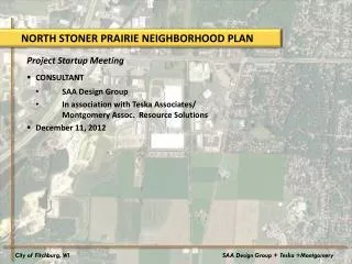
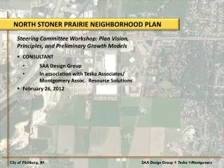
NORTH STONER PRAIRIE NEIGHBORHOOD PLAN. Steering Committee Workshop: Plan Vision, Principles, and Preliminary Growth Models CONSULTANT SAA Design Group In association with Teska Associates/ Montgomery Assoc. Resource Solutions February 26, 2012. City of Fitchburg, WI.

E N D
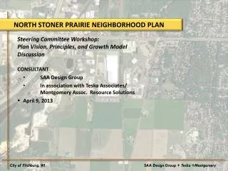
NORTH STONER PRAIRIE NEIGHBORHOOD PLAN Steering Committee Workshop: Plan Vision, Principles, and Preliminary Growth Models • CONSULTANT • SAA Design Group • In association with Teska Associates/ Montgomery Assoc. Resource Solutions • February 26, 2012 City of Fitchburg, WI SAA Design Group + Teska +Montgomery
TODAY’S AGENDA Neighborhood Plan Vision and Design Principles Review Neighborhood Planning Process Discuss Preliminary Growth Model Alternatives Next Steps City of Fitchburg, WI SAA Design Group + Teska +Montgomery
NEIGHBORHOOD VISION STATEMENT North Stoner Prairie will be a vibrant, sustainable neighborhood that is home to a diverse range of uses, from an employment center to housing to neighborhood schools. Through protecting natural resources, bikeways and open spaces, North Stoner will set an example for respecting water resources and the environment while promoting jobs and economic development. The North Stoner Neighborhood offers a transition between the urbanized area of the City of Fitchburg and agricultural resources to the south. It will offer a connection to nature, community gardens and agriculture, while creating a walkable neighborhood to enjoy access to schools, parks, retail and jobs. City of Fitchburg, WI SAA Design Group + Teska +Montgomery
NEIGHBORHOOD DESIGN PRINCIPLES • Integrated, holistic planning process • Know and work with site capacity • Respect and preserve open space, cultural, historic, and natural resources • Provide a diversity of land uses • Incorporate density and jobs • Accommodate housing of varying types and price ranges • Create integrated, multi-modal transportation network including bikeways, complete streets, support for walkability and access to transit • Conserve energy and water resources • Build on unique neighborhood attributes to create authentic, dynamic character City of Fitchburg, WI SAA Design Group + Teska +Montgomery
NEIGHBORHOOD PLANNING PROCESS Comprehensive Development Plan/Subdivision Plat Alternative Growth Models Preferred Growth Model/Land Use Plan Public Process – Neighborhood Planning Private Landowner/ City Process City of Fitchburg, WI SAA Design Group + Teska +Montgomery
PRELIMINARY GROWTH MODELS (PUBLIC) • Do: • Provide alternative approaches to: • Articulating Neighborhood Vision in graphic form • Reflecting Neighborhood Design Principles City of Fitchburg, WI SAA Design Group + Teska +Montgomery
FINAL GROWTH MODEL/LAND USE PLAN (PUBLIC) • Does: • Illustrate general land use patterns • Provide general assumptions for stormwater management, density of uses, open space • Identify key access points and connectivity to existing transportation network • Establish framework of expectations for the future development by the private sector City of Fitchburg, WI SAA Design Group + Teska +Montgomery
FINAL GROWTH MODEL/LAND USE PLAN (PUBLIC) • Does Not: • Dictate highly specific development details, such as: • Internal road network • Individual lot size • Individual building footprints/sizes • Number of developable lots in any one area or throughout neighborhood • Mandate development • Permit development City of Fitchburg, WI SAA Design Group + Teska +Montgomery
COMPREHENSIVE DEVELOPMENT PLAN (PRIVATE) City of Fitchburg, WI SAA Design Group + Teska +Montgomery
GROWTH MODEL ASSUMPTIONS • Density • Single-family – 4 dwelling units/acre • Multi-family – 8 dwelling units/acre • Business Park – 70% lot coverage, 1 story • Commercial – 50% lot coverage, 1 story • Mixed Use – 70% lot coverage, average of 2 stories • Set-Asides • Stormwater - 30 acre closed depression in addition to 10% for each subarea • Open space – 25% for commercial, 10% for business park, 10% for residential • Right-of-way – 10% City of Fitchburg, WI SAA Design Group + Teska +Montgomery
GROWTH MODEL – Option 1 Single-family Dwelling Units 358 Business Park 114 acres, 2.4 million sq. ft. Commercial 35 acres, 0.6 million sq. ft. Stormwater Detention 30 acres City of Fitchburg, WI SAA Design Group + Teska +Montgomery
GROWTH MODEL – Option 1 • Band of open space and stormwater spans east-west portion of study area • Bike path connects Quarry Ridge Recreation Area through open space band eastward to school campus • Countryside commercial and mixed-use area located at Seminole Highway and Lacy Road • Woodland, stone foundation on Lacy Road and stone barn on Seminole Highway are all preserved • Retail/commercial uses are planned along Seminole Highway in northern portion of neighborhood • Assumptions: • Total Open Space – 37 acres • Total Stormwater – 61 acres • Total Righ-of-Way Dedication – 31 acres City of Fitchburg, WI SAA Design Group + Teska +Montgomery
GROWTH MODEL – Option 2 Single-family Dwelling Units 281 Multi-family Dwelling Units 18 Business Park 126 acres, 2.7 million sq. ft. Commercial 24 acres, 0.4 million sq. ft. Stormwater Detention 30 acres City of Fitchburg, WI SAA Design Group + Teska +Montgomery
GROWTH MODEL – Option 2 • Neo-traditional area west of Badger State Trail and surrounding park and stormwater detention • Possible high school site adjacent to existing schools (marked open space on map) • Business Park connects north toward McKee Road as well as south towards Lacy Road • Mixed use development and more intensive use along Seminole Highway • Low density residential and park space or school site east of utility easement • Assumptions: • Total Open Space – 32 acres • Total Stormwater – 59 acres • Total Righ-of-Way Dedication – 29 acres City of Fitchburg, WI SAA Design Group + Teska +Montgomery
GROWTH MODEL – Option 3 Single-family Dwelling Units 347 Multi-family Dwelling Units 101 Business Park 76 acres, 1.6 million sq. ft. Commercial 59 acres, 1million sq. ft. Stormwater Detention 30 acres Institution (High school)38 acres City of Fitchburg, WI SAA Design Group + Teska +Montgomery
GROWTH MODEL – Option 3 • Area is divided into three subareas: • Business park which provides expansion area for Sub Zero and industrial uses • Commercial, housing, and school campus expansion east of the Badger State Trail • Residential and open space subarea west of Badger State Trail • Utility easement relocated to be adjacent to Badger State Trail • Woodland, stone foundation on Lacy Road and stone barn on Seminole Highway are all preserved • Assumptions: • Total Open Space – 37 acres • Total Stormwater – 58 acres • Total Righ-of-Way Dedication – 28 acres City of Fitchburg, WI SAA Design Group + Teska +Montgomery
GROWTH MODEL – Option 4 Single-family Dwelling Units 377 Multi-family Dwelling Units 177 Business Park 80 acres, 1.7 million sq. ft. Commercial 35 acres, 0.4 million sq. ft. Stormwater Detention 30 acres Institution 3 acres City of Fitchburg, WI SAA Design Group + Teska +Montgomery
GROWTH MODEL – Option 4 • Single family residential in southwest portion of site • Buffer area between single family residential and business park • Multi-family housing and mixed-use development along Badger State Trail and Seminole Highway • Retail/commercial in northern portion of Seminole Highway and on Lacy Road • Assumptions: • Total Open Space – 36 acres • Total Stormwater – 61 acres • Total Righ-of-Way Dedication – 31 acres City of Fitchburg, WI SAA Design Group + Teska +Montgomery
GROWTH MODELS – DISCUSSION Model 1 Model 2 Model 3 Model 4 City of Fitchburg, WI SAA Design Group + Teska +Montgomery
NEXT STEPS Neighborhood Q&A? City of Fitchburg, WI SAA Design Group + Teska +Montgomery
NEXT STEPS • Refinement of Growth Models • Second round of Staff/Committee sessions to discuss refined model/models – MARCH 26 • Present proposed growth model to CEDA, Plan Commission, Parks Commission • Update project website City of Fitchburg, WI SAA Design Group + Teska +Montgomery