Topographic Map Orientation
Topographic Map Orientation. Brian Waranauskas NWS Great Falls. Steps 1 & 2: Intro & Clay Model. Intro: Discuss how maps represent 3-D features in 2-D format Fun, hands-on activity Procedure outlined in lesson plan on MKIW CD Notes:

Topographic Map Orientation
E N D
Presentation Transcript
Topographic Map Orientation Brian Waranauskas NWS Great Falls
Steps 1 & 2: Intro & Clay Model • Intro: Discuss how maps represent 3-D features in 2-D format • Fun, hands-on activity • Procedure outlined in lesson plan on MKIW CD • Notes: • About 10 oz of clay (2 small Play-Doh containers) per student group • Use double-line or second color on one axis for easier reference • Finished product leads to discussion about contours • Non-symmetrical shapes work best for highlighting key points • Additional exercise sheets for contour discussion being emailed (not on CD)
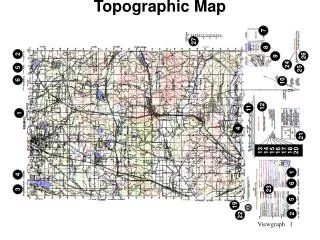
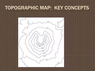
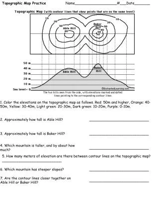
Steps 3 & 4: Contours and Map Exercise • Contour & map orientation discussion: • Lesson plan defines contour interval, index contour, and intermediate contours • Discuss / show • Close contours = steep terrain • Spread contours = less-sloped terrain • Map orientation: discuss map scale, legend info, compass rose • Map-reading exercise • Exercise sheet and separate answer key on your MKIW disk • Easy questions on interpreting map features
514 County road 4 8 3 Forest service road BM 4513 0 0.5 mile BM X 4790 0 2000 ft Benchmark elevation (feet, MSL) 8712 Spot elevation (feet, MSL) X7743 KINGS HILL TOPOGRAPHIC MAP Contour interval: 40 feet