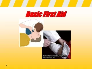
Basic First Aid Wounds and bleeding
Basic First Aid Wounds and bleeding. What is First Aid. The objectives of first aid are: Preserve life. Prevent the illness or injury from becoming worse. Promote recovery. Who is a first aider?. A first aider is someone who takes charge of an emergency and gives first aid.

Basic First Aid Wounds and bleeding
E N D
Presentation Transcript
What is First Aid The objectives of first aid are: Preserve life. Prevent the illness or injury from becoming worse. Promote recovery.
Who is a first aider? A first aider is someone who takes charge of an emergency and gives first aid. A fist aider does not diagnose or treat injures or illness, this requires a medical professional. A first aider suspects injuries and illness and gives first aid.
What can a first aider do? Protect casualty’s belongings Keep unnecessary people away Reassure family and friends of the casualty Clean up the emergency scene and work to correct any unsafe conditions that may have caused the injury in the first place.
First aid and the law. Principles of the good Samaritan You are a good Samaritan if you help a person and have no legal duty to do so. Whenever you help a person in an emergency, you should abide by the following principles: Consent Reasonable skill and care Negligence Abandonment
Safety and First Aid. Risks to be aware of: Is the energy source still active? ie power lines down External hazards. ie. At a car crash fuel leaks, explosion Injury incurred by first aider. ie. The casualty is to large to move alone
Preventing infection. Bloodborne and airborne. Protect yourself and the casualty if possible with: Gloves Face masks or shield Hand washing
Safety in a violent situation Protect your safety and others if possible Give first aid with awareness of casualty’s emotional state Keep onlookers away Leave everything at the scene as is
Medical help Medical help can only be given by a doctor or under the supervision of a doctor. The Golden Hour is the first hour after the injury. EMS emergency medical services
Emergency scene managementFour steps Scene survey- take control, what happened etc. Primary survey- assess the casualty and start first aid. Secondary survey- more thorough check for injuries. On going casualty care- stay with casualty until medical help arrives.
Primary survey A= Airway B= Breathing C= Circulation
Secondary survey History of the casualty Assess the vital signs Head to toe examination Give first aid
Ongoing care Give first aid for shock Monitor the casualty’s condition Record the events of the situation Report what hapened
Chain of survival. Early Healthy Choices. Early Recognition. Early Access. Early CPR. Early Defibrillation. Early Advanced Care. Early Rehabilitation.
The 4 Rs of CPR are: Risk: factors in your life that predispose you to developing heart problems or a stroke. Recognize: how to recognize the signs of a developing medical emergency; React: what to do when you see a developing emergency. Resuscitate: how to do CPR and how to help someone who is choking.
What is a heart attack? The heart is a muscle that needs oxygen to function. (like all muscles) If arteries which supply Oxygen to the heart are blocked then the heart can’t function = HEART ATTACK! Angina is when blood flow is temporarily blocked then clears. Person will experience some pain but it passes. (definite danger of heart attack!) Cardiac Arrest is when the heart stops beating and is no longer pumping blood to the rest of the body. Without oxygen serious brain damage starts in 4 to 6 minutes.
What is a stroke? A stroke, or cerebrovascular accident (CVA). Occurs when blood supply to part of the brain is blocked, causing brain cells to die.
Risk Factors for Heart Attack and Stroke Risk Factors You Can't Control • Age • Gender • Family history • Race Risk Factors You Can Control • Smoking • Lack of exercise • High blood pressure • High blood cholesterol • Unhealthy weight • Diabetes Stress
What You Can do to Lower Your Risk Be aware of your risk factors Be smoke free Be physically active Know and control your blood pressure Eat a healthy diet that is lower in fat, especially saturated and trans fats Maintain your diabetes Limit your alcohol use Reduce stress See your doctor regularly and follow your doctor's advice
Recognize the warning signs of heart attack and stroke. Heart AttackOne or more of the 5 P’s • Pain- Chest pain or discomfort, radiating pain in arm, neck jaw or back. • Pale skin - Sweating • Puffing – trouble breathing • Pooped – feeling very tired • Puking – sick to stomach or vomiting StrokeOne or more of SUDDEN • Weakness, numbness in face and or limbs • Trouble speaking • Visions problems • Severe headache • Dizziness Call 911 or your medical emergency number immediately
Cardiopulmonary Resuscitation for an Adult Victim Situation: Adult (8 years old and up) was found, looking unconscious. This incident was un-witnessed by yourself or any bystanders. 1. Check for hazards: make sure the environment is safe for you and the victim. The area around him/her may give you clues about what happened 2. Assess Responsiveness: without actually moving the victim, tap shoulders, bang the ground, shout, pinch his/her earlobes, etc. See if they will wake up. 3. Call 911 • If there is no one around, you need to call 911. If you have a cell phone, remember to give your address/location – 911 cannot trace cell phone locations! If you do not, you must leave your victim and find the nearest phone. Remember, if you don’t go and call, no one is coming to help you! • If there is a bystander around, direct him/her to go and call 911 and tell them there is an adult who was choking and passed out. Ask your bystander if s/he understands then tell to report back to you so that you know the call was made.
4. Open the airway: using the head tilt-chin lift - (chin should be the highest point of face) and check for breathing 5. Check for breathing: for up to 10 seconds. Put your ear over the persons mouth and nose. • Look for chest movement • Listen for sounds of breathing • Feel for exhaled breath 6. Give 2 Breaths: If victim is not breathing, give 2 full, slow breaths – each breath should take 1 second to administer. (full seal – either mouth-to-mouth, mouth-to-nose, mouth-to-stoma or mouth-to-mask).
7. Begin compressions for cardiac arrest : • Place the heel of the hand on the breastbone in the center of the chest between the nipples. • Place the heel of the second hand on top of the first so that your hands are overlapping and parallel. • You may link you fingers together for added stability but keep them off the chest. • Shoulders directly over hands with arms straight and locked. 8. Give 30 compressions: Compress to a depth of 2 inches. Make sure your compressions are sharp and vigorous • You need to compress at a rate of approximately 100 per minute (slightly less than 2 per second) • Keep your speed up, but don’t go so fast that your limbs cannot keep up with your count.
Aim of Map Reading... • To navigate & recognize features on the ground & map. • To picture the ground even though it hasn’t been seen. • To understand and pass information quickly. • Determine and plan a safe route.
Definition of a Map… • Its a scaled representation of the earths surface shown on a plane surface. • It shows natural and/or artificial features. • Used as a form of communication, used to convey land features. • However, its only accurate at time of aerial photo or field revision.
Types of Maps... • Street directory • Topographic map • Thematic • Scientific
Basic Street Directory Map Edition (year) Legend Facility index Street index Map & reference
Town of Hampton Map • Using the grid reference system; A to J down the sides and 1 to 10 along the bottom • Locate two of each symbol from the legend on the map and record it in your note book. • For example: Cemetery “Grave Duguan Girl 1916” Grid reference G 6 If possible locate your home and reference it.
Marginal Information/Legend • Printed around the margin of the map to aid in using the map. • E.g.. Title, scale, type, legend of symbols, edition & sheet number, adjoining maps, contour interval, magnetic variation, grid reference block,
Conventional Symbols… • Water features • Structures • Boundaries • Road & Rail • Land features
Scale… Scale is expressed in 3 methods. • In words (One cm = One km) • Representative fraction. (RF) 1:25000 E.g 1cm = 25000cm or 250m. TRICK - REMOVE LAST 2 ZEROS TO GET ACTUAL SIZE ON GROUND IN METRES 1:10,000 to 1:100,000 are small scale 1:250,000 to 1:10 million are large scales • Linear scale - scaled ruler. TIP As the second number increases, detail shown on the map decreases
Measuring Distance… • Measuring straight line distance (map) • Paper • Divider • Ruler (side of compass) • Length of string
Map Coordinates Latitude& Longitude • Latitude = Horizontal lines (N or S of equator) • Longitude = Vertical lines • (E or W of Greenwich) • 2 Types • Geographical coordinates given as latitude and longitude • Grid coordinates given as Eastings & Northings
Grid Coordinates • Used to accurately locate/position objects on a map. • Two sets of numbered parallel lines (vertical & horizontal) intersecting at right angles to form squares on a map. • Superimposed over the map to provide a reference system. • Grid squares are generally 1km2. • Grid lines are defined as ‘Eastings’ & ‘Northings.’
TIP Across first, then up Or E before N Cont’… • Northings are the horizontal lines numbered bottom to top. • Read ‘Eastings’ first, then ‘Northings’. Developed by: Dave Bere Eastings are the vertical lines, numbered left to right. 99 00 01 02 03 03 02 01 00 99
4 Figure Area References… Developed by: Dave Bere • The co-ordinates represent the whole square, not just the single point. E.G 1201 - represents 1km2 • Find ‘12 easting’ first. • Find ‘01 northing’ second. 11 12 13 03 02 01 00
GPS… Developed by: Dave Bere • Global Positioning System (satellite based navigation) • Features included: • Your position on the Earth’s surface • Your current height - ASL • Your speed and direction of travel • Lat/Long or UTM • Different world datums • WGS84 • Developed by US Defence system • Uses 24 satellites orbiting the Earth twice a day Signal doesn’t penetrate buildings or thick scrub. Uses triangulation principle to pinpoint location. Minimum of 4 satellites are needed for an accurate 3D position Typical accuracy is within 30m - 95% of the time Interfaces with your PC and mapping software Consult users guide for operating instructions
Ground Shape… • Allows the user to visualise the surroundings • Ground shape is referred to as relief. • Relief can be shown as: • Hill shading & • Contours Developed by: Dave Bere
Contours… Developed by: Dave Bere A contour is a line that joins points of equal elevation Contour interval is the vertical distance between contour lines See legend for contour interval
Contour Patterns… • Contour lines close together show steep slopes • Contour lines far apart show gentle slopes • Contour lines evenly spaced show uniform slope • If the spacing decreases when going from high to low, the slope is convex • If the spacing increases when going from high to low, the slope is concave Developed by: Dave Bere
Land Features… • Representation of height • Bench mark, trig station, spot height • Physical features • Knoll • Saddle • Spur, ridge • Valley, gorge • Escarpment • Re-entrant • Crest • Plateau Developed by: Dave Bere
Gradient… • A method of expressing ground slope. • Gradient = Contour interval (height) Horizontal Distance • 1:10 = 1 unit up or down / 10 units across. • 1:1 is a 450 • Simplify to smallest fraction = 20 = 1 = 1:6 • 120 6 Developed by: Dave Bere
Compass… Developed by: Dave Bere • Degree system - (3600 circle) • North = 0/3600 • South = 1800 • East = 900 • West = 2700 • Cardinal points • 32 in total, • only 16 are really used.
Bearings… Developed by: Dave Bere The purpose of a bearing is to give an accurate indication of direction from one point to another. Simply, a bearing is an angle. It is the angle measured clockwise from a fixed zero line, generally north. • Grid bearings • Used when bearings are taken from or to the map. • Magnetic bearings • Used in conjunction with a compass. This type of bearing is for field operation. • Bearings are measured using a protractor or compass.
North Points… • True north - TN • Earth spins on this axis • Magnetic north - MN • Compass needle points to magnetic north • Its a location in the far north of Canada • Grid north – GN • The vertical lines overlayed on a map point to grid north – (eastings) • Not exactly true north. • Difference between TN & GN is called convergence • In map reading we only use GN & MN Developed by: Dave Bere
Magnetic Variation… • The difference between ‘grid north’ & ‘magnetic north’ is called magnetic variation. • The magnetic north pole is not fixed, it moves continually • Easterly & westerly variation • Check map for accuracy of variation Developed by: Dave Bere