Download
1 / 16
170 likes | 248 Views
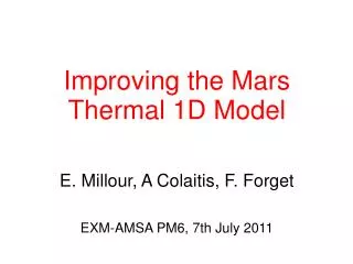
E. Millour, A Colaitis, F. Forget EXM-AMSA PM6, 7th July 2011. Improving the Mars Thermal 1D Model. Overview of the lmd1d tool. Initially provided by LMD to ESA in Feb. 2008 A simple, straightforward program designed to compute: - The downward thermal IR flux at the surface.

E N D
E. Millour, A Colaitis, F. Forget EXM-AMSA PM6, 7th July 2011 Improving the MarsThermal 1D Model
Overview of the lmd1d tool • Initially providedby LMD to ESA in Feb. 2008 • A simple, straightforward program designed to compute: - The downward thermal IR flux at the surface. • - The surface temperature. • - The near surface (1m) atmospheric temperature. • - The sub-surface temperatures down to ~2m. • - … • With the full LMD Mars GCM physics At the time, the main improvements (wrt MCDv4.3) were: • - An improved radiative transfer (Toon et al.) • - Adding the possibility of choosing the dust optical properties between Clancy and Lee (as in the MCD) or Ockert-Bell descriptions • Recent improvements such as Wolff et al. dust properties and the thermals modelnow need be included in the lmd1d model.
inputs user-supplied parameters outputs_atm atmospheric data lmd1d.e main program outputs_soil (optional) sub-surface data z2sig.def atmospheric levels Overview of the lmd1d tool Fortran main program: lmd1d.F + routines (lmd1d_routines.F & physiq.F) + header files ( *.h files) • Input (text) files: “inputs” to define run parameters “z2sig.def” to define atmospheric levels • Output (text) files: “outputs_atm” which contains output atmospheric data “outputs_soil” which contains optional sub-surface temperatures
Contents of “inputs” file This file contains the run parameters set by the user • Solar Longitude: -Real- Solar longitude (degrees) at which results are sought. • Local true solar time: -Real- in martian hours (between 0 and 24; noon=12). • Duration over which results are given: -Integer- in sols: 0 means just at times given above. If non-zero, values are given over as many sols, every half-hour. • Latitude: -Real- latitude (degrees) at which results are sought. • Ground pressure: -Real- ambient atmospheric pressure at ground level (Pa). • Tau: -Real- dust opacity in the visible (0.67µm), if given as a positive number. Negative values -1 or -2 trigger automated use of tabulated values
Tabulated (-1) dust opacity • Analytical function of time (Ls) and latitude (). • Developed (in 2000) to match temperature profiles observed by radio occultation and inversion of TES data.
Tabulated (-1) dust opacity • Illustration of dust optical depth at 700 Pa: • Note that to match atmospheric temperature in the GCM, we needed to use : • vis = TESabs x 2 x 0.75 with Ockert-Bell • vis = TESabs x 2 x 1.3 with Clancy & Lee • But with the new Wolff et al. dust properties, no need for adjustments!
Tabulated (-2) dust opacity • « ExoMars Scenario » provided by S. Zimmerman (technical note CDF-TN-037, 09/03/2005) where visible dust opacity (at 700 Pa) depends only on Ls:
Contents of “inputs” file • Dust opacity ratio: -Real- visible (0.67µm) to infra-red (9µm) dust opacity ratio. Typically = 2. • Albedo: -Real- albedo of bare ground. Typically between 0.1 and 0.3 (see map); up to 0.55 in extreme (North or South cap) cases. • Emissivity: -Real- Infra-red emissivity of bare ground. Typically 0.95. • Near-surface thermal inertia: -Real- Thermal inertia of near-surface ground layer, given in J.s-1/2.m-2.K-1. • Volumetric heat capacity: -Real- Volumetric heat capacity of near-surface ground layer, given in J.m-3.K-1. Typically C = 106 J.m-3.K-1 • Depth at which second layer begins: -Real- this is the depth (m) at which an optional second layer of ground begins. No second layer if set to more than the vertical extent of the model (26.2 m). • Thermal inertia of second layer: -Real- • Volumetric heat capacity of second layer:-Real- • Flag: -Logical- Compute soil temperatures? (T:yes, F:no).
Contents of “outputs_atm” file 1 line of output for each time, with 11 columns of data • Mars date: in sols (and decimal fraction thereof) elapsed since Northern Hemisphere equinox (Ls=0°). • Solar longitude: Solar longitude, in degrees. • Local True Solar Time: in Martian hours; 1 sol=24 hours and 0=midnight. • SW Flux: Downward total incident SW flux (on a flat horizontal surface), in W.m-2. • SW scattered Flux: Downward scattered incident SW flux, in W.m-2. • Solar zenith angle: in degrees, =0 at zenith and =90 when sun is at or below the horizon. • Sun azimuth: in degrees, south=0, west=90, north=+/-180, … • IR Flux: Downward total incident IR flux (on a flat horizontal surface), in W.m-2. • Sky brightness temperature: Temperature, in K, computed from the downward total incident IR Flux F : T4sky= F/ • Ground Temperature: Temperature (K) of the ground-atmosphere interface. • Atmospheric temperature at 1m: Temperature (K) at 1 m above the ground.
Contents of “outputs_soil” file This output file is created/filled only if computation of soil temperatures was requested (Flag, parameter 15 in “inputs” file, is set to true). There is one line of output for each time, which contains: 1. Mars date: in sols (and decimal fraction thereof) elapsed since Northern Hemisphere equinox (Ls=0°). 2. Solar longitude: Solar longitude, in degrees. 3. Local True Solar Time: in Martian hours; 1 sol=24 hours and 0=midnight. 4. Ground Temperature: Temperature (K) of the ground-atmosphere interface (same as output n° 7 of “outputs_atm” file). 5.-16. Temperatures: in K, at depths of 0.0023, 0.0045, 0.0091, 0.0181, 0.0362, 0.0724, 0.1448, 0.2896, 0.5793, 1.1585, 2.3170 and 4.6341 m (more than just these layers are used in the computation).
Implementation of Wolff et al. dust properties in lmd1d • The dust properties change is such than only a change in header file is needed. Open question: should we keep it so? • The following slides illustrate the impact of dust properties change for downward IR flux at the surface, surface temperature and atmospheric temperature at 1m above the surface, for the Meridiani landing site.
Meridiani Site TI = 238 SI , Albedo = 0.205 Surface pressure = 720 Pa Latitude = -1.82° , Ls = 245° Optical depth (at 700Pa) = 1
Meridiani Site TI = 238 SI , Albedo = 0.205 Surface pressure = 720 Pa Latitude = -1.82° , Ls = 245° Optical depth (at 700Pa) = 5
Implementation of the thermals model in lmd1d • See A. Colaitis’ presentation on the thermals model and how it improves the representation of the physical processes at work. • The thermals model has been included in lmd1d. Some fine tuning still needs to be done. • The issue about the best way to interpolate temperature near the surface ,i.e. between the first atmospheric level and the surface, to obtain temperatures at 1m also needs to be addressed (so far linear interpolation is used). See A. Spiga’s presentation.
Meridiani Site TI = 238 SI , Albedo = 0.205 Surface pressure = 720 Pa Latitude = -1.82° , Ls = 245° Optical depth (at 700Pa) = 1
Finalization of the lmd1d tool • Use of the Wolff et al. dust properties has been included. • The thermals model has been included (some fine tuning still necessary). • A strategy for the best physically based interpolation (to obtain temperatures at 1m) is within reach. • Once the lmd1d tool is finalized, it will be delivered, along with updated documentation: users’ manual, detailed design document and validation document.