Interoperable Geographic Information for Biosphere Study (IGIBS)
150 likes | 435 Views
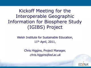
Interoperable Geographic Information for Biosphere Study (IGIBS). Biosffer Dyfi Biosphere Research Forum , 18 th May, Aberystwyth University Chris Higgins, EDINA, Project Manager, chris.higgins@ed.ac.uk. IGIBS – What is it?. JISC funded 7 month project (to Nov 2011)

Interoperable Geographic Information for Biosphere Study (IGIBS)
E N D
Presentation Transcript
Interoperable Geographic Information for Biosphere Study (IGIBS) Biosffer Dyfi Biosphere Research Forum, 18th May, Aberystwyth University Chris Higgins, EDINA, Project Manager, chris.higgins@ed.ac.uk
IGIBS – What is it? • JISC funded 7 month project (to Nov 2011) • Kickoff meeting was at Wales Institute for Sustainable Education on 11th April • Partnership between: • EDINA • Institute of Geography and Earth Sciences (IGES), University of Aberystwyth • Welsh Assembly Government • Exploiting developments in data access to make it easier for people to get the data they want online in a form conducive to what they want do
EDINA EDINA • JISC Designated, part of University of Edinburgh • A National Data Centre for Tertiary Education since 1995 to enhance the productivity of research, learning and teaching in UK higher and further education (mission statement) • Focus is on services but also undertake r&D • Geospatial data services include content from: Ordnance Survey, Geology, UKHO, etc • EDINA provides technical support in the operation of the UK Access Management Federation • Uses Shibboleth open source software (an implementation of OASIS Security Assertion Markup Language) • Approx 8 million users • 837 Member Organisations (IdPs and SPs)
Spatial Data Infrastructure #1 “SDI encompasses the policies, organisational remits, data, technologies, standard delivery mechanism and financial and human resources necessary to ensure that those working with spatial data, whether at the global or local scale, are not impeded in meeting their objectives (INSPIRE consultation paper, 2003)”
Spatial Data Infrastructure #2 • Infrastructure for Spatial Information in Europe (INSPIRE) Directive • UK Location Programme • Our National SDI • Rolling out INSPIRE in the UK • UK Academic SDI • Some key EDINA/JISC components of the UK Academic SDI relevant to IGIBS: • GoGeo! http://www.gogeo.ac.uk/ • GeoDoc • ShareGeo
Main IGIBS Aim – Improve UK SDI Interoperability • Real world SDI R&D requirements • Resources • Data Public Sector Academic sector Virtuous Circle • Better educated graduates • Future customers/employees used to using high quality public sector reference data via Geospatial Web Services • R&D requirements get met
Requirements gathering • Primarily through focussing on real world, interdisciplinary use cases emerging from Dyfi Biosphere related R&D • You (BDB Research Forum) are one of the key target user groups for this project • UNESCO Biosphere Reserve network potentially excellent exemplar areas for this kind of work • Stakeholder engagement work package led by IGES: • Interviews • Site visits • Blog • Questionnaire
User Groups • Students, researchers, etc, within IGES • Students, researchers, etc, within the rest of the University of Aberystwyth, ie, other disciplines • Other academic sector Wales, UK • Other non-academic sector users 1 2 3 4 • Groups 1-3 research and education related to Biosffer Dyfi Biosphere • Group 4. Citizens
WMS Factory Tool • Open geospatial interoperability standards underpin SDI • Web Map Service (WMS) • Or View Service in INSPIRE jargon • A tool, an application to allow users to upload their data, and instantiate a WMS • That can then be viewed online in conjunction with…
Mapping Application • Reference data from Welsh Assembly Government, eg, • Transport Networks • Protected Areas • Hydrology, etc, etc • Simple mapping prototype application to allow a variety of data relating to the Biosphere Reserve to be integrated and viewed, explored, analysed, etc. • Access control around some services so that a wider range of data can be available
Use Case #1 • Working tool • A student has a work in progress • Wants to quickly view their data in conjunction with reference data from WAG • Uses the “WMS Factory” tool to upload data and create a WMS • Can see their WMS layer within the mapping application • Can control who else can access it, eg, individual, department, university, etc.
Use Case #2 • More general • Completed data • User wants to publish the dataset for: • wider use • data management • More comprehensive metadata required
Longer Term #1 • Lessons may be of much broader applicability, eg, citizens • Reuse of these components as standards and use of open source allows strong element of plug and play • Could form a key (geospatial) component of a future Dyfi Biosphere web site
Ways you can help ? • Feed us your information requirements? • Do you have data you can contribute? • Please visit blog and respond to postings • Please fill in questionnaire • Do these Use Cases ring a bell?