Download
1 / 24
240 likes | 429 Views
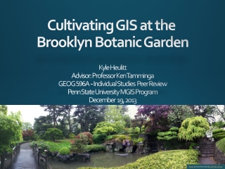
Kyle Heulitt Advisor: Professor Ken Tamminga GEOG 596 A - Individual Studies Peer Review Penn State University MGIS Program December 19, 2013. Cultivating GIS at the Brooklyn Botanic Garden. Photo by HorsePunchKid / CC BY-NC-SA 2.0. Presentation Overview. Background and Objectives

E N D
Kyle Heulitt Advisor: Professor Ken Tamminga GEOG 596A - Individual Studies Peer ReviewPenn State University MGIS ProgramDecember 19, 2013 Cultivating GIS at the Brooklyn Botanic Garden Photo by HorsePunchKid/CC BY-NC-SA 2.0
Presentation Overview Background and Objectives Proposed Methodology Costs, Funding, and Timeline References Acknowledgements and Questions Photo by afagen/CC BY-NC-SA 2.0
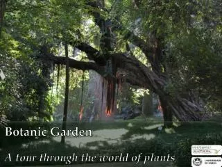
Background and Objectives Photo by HorsePunchKid/CC BY-NC-SA 2.0
About the Brooklyn Botanic Garden (BBG) Located in the heart of Brooklyn, New York City Opened to the public in 1910 Original design by the Olmsted brothers; current garden reflects design of landscape architect Harold Caparn More than 900,000 visitors every year 52-acres and over 12,000 kinds of plants One of foremost cherry-viewing sites outside of Japan Core missions to educate, conduct research, and display plants in a beautiful setting for the enjoyment of the community Photo by Steve Soblick/CC by 2.0
Maps and Information Science at Botanic Gardens - History Photo by Cartography Associates/CC BY-NC-SA 3.0 For centuries – paper maps and index cards 1980’s – digital CAD maps and databases 2000’s – GIS Photo by pennstatenews/CC BY-NC 2.0
Why Does BBG Need GIS? Facilitate data sharing Support of planning and design Visualize change in garden over time Work order and tree assessment management capabilities To spatially enable their existing plant data Improved curation and management Empower staff with location data Visitor engagement, education, and orientation Support and track research
Project Objectives • Create a geodatabase that enables the garden to store location data for plants and other assets • Tie into existing accession database • Develop a web/mobile GIS application to support garden staff and provide public access to the garden’s GIS • Provide adequate documentation and training to support garden staff • Serve as a case study for other botanic gardens interested in deploying GIS
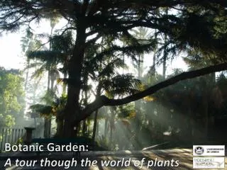
Proposed Methodology Photo by HorsePunchKid/CC BY-NC-SA 2.0
Proposed Methodology Overview • Existing Data and Map Infrastructure • Literature Review/Case Studies • Needs Assessment • Geodatabase Design • Location Data Sources and Collection • Web/Mobile Application Conceptual Design • Training and Support
Existing Data and Map Infrastructure FileMaker Pro Database • Used to track information about plants • Each plant has a unique accession number in database and in garden • Relational database structure designed by BBG • Apple-centric software • Plan to serve data from FileMaker Pro Server to field I-Pads Photo by aloucha/CC BY-NC-SA 2.0 AutoCAD Drawing • Plant locations with accession numbers • Buildings and other features • Covers majority of garden • Not georeferenced • Not updated since 2009
Literature Review/Case Studies • GIS design and implementation at other gardens informs project design • University of California (UC) Davis Arboretum • Arnold Arboretum of Harvard University • Work at these gardens led to creation of: • Alliance for Public Garden GIS (APGG) • ArcGIS Public Garden Data Model • Arboretum Explorer
Needs Assessment • Will be conducted in collaboration with garden staff • Meetings with key personnel are planned to identify stakeholders, discuss current practices/workflows, and determine project requirements • Metrics will be developed to gauge the success of the project • Project requirements will be re-evaluated over the course of project
Geodatabase Design • Structure – ArcGIS Public Garden Data Model • Format – File Geodatabase • Coordinate System – TBD
Location Data Sources • Basemap Data • Orthophotos, topography, soil type, etc. • Local/State/Federal Agencies • Clipped to garden boundaries and uploaded to appropriate feature classes in geodatabase • Site-Specific Data • Plant centers, mass plantings, buildings, trails • Obtained from BBG AutoCAD Drawing or GPS Survey • BBG AutoCAD drawing • Collect control point locations using GPS • Georeference CAD drawing using rubber sheeting • Export CAD entities to GIS feature classes in project geodatabase • Associate accession numbers with features
Location Data Sources (cont’d) • GPS Survey • Only plant centers and mass plantings will be GPS’d • BBG to provide support staff • Will be performed in winter/early spring to minimize obstruction of satellite signal by tree canopies • All data will be post-processed • GPS Equipment and Software • Trimble ProXH GPS receiver (sub-foot accuracy) • Trimble Nomad outdoor rugged handheld computer • Trimble Terrasync GIS data collection software • Trimble Pathfinder Office software • Atlanta Advantage Laser Range Finder • Tripod and Reflector Pole
Web/Mobile Application Conceptual Design • Prototype Application - Arnold Arboretum’s Arboretum Explorer (http://arboretum.harvard.edu/explorer/) • Compatible with web browsers and mobile devices • Web Framework - ArcGIS API for Javascript • Mobile Framework - jQuery Mobile • Web Server – Existing BBG web server • Database Server – Existing Filemaker Pro Server • GIS Server – ArcGIS Server or GeoServer
Web/Mobile Application Conceptual Design (cont’d) User Interface Functionality Takes user to additional information about specimen Navigation Tools Pop-Up Window Appears When a Specimen is Selected Queries
Web/Mobile Application Conceptual Design (cont’d) System Architecture Geo database Web Application GIS Server Web Server Mobile Application Filemaker Pro Database Server
Training and Support • Instructions and other supporting documentation will be developed • Training/Q&A session • Telephone and Email • BBG Director of Collections Management has GIS and database development experience • BBG may hire a GIS professional to support ongoing GIS and mapping efforts
Costs and Timeline Photo by aloucha/CC BY-NC-SA 2.0
Project Costs and Funding • ArcGIS for Public Gardens Program • ArcGIS Desktop, ArcPad, and ArcGIS Online for $100 • Other software (ArcGIS Server?) available upon request • GPS Equipment • My employer has agreed to let me borrow GPS equipment for this project • BBG may need to upgrade GPS equipment to support future GIS and mapping efforts • IMLS Grant • $150,ooo over 3 years in support of living collection management
Project Timeline Potential Conferences • American Public Gardens Association Conference – June 2014 in Denver, CO • ESRI Mid-Atlantic User Conference – Date and Location TBD • ESRI International User Conference – July 2014 in San Diego, CA
References Alliance for Public Garden GIS (n.d. a). Geographic Information Systems (GIS) for Public Gardens: The Geospatial Revolution. Retrieved 11/27/13, from http://publicgardensgis.ucdavis.edu/wp-content/uploads/2012/12/Geographic-Information-Systems-GIS-for-Public-Gardens.pdf. Alliance for Public Garden GIS (n.d. b). ArcGIS Public Garden Data Model Metadata. Brooklyn Botanic Garden (2011). Brooklyn Botanic Garden Announces $7.5 Million Leon Levy Foundation Gift. Retrieved 11/24/13, from http://www.bbg.org/press/capital_campaign. Brooklyn Botanic Garden (n.d. a). Gardens and Collections. Retrieved 11/24/13, from http://www.bbg.org/discover/gardens. deMause, Neil and Berenson, Richard J. (2001). The Complete Illustrated Guidebook to Prospect Park and the Brooklyn Botanic Garden. New York, New York. Silver Lining Books. ESRI (n.d.). ArcGIS for Public Gardens. Retrieved 12/1/13, from https://docs.google.com/file/d/0BwQr0TOjL0StUTVvNkpoeUtXRk0/edit. Morgan, Brian J., Burke, Mary T., & Greco, Steven E. (2008). The ArcGIS® Botanical Garden and Zoological Park Data Model. Retrieved 10/29/13 from http://proceedings.esri.com/library/userconf/proc08/papers/papers/pap_1125.pdf. Morgan, Brian (2011). GIS for Public Gardens: Tools and Techniques for Collection Management & Research. Retrieved 10/29/13, from http://www.slideshare.net/bjmorgan1026/gis-for-public-gardens. The Arnold Arboretum of Harvard University (2013). GIS at the Arboretum. Retrieved 10/29/13, from http://arboretum.harvard.edu/plants/gis-at-the-arboretum/. Wikipedia (2013). Brooklyn Botanic Garden. Retrieved 12/15/13 from http://en.wikipedia.org/wiki/Brooklyn_Botanic_Garden.
Questions? Thanks to: Prof. Ken Tamminga Dr. Douglas Miller Beth King Tony Morosco Ernie Salazar Erin Kramer Photo by jturbanos/CC BY 2.0 Ferris Bueller's Day Off Credit: Paramount Home Video