Download
1 / 21
210 likes | 288 Views
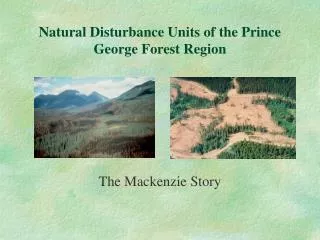
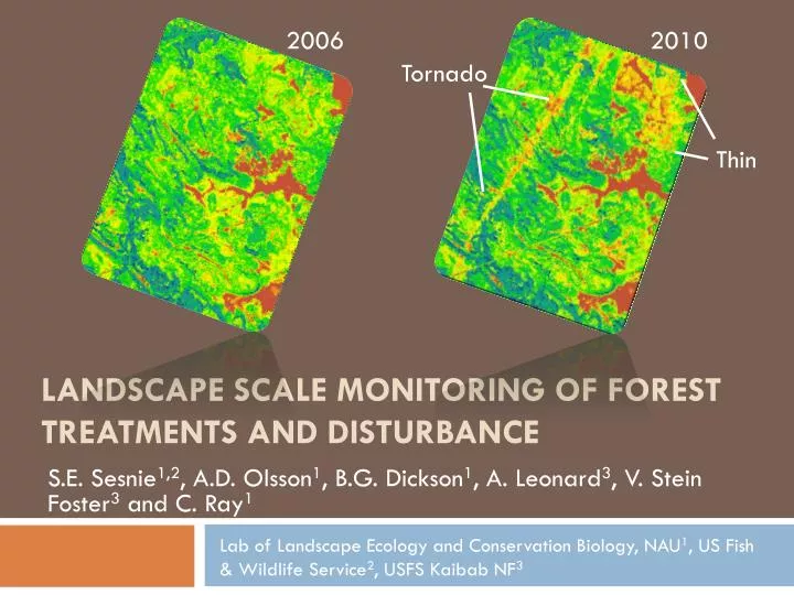
2006. 2010. Tornado. Thin. Landscape Scale Monitoring of forest treatments and disturbance. S.E. Sesnie 1,2 , A.D. Olsson 1 , B.G. Dickson 1 , A. Leonard 3 , V. Stein Foster 3 and C. Ray 1.

E N D
2006 2010 Tornado Thin Landscape Scale Monitoring of forest treatments and disturbance S.E. Sesnie1,2, A.D. Olsson1, B.G. Dickson1, A. Leonard3, V. Stein Foster3 and C. Ray1 Lab of Landscape Ecology and Conservation Biology, NAU1, US Fish & Wildlife Service2, USFS Kaibab NF3
Collaborative Partnerships USFS-FIA FWS NAU Stakeholders Kaibab NF USFS-4FRI USFS R3
Previous assessments Region Landscape Patch
Disturbance Fire Urbanization Insects & Disease Silviculture Wind Drought
Kaibab NF Monitoring Need for landscape-scale, up-to-date and repeatable forest data complementary to: • Monitoring planned and unplanned disturbance • Assessing changes wildlife habitat • Mitigating fire hazard and risk • Biomass & forest carbon assessment • Other planning objectives
Objectives • Model & map forest structure • Inexpensive • Validated • Consistent/repeatable BA SDI HGT CC TPA QMD Others…
Study Area – Kaibab NF • 1.6 million acres (647,497 ha) • Ongoing management & 4-FRI • Three major forest types
Methods – reference data USFS Forest Inventory and Analysis (FIA) plots • Measure10% of state’s forest per year • n = 648 plots (2001 – 2009) • Monitor forest status and trends • FVS compatible ~1 acre of forest land
Methods – remotely sensed data Landsat TM (2006 & 2010) • 6 spectral bands • 2 dates (leaf on/off) Spectral Derivatives • NDVI • NDVIc Digital Elevation Model • Elevation • Terrain 39 Predictor Variables Leaf-on TM1 TM2 TM3 TM4 TM5 TM7 Brightness Greenness Wetness NDVI_on NDVIc_on NDVI4_on PCA1 PCA2 PCA3 Leaf-off TM1 TM2 TM3 TM4 TM5 TM7 Brightness Greenness Wetness NDVI_off NDVIc_off NDVI4_off PCA1 PCA2 PCA3 DEM Elevation Slope Aspect (trasp) Roughness CTI Others NDVI_ratio
Methods – correction + modeling Image correction: • Uncorrected Landsat TM • Image normalization (MAD) • Atmospheric correction (FLAASH) • Terrain correction (C-correction) Modeling: • Random Forest (regression)
Results – outputs Change (%) 2006 2010
Results – outputs 2006 2010
Results - Validation Basal Area – Predicted vs. Actual
Results - Validation Basal area Stand Density Index All predictors Best subset Number of predictors
Results – Consistency • Compare 2006 and 2010 basal area • 1km x 1km points (n = 4622) • Pearson correlation coefficients • Kruskal-Wallis One Way ANOVA on Ranks
Results – Consistency Between years for each correction technique (Basal area)
Results - Consistency 2006 basal area, H = 33.927 (P = <0.001) 2010 basal area, H = 26.090 (P = <0.001)
Monitoring applications Stand density index (SDI) Treatment types 2006 - 2010 SDI change (%)
Conclusions • Terrain and atmospheric corrections important • We are likely to witness large and small disturbance events in the future • Forest structure data are consistent & sensitive to a variety of disturbance factors • The outputs support a range on of landscape scale analyses
Acknowledgments • Kaibab National Forest • USFS Forest Inventory and Analysis program, Ogden UT • USFS Region 3 Office • US Fish & Wildlife Service