Download
1 / 31
310 likes | 327 Views
This NASA Earth Science mission focuses on advancing knowledge of the Earth system and improving predictions through applied research. The program aims to inform decision-making processes and actions by integrating Earth observations and data assimilation. It also supports the development of decision support systems and provides valuable insights into the socioeconomic impacts of Earth science applications.

E N D
Science Mission Directorate Earth Science Division Earth Science Applications Lawrence Friedl, Director ESD Applied Sciences Program Ecological Forecasting & Biodiversity Team Meeting May 7-9, 2014
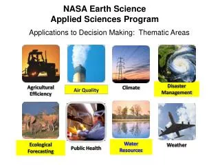
NASA Earth Science Technology Flight Missions Research Data Systems Education Applications NASA Earth Science supports basic and applied research on the Earth system and its processes. Characterize, understand, and improve predictions of the Earth system to advance knowledge and benefit society. | 2
The mind may, as it appears to me, divide science into three parts. The first comprises the most theoretical principles, and those more abstract notions whose application is either unknown or very remote. The second is composed of those general truths which still belong to pure theory, but lead nevertheless by a straight and short road to • practical results. Methods of application and means of execution make up the third. • Each of these different portions of science may be separately cultivated, although reason and experience show that none of them can prosper long, if it be absolutely cut off from the other two. • Alexis DeTocqueville • Democracy in America, 1835
Earth Science and Applications Basic Research Applied Research Applications
Public and private organizations routinely and seamlessly integrate Earth observations in their decisions and actions, and they demand additional observation types and Earth science knowledge.
Inform Decisions & Actions Applied Sciences Program Approach to Integrated System Solutions Predictions/ Forecasts Value and Benefits to citizens and society Partnership Area Earth System Models Land, Atmosphere, Oceans, Cryosphere, Coupled Models Model Products, Data Assimilation, Predictive Capabilities High-Performance Computing, Communication, and Visualization Policy Decisions Decision Support Systems Assessments Scenario Tools Management Decisions Data Standards and Interoperability Earth Observatories & Measurements Analysis to support decision-making processes & actions Satellite, Airborne, Ground, In-situ Missions, Sensors, Data Products Observations Inputs Outputs Outcomes Impacts Partners with Decision Support Systems NASA and Partners | 6
Socioeconomic Impacts: A Primer Purpose: Inform the Earth observations community and project teams about the language, key principles, techniques, and applications of socioeconomic impact analyses. Released March 2013 | 7
Applications Heritage Studies of the lineage and heritage of applications in scientific research, mission, data systems, technology backgrounds, decision support tools, partnerships, etc. Studies support understanding of effective approaches to bridge from research & development to applications and sustained uses. Studies examine pathways from scientific and technical achievements that led to and enabled applications. Heritage in Science & Technology • Global Fire Information Management System (GFIMS) • Heritage study of this • application is developed and • is in final draft. Considering publication options. • Heritage aspects include: • Technology: Sensors, Satellites, and Algorithms • Field Campaigns • Data Access and Latency • Conferences, Collaborations, and Partnerships • Decision Support Systems | 8
Users, Behaviors, Preferences Where and how do people get their data and information? What are demographics and user characteristics?
perceptions attitudes satisfaction factors technographics aversion to new information sources familiarity with Earth observations user traits existing value chains consumer information disposition to technology psychographics expected level of service and support lifestyle trusted sources preferences
Hello Lawrence Friedl. We have recommendations for you. Lawrence’s earth.orb | Today’s Specials | Wish List Search earth.orb Cart Search all SBAs Land Cover Type Yearly L3 Global 1km SIN Grid Terra-MODIS (13,769 user reviews) - - - - - - - - - - - - - - - - - - - - - - - - - - - - - - - - - - -- - - - - - -- - - - - - -- - - - - - - Level 3. Ships from Land Processes DAAC GO Customers Who Accessed This Item Also Accessed • Burned Area Emissivity (LST) Vegetation (NDVI) Leaf Area Index (FPAR) • Editorial Reviews MODIS Science Team The MODIS Land Cover Type product contains multiple classification schemes, which describe land cover properties derived from observations spanning a year’s input of Terra data. The primary land cover scheme identifies 17 land cover classes defined by the International Geosphere Biosphere
Programme (IGBP), which includes 11 natural vegetation classes, 3 developed and mosaicked land classes, and three non-vegetated land classes. The MODIS Terra Land Cover Type Yearly L3 Global 1 km SIN Grid product incorporates five different land cover classification schemes, derived through a supervised decision-tree classification method. See all Editorial Reviews • Product Details • Product code: MOD12Q1 • Platform: Terra • Raster Type: Tile • Resolution: 1000m • Temporal Granularity: Annual • Earth Science Best Sellers Rank: #142 • Customer Reviews • Average Customer Review: (278 customer reviews) • Most Helpful Customer Reviews78 of 81 people found the following review helpful: • Latest product is based on MODIS v.5; found that the urban classification is underrepresented but otherwise a great product. • › See all 278 customer reviews...
Earth Science & Applications from Space The national strategy outlined here has as its overarching objective a program of scientific discovery and development of applications that will enhance economic competitiveness, protect life and property, and assist in the stewardship of the planet for this and future generations. Earth Science Decadal Survey 2007 | 15
Missions & Applications • Applications in Mission Life-cycle • Significant efforts for applications-oriented users to engage throughout the satellite mission lifecycle, especially planning, formulation, and development phases. Examples include: • Community Workshops • Early Adopters • Mission Applications Plans • Applications Traceability Matrices • Webinars • Tutorials | 16
Earth Science Missions – Early Adopters • Early Adopters: New with SMAPPurpose is to conduct pre-launch applications research to accelerate use of data after launch. • Organizations with clearly-defined needs for SMAP-like data products evaluate & demonstrate the utility of SMAP data for their application and decision making. • Early Adopters: • Use data products prior to launch (simulated data and cal/val data from field campaigns) • Provide feedback on products and formats to increase applications value of mission • Streamline and accelerate use of data soon after launch and check-out • Supply own resources to do these activities 35+ organizations are currently EAs from public & private-sector, domestic & foreign ** ICESat-2 started Early Adopters in 2013 ** | 17
HyspIRI: Applications Traceability Matrix PACE The following is an example row from the HypspIRI Applications Traceability Matrix | 18
NASA Flight Project Life Cycle Mission Phase Durations: Mission development (A – D) duration may be 5 to 8 years 2–n years ½–1½ years 1–2 years 1–3 years 1–1½ yrs 3–10+ years
NASA Earth Science Applied Sciences Program NASA Headquarters Washington, DC 1.202.358.7200 http://AppliedSciences.NASA.gov
Back-up Materials http://AppliedSciences.NASA.gov
Lines of Business Discovering and demonstrating innovative and practical uses of Earth observations in organizations’ policy, business, and management decisions. http://AppliedSciences.NASA.gov Applications Prove-out, develop, and transition applications ideas for sustained uses of Earth obs. in decision making. Capacity Building Build skills and capabilities in US and developing countries to access Earth observations to benefit society. Mission Planning Identify applications early in mission lifecycle and integrate end-user needs in mission design and development. | 22
Interagency http://www.whitehouse.gov/blog/2013/04/19/taking-pulse-our-planet-new-strategy-earth-observations • Supports efforts to organize existing Earth-observation systems and to coordinate plans for future projects. • Provides an evidence-based framework for routine assessment, prioritization, and planning across all Federal agencies engaged in Earth observations. • In development: National Plan for Civil Earth Observations, 2014-2024 • Addresses sustained and experimental observations, priority observations, balanced portfolio approach, and guidance on implementation. • Plan is organized by the interagency U.S. Group on Earth Observations (USGEO), a Subcommittee within NSTC CENRS National Civil Earth Observations Strategy Released 4/19/2013 | 23
Applications & Capacity Building The Applied Sciences Program funds projects that enable uses of NASA Earth science data in organizations’ policy, business, and management decisions. • Applications Areas • The program focuses on economic, health, resource management, and other themes to discover and demonstrate applications targeted at integrating Earth observations in specific decision-making activities. Projects with public and private organizations. • Applications Projects • Feasibility Studies • Applied Research Teams • Mission Planning Support • Capacity Building • The program sponsors specific activities to build skills, users, and capabilities in the US and developing countries on how to access and apply environmental satellite data to benefit society. • SERVIR • DEVELOP & Workforce development • Gulf of Mexico Initiative • Training Modules | 24
Performance ARL 9 – ARL 8 – ARL 7 – ARL 6 – ARL 5 – ARL 4 – ARL 3 – ARL 2 – ARL 1 Applications Readiness Levels (ARL) 9. Approved, Operational Deploymentand Use in Decision Making 8. Application Completed and Qualified 7. Application Prototype in Partners’Decision Making 6. Demonstrate in RelevantEnvironment 5. Validation in Relevant Environment 4. Initial Integration and Verification 3. Proof of Application Concept 2. Application Concept 1. Basic Research Partner Demonstration and Transition Development, Test, and Validation Discovery and Feasibility | 25
Applications Readiness Level • Applications Readiness Level (ARL) • Nine-stage metric to track the maturity of applications projects – from initial idea, through development, to the transition to operational use. • ARL as a tool: • Communication Tool to convey expected advancement to PIs & project teams. • Analysis Tool to assess progress of a project or state of entire project portfolio. • Reporting Tool for performance goals. • Diagnostic Tool to identify where projects tend to break down in development. ARL 9 – ARL 8 – ARL 7 – ARL 6 – ARL 5 – ARL 4 – ARL 3 – ARL 2 – ARL 1 ARL 7-9: Partner Demonstration and Transition ARL 4-6: Development, Test, and Validation ARL 1-3: Discovery and Feasibility | 26
Comments from peers Suggestions Rating system Message boards Personal tailoring Feedback at the point of experience One-touch efforts and, of course, free shipping on orders over $25
Key Questions to be Addressed in Pre-Phase A Should be resolved ~ 12 months prior to KDP A • What science MUST this mission achieve? • What specific measurements? • To what accuracy? • What are the required data products? • What mission parameters can achieve the science? • What orbit (inclination/altitude)? • Which instruments? • What is the baseline mission duration? • How can NASA achieve these measurements? • Are there other missions required/desired to achieve the science? • Who can NASA partner with to achieve this mission? Should be resolved ~ 6 months prior to KDP A
topics Intellectual context and what i/we are wrestling with Vision Customer oriented view of applications Though can lead to new research questions Rewards within the Applied research Natural-social sicenceintereactions: can go applied but not ncessarily. Again, new research questions Research quetoisn from users Way to sell the research Induced demand Heritage reports Amazon.com example User demogratics and technographics Cross-disciplinary Tie back to Decadal Survey Bring in EO Plan | 29
Observations to Knowledge Products “from photons to electrons to neurons”
Notional Mission Timeline NOTE: The time for each phase is considered nominal - could be accomplished earlier