Download
1 / 23
230 likes | 246 Views
Developing a public digital private water well system in GIS for Gaston County to ensure safe drinking water. Learn about geocoding techniques, challenges, and strategies to increase geocoding results.

E N D
Department of Health & Human Services Developing a Public Digital Private Water Wells System in GIS • Presenters • Claudio Owusu • (UNCC) • & • Samantha Dye • (Gaston County, DHHS) June 25, 2018
Project team Gaston County Department of Health & Human Services, Gastonia, NC Samantha Dye Department of Geography and Earth Sciences and Center for Applied Geographic Information Science Claudio Owusu Yu Lan Dr. Wenwu Tang Dr. Eric Delmelle Department of Public Health Sciences Alexandra Alcorn Dr. Gary S. Silverman
Thanks to our project sponsors • National Center for Environmental Health, Centers for Disease Control and Prevention. • Environmental Health Services Support for Public Health Drinking Water Programs to Reduce Drinking Water Exposures. CDC-RFA-EH15-1507 • Gaston County Department of Health & Human Services
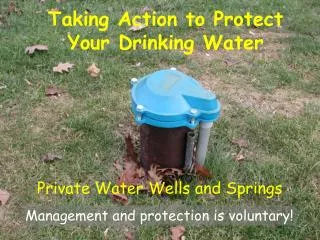
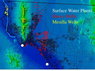
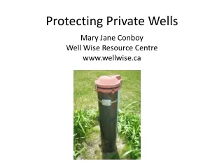
Study Area Gaston County: Townships North Carolina Most urban: Gastonia • 8,000+ private wells supply water to ~43,190 residents • Relatively low testing of contaminants • Private well database is unavailable
Objective • Develop a public digital private well systems in GIS • In order to achieve this: • Geocode all addresses on permits to create a well database • Verify locations of active/inactive wells in a field survey • Join organic & inorganic test results to the well database
Geocoding • Translate text-based information about locations into numerical geographic coordinates • Example: 117 Union Rd • where v = interpolated distance, d= offset distance • Street geocoding process in GIS A Complete address in the U.S. must have these key components House number Directional attributes(if available) Street name Street type State Zip Example i. ii. iii. iv. v. vi. 826 N Peachtree Ave NC 28213
Geocoding Techniques Address locator: a model used to create geometry for textual descriptions representing addresses in the reference data
Workflow Scanning & data entry Address points layer Attribute Database Geocoding Parcel layer Well ID Well ID Well ID Road layer Coliform Test Attributes InorganicTest Permits (8,000+ records) Inorganic Field Results GPS Coordinate Permits Attributes Optimize Routing Geo-database Composite address locator Field Work Private Drinking Water GIS layer
Geocoding Challenges 1.Temporal variations in addresses 2. Paper damage 3. Incomplete address What strategies can be used to reduce the uncertainties in the data to increase the geocoding results?
Strategies to Increase Geocoding Results • Hybrid Geocoding—Combine different geocoding techniques with hierarchical rules to form a composite address locator • Spatial Accuracy of reference data • Temporal accuracy • Text matching • Probabilistic record linkage--process assigns weights of a the probability to a record during matching • Manual Geocoding
Text Matching Subdivision name Countryside acres Surname Lot Area 2.37 Lot # 4 Tax Location Code 11 21 4.11 = 11 021 004 11 000
Text Matched to Parcel Data Parcel Data Permit Data Lot Area 2.37 Tax Location Code 11 021 004 11 000 Surname Subdivision name Countryside acres This address is then geocoded Lot # 4
Geocoding results N=8000; Permits geocoded = 7779; Unmatched = 220 • By using hybrid geocoding and text matching, we increased geocoding results from initial 40.5% to 97.2%. Part 1
Routing optimization Part 1 Methodologies: field data collection
Sample Routing optimization 2 1 2 1 Part 2 Methodologies: field data collection
Next Steps • Integrate all geocoded well data, field results (Coliform) and inorganic test results (if available) • Develop an interactive web mapping of the results
Implications of the results • Public digital database of private water wells in Gaston County • Create a transparent system to encourage active involvement by local residents • Make data available to regulators and researchers to enable systematic investigation of groundwater quality • Promote the protection of private well water supplies
Questions & Comments Claudio Owusu cowusu@uncc.edu & Samantha Dye Samantha.Dye@gastongov.com