Download
1 / 23
230 likes | 483 Views
Dominique Obaton http://www.mercator-ocean.fr. The MERCATOR project. MERCATOR OCEAN. Joined effort of 6 major French agencies to develop operational oceanography : Strong links with GODAE + European level : GMES (MERSEA) June 1995 : start of MERCATOR project

E N D
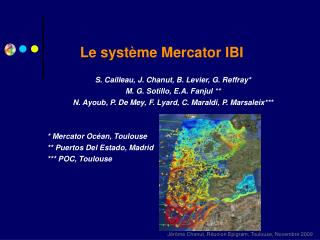
Dominique Obaton http://www.mercator-ocean.fr The MERCATOR project IST/MARETEC, 27 April 2005
MERCATOR OCEAN • Joined effort of 6 major French agencies to develop operational oceanography : • Strong links with GODAE + European level : GMES (MERSEA) • June 1995 : start of MERCATOR project • January 2001 : first bulletin. Ocean circulation forecast in place • April 2002 : GIP MERCATOR OCEAN is created in Toulouse • Since 2003, 35 people working full time for MERCATOR-Ocean R&D, Exploitation, Distribution, Administration to a real-time ocean forecasts • Today more than 150 referenced users • May 2006 : Mercator Ocean will become a European Center for Operational Oceanography
MERCATOR objectives: • To run a high resolution operational (forecast mode) global ocean system • To provide initial and boundary conditions to any coastal systems • 1st users and institutes to be served : French agencies which compose Mercator Ocean
Global operational ocean system • 2008 : to have a global 1/12° demonstration system –ready to be operational MERSEA objective • Step by step : • Global • 2° global ocean forecasting system operational -with assimilation of SLA- • ¼° global ocean forecasting system operational by summer MERSEA Global Ocean initial component • High resolution North Atlantic + Mediterranean sea • 1/12° (5-7 km) operational system –monovariate assimilation of SLA This system used to provide IC & BC to coastal models • 1/12° system + multivariate assimilation : SLA & in situ : operational by summer
The global 2° prototype • OPA8.2 ocean code (LODYC, Paris) • 2 poles in the northern hemisphere • Horiz. mesh : 182149 points, refined at the Equator (2°0.5°), isotropic at higher latitudes (~2°) • Z coordinate, 31 levels , with an • embedded mixed layer model(1.5 order closure scheme for TKE) • Diagnostic ice model • Surface fluxes : ECMWF
The global ¼° model Ocean code: OPA8.2 (LODYC, Paris) Grid:Global ¼° ORCA-type grid 1442x1021 points (6 to 28 km) 46 levels (6 to 250 m) Bathymetry:ETOPO 2 + BedMap Coastline: IDL – 1 km Initialisation: Lévitus 98 1° + MEDatlas + PHC in Arctic Ocean + mean profile in Red Sea Parametrisation: - Free Surface - Diagnostic Sea Ice: “Glace-IF” then LIM model - Isopycnal diffusion, Biharmonic horizontal viscosity, enhancement of the viscosity in tropical band - Buffer zones at Gibraltar and Bab El Mandeb Straits - Monthly Runoffs for 120 river-mouths Assimilation: - univariate : OI SLA 6 km 28 km 6 km
The global ¼° prototype Global ¼° Mercator Circulation in ARCTIC Circulation by Grotefendt et al. (1998)
Ice cover in Arctic « IF » Ice Model Global ¼° Mercator
Equatorial Pacific currents Johnson et al., oct. 2001 EC EUC NEC NECC Global ¼° Mercator
Comparison Mercator global 2° vs ¼° : SST Mercator 2° – 10/01/96 Mercator ¼°– 10/01/96 - 2 weeks average
Comparison Mercator global 2° vs ¼° : current at 50 meters Mercator 2° – 10/01/96 Mercator ¼° – 10/01/96 - 2 weeks average
Mercator system prototypes : GLOBAL • La simu de Thierry
The global ¼° system • Next improvements in global ¼° system • Louvain ice model • Multivariate assimilation SLA + in situ (temperature + salinity) provided by Coriolis database • … and upgrades in OPA
1/3° 1/15° North Atlantic + Mediterranean sea • North & Tropical ATLANTIC 20°S-70°N • Resolution 1/3° ; 43 levels • Hindcast, Nowcast, Forecast, since January 2001 • Jan 2001- Avr 2004 : univariate Assimilation SLA (Cooper & Haines method) • Jan 2004 – present : multivariate assimilation SLA, SST, in situ T&S (EOFs) • North ATLANTIC 20°S-70°N & MED sea • Resolution 1/15° (5-7 km) ; 43 levels • Hindcast, Nowcast, Forecast, since JAN 2003 • Jan 2003- present : univariate Assimilation SLA (Cooper & Haines method) • summer 2005 : multivariate assimilation SLA, SST, in situ T&S (EOFs) • PLANS for a new configuration for Atlantic front and Mediterranean sea. Open ocean / coastal needs
Buffer zone The high resolution (5-7km) MERCATOR model 5 to 7 km rotated grid in the Atlantic, 1/16° in the Med 43 levels in both basins (19 at Gibraltar Straight) Code: OPA 8.1 http://www.lodyc.jussieu.fr/opa/ Bathymetry:Smith & Sandwell Forcing:ECMWF daily averaged (wind stress, heat, freshwater) Boundaries: buffer zone (Reynaud climatology) for temperature and salinity. Restoring zone under 500m in Cadiz Gulf. Parameterizations: Rigid lid, z-level, TKE mixing scheme, bilaplacian operator, free slip condition.
PSY1v2 (1/3°) 24/3/04 PSY2v1 31/3/04 (t+7) PSY2v1 (1/15°) 24/3/04 The high resolution (5-7km) MERCATOR model SSH on 24 March 2003 PSY1 (1/3°) PSY2 (5-7 km ; 1/15°)
Upwelling along Moroccan coast Sea Surface Temperature Western Africa Upwelling 18 April 2001 Satellite data (AVHRR, mean) Mercator 1/15° Analysis (altimeter assimilation : T/P+ERS+GFO) Mercator 1/3° Analysis (altimeter assimilation)
1/3° + SLA ass. Climatology 1/3° + SLA & in situ 1/15° + SLA ass. 35psu Salinity section:Florida-Portugal (weekly mean) :
Regional scale : 1st objective • To provide initial and boundary conditions to coastal models • Extraction on Mercator fields on a smaller area • Interpolation, extrapolation and optimisation of Mercator fields on a coastal grid (using any other model) • Extraction of Mercator fields available via web by end 2005 • 1st version of interpolation /extrapolation /optimisation tool ready by spring 2006 –via web • Will be upgrade for HYCOM model end 2006
Regional scale : 2nd objective • To build regional systems • On the Atlantic front • On the Mediterranean sea • Characteristics: • 1/36° horizontal resolution • Refinement of surface layers • Upgrades in OPA : free surface, partial step / σ coordinate • tides • Forced at open boundaries by MERSEA • Assimilation (OI, SEEK) • Objective : be correct on shelf/slope interaction • To provide better (good) initial and boundary conditions to coastal systems • Sense only if • coastal systems –and teams- are interested • End users are interested
Which means : • Work with regional and coastal teams • In France • In Europe • Reach end users via coastal teams and specific applications
Atlantic front regional system • Idea : downscaling strategy + end user applications : HAB, oil spill, storm surge • Regional system : Mercator & ESEOO II nested in MERSEA • Coastal systems nested • Bay of Biscay : Ifremer • Galician coast : IEO; MeteoGalicia • Iberian shelf : IST/MARETEC • Tagus estuary : IST /MARETEC • Irish shelf : Irish Marine Institute • … • Means : • IBIroos : • version 0 • National founding • ECOOP (Pierre : steering team) • Version 1 • European founding 2008-2011 • Same strategy for Med. Sea and other European seas