Download
1 / 49
490 likes | 672 Views
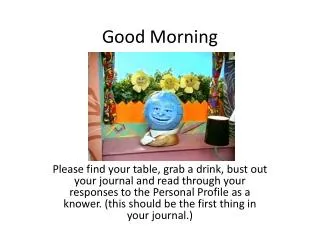
Good Morning . Please find your table, grab a drink, bust out your journal and read through your responses to the Personal Profile as a knower. (this should be the first thing in your journal.). Who is the “International student”? Isn’t it you?.

E N D
Good Morning Please find your table, grab a drink, bust out your journal and read through your responses to the Personal Profile as a knower. (this should be the first thing in your journal.)
Who is the “International student”? Isn’t it you? • Write your name and nationality clearly on the top of the paper. • You have seven minutes in which to draw as accurately and completely as you can, a map of the world. • Don’t waste time telling yourself that you cant. Just do your best and discover what you carry (or don’t carry) in your mind as your picture of the world. You will not be graded or otherwise judged in the accuracy of the results. • When you have finished, be prepared to show the results to the others in the class.
On the back of your map respond to the following questions: • What part of the world is in the center of your map? • What parts of the world have you drawn in greatest detail? • What parts of the world have you drawn in little detail or even left out?
Let’s take a look at some maps drawn by students from different parts of the world. Can you match where they are from? • Japan • Greenland • Italy • Costa Rica • Canada
How about a snack? • Try to peel your tangerine, keeping your peel in one piece. • Try to lay your peel flat on the table. • Now try to copy your map onto it. • Its understandable that maps drawn from memory will vary, but what about maps made by professional cartographers?
It’s impossible to show a sphere on a flat surface. Look back at your sad tangerine peels. • Cartographers (map makers) use different projections to peel the earth and wrapping the peel to present it. • Lets take a look at a few more maps.
What choices did the mapmakers make in each of the versions? • What is selected to be shown? • Do humans have a greater interest in land or water? • Do our maps show the bias of our species? • Do the maps represent the physical geography of the world or its human political divisions?
What is emphasized in each case? • What is in the center , or both in the center and at the top? • What is artificially enlarged by the particular projection chosen? • Compare the other maps to the Peters equal area projection, which choses to distort shapes in order to preserve correct relative size.
Good Morning Please grab a drink, sit at your assigned table from yesterday and take out your journal and maps.
Which map features are found in the world and which ones are humanly created? • Do lines of latitude and longitude “really” exist? • Do national borders exist if the earth was seen from space? • Do north, south, east and west exist in nature? • How do north and south differ this way from east and west? • Does the north always have to be on the top? • How do we separate west from east, since all points are west of something and east of something else? • What political and economic ideas come with “north” and “south”, “east” and “west”?
In what context and how are the map images used? • Maps are made in for a practical purpose, whether to show relative position, to navigate, or to represent a connection between the physical world and an idea. • How are maps used?
Mercator Map • Originally designed as a mariners map. • Icon of Eurocentric thinking because it was adopted by colonial powers and spread by them. • South America is almost double the size of Europe. India is roughly three times the size of Scandinavia, but Scandinavia appears larger. • The southern hemisphere is squashed into 1/3 of the map while the northern hemisphere takes up 2/3 • It is a view of Europe, top, center, dominant. • Most Europeans would have been, and perhaps still are, unaware of the bias in their familiar image of the world.
Global perspectives from IB students What’s in the middle when west and east are just relative locations on a spinning globe? • In Chinese the name for China is “Middle Kingdom.” Historically we thought of ourselves in the center of the world. We didn’t actually need anyone else. • Toi Yam Karyn Wong, China
How many continents are there? • There are seven continents –Antarctica, North America, South America, Europe, Asia, Africa, and Australasia (or Oceania). This is what I learned in school and all continent maps color these seven differently. • The division of North and South America is just common sense. They have completely different • histories as they were colonized differently. The Panama Canal divides them, though it does leave Central America in a rather grey zone. • Europe and Asia are different continents, divided along the Ural Mountains and the Black and BosphorusSeas. I learned that Istanbul (or Constantinople) was seen historically as the gateway to Asia and the last step of what was known. This vision was tied to the idea of the Roman Empire as the civilized world. • I can see now the inconsistencies in division of continents, in that some have a geographical justification and some have a political or historical justification. • Adam Spooner, England
How many continents are there? • North America, Central America, and South America – they are all one continent. They are naturally joined together. The Panama Canal was man-made. If it’s more than one, it has to be three if you are dividing geographically, to recognize Central America. How can some Europeans say that it’s two continents and call Europe, which is joined to Asia, a continent? • I think that when some people divide America, they are thinking about culture and not the land at all. When they talk about North America, they’re really talking only about Canada and the United States. • Giorgina Alfonso Rodriguez, Uruguay
Does north have to be at the top? What is “up” on a globe in space? • Our Maori map always puts the south at the top because the map is actually a picture of the creation of the islands of New Zealand. The name of the south island, Tewaka-a-Maui, means “Maui’s canoe” and the name of the north island, Teika-a-Maui, means “Maui’s fish.” In the story, Maui, our god ancestor, had travelled from faraway islands with his four brothers. His canoe hit a rock (Rakiura, Stewart Island) and got stuck. It never moved again and became the south island. There the brothers decided to go fishing, sensing that there was something big under the sea. Maui hooked a giant fish and dragged it to the surface. His brothers jumped on it and killed it with their oars. It turned to stone and became the north island. You can see the fish in the shape of the island. It’s a stingray. • The map has to put the fish’s mouth at the top because that’s how Maui pulled it out of the water. Besides, the head has to be at the top because it’s the most significant part of the body – it’s the first part the sun sees, it’s the first part that you see when someone appears over a hill, and it’s the part that holds all knowledge. Our picture of the islands as the canoe and the fish is part of our everyday speech in Maori. I live on the north island, and my region is referred to as “the fish’s stomach.” If I go to the south island, I’d say, “I’m going up to the canoe.” And we refer to Wellington as “the fish’s mouth.” • RuakiriFairhill, New Zealand
Reflections on maps as knowledge, and knowledge as a map. • As we dredge up from memory our pictures of the world and attempt to draw them, we are obviously doing so as individuals with differing past attention to geography, differing memories, and differing drawing skills. • At the same time as we are individuals, though, we are also members of our own social groups in our own home spot on the planet. • Our pictures of the world, and our knowledge of the world, are learned within our own contexts and our own cultural worldviews.
Our maps, often beautiful and enticing, are images not just of our planet but the way that we think about it. • As we flatten planet Earth for viewing, we choose a particular projection (with its influence on shape and size), up/down orientation, and centering. • We overlay the image with conceptual schemes that cannot be seen in nature: the grid lines, borders, colors, and names. • These precious images, which pack so much knowledge onto a small surface, are a product of our history, our technological skill, and our politics.
It is strange to think that, aside from recent astronauts, none of us through all of history has ever seen the whole Earth with our own eyes. • It is stranger still that the astronauts could not see what is so often most important to us about the surface of our planet—the ideas that we tie to it. • We link the Earth with ideas of time (zones), economics (developed/developing world), and culture (for example, the west/the east). • We link ourselves to it with ideas of belonging to certain places and not to others. And, sometimes with grim consequences, we link it with ownership (borders and names).
Knowledge is power, it has often been said, and map knowledge stands as a graphic example. • As an idea-tool, maps have long been used for controlling empire; map knowledge was once the knowledge of rulers. • With a map, colonizing nations have laid claim to territory, dispossessing or killing indigenous people who had no concept of “ownership” of their homeland, no deeds of possession, no flags.
With a map, colonial powers carved up their territorial possessions from a distance, imposing borders and ownership that created on the ground a reality with vast consequences. • With a map, technologically advanced nations drop bombs on targets without their people ever having to see the faces of the people exploded by the blast. • Maps are at the heart of many of the fierce conflicts of the world, representations not only of the land but of all the ideas tied to it; maps represent not what we see but what we believe.
Yet a map is an idea-tool that, in itself, is neutral. • Although it can be used for conquest, it can also be used for learning and appreciation. • Is it wrong to put ourselves in the center of our own maps of the world? • Surely not. Surely we learn in part by reaching out from our own centers of self and family and society and job and religion and political affiliation, to meet others reaching out from theirs. • Imaginatively entering a different vision of the world that is “off center” or “upside down” according to our own conventions and beliefs can bring an exciting jolt of realization of other possibilities.
Familiarity with other centers can refresh us as we come to place new multi-centered version illuminating things we never noticed about our own. • “I never knew Africa was so big,” commented an African student from a former European colony, realizing for the first time that the map on his classroom wall had exaggerated the size of Europe. • “I didn’t know that India’s map of Kashmir wasn’t everyone’s,” acknowledged a student from India, and painfully recognized at least the existence of alternative political claims.
Does appreciation of others’ maps mean that all maps are equally right? • Yes, if all we ask the map to do is to represent our worldview or be useful for a practical purpose. • However, as soon as we expect the map’s picture of the world to correspond to how the world really is, we will have to recognize that some images are better than others—better, as a picture of the world outside our minds.
Faulty maps • If a version leaves out (or invents) an entire continent, it is faulty. • If a version changes sizes of land masses in a way inconsistent with its projection, it is faulty. • If a version imposes borders that are not accepted by the world community, it may be harder to declare it faulty but we still have political criteria for doing so. • Our picture of the world needs to be checked against the world itself.
Here is one of the major challenges for all of us, human beings building our understanding of ourselves and our world. • So many different representations surround us. How can we simultaneously appreciate the variability of worldviews, and at the same time insist on some standard of accurate representation with which to evaluate them all? • How do we deal with worldviews that clash? • In attempting to understand, evaluate, reject, or reconcile multiple views, we are taking on possibly the most interesting and significant challenge of living in an international, intercultural world.
In your journal please respond to this question • How does the map you drew from memory yesterday have value?
Good Morning Please grab a drink, have a seat and take out your journals.
Gaining our maps • What are the sources of your knowledge? • One of the most significant ways is our Education system. • These systems have been created by people who have decided what is most important for us to know and how best we can learn it. • Let’s take a look at the educational systems you have been exposed to.
Respond to the following questions in your TOK Journal • Answer questions from handout.
Global Perspectives • In Niger in rural societies (in the village, for example) most parents don’t like to send their children to school because they want them to stay at home and work in the kitchen or on the farm. • But in urban areas, people send their children to school because they want them to receive a good, modern education so that they will have more luck to have a job later. • HalimatouBachirAbdou, Niger
In Norway, you are supposed to respect your teachers, even though you talk to them in a familiar way. • At one time teachers were big authorities, but now they are respected instead of maybe feared. A good teacher listens to the students and respects their points of view, even if they are different from his/her own. • The ability to work together is also highly valued, and we do a lot of projects in groups. I would also mention the appreciation of the independent individual, who can gain knowledge and understanding on his/her own. • SynnøvePaulen, Norway
In Japan, the modest and obedient student is “good”. Let me describe the behavior of a good student. Sit down on the chair, put the hands on the thigh (male way, female way), look at the teachers’ faces and listen to them carefully with shining eyes. • And you should keep quiet during the classes until the teacher asks you a question. The good student studies very hard after school and gets high scores in the exams. And the good student would hardly complain about anything especially about their teacher or school. • They believe in respecting what their teachers say and try hard to understand more from the teachers. • Rie Endo, Japan
Education in the context of values • One of the contributors to your current knowledge is of course the International Baccalaureate Organization. The International Baccalaureate Organization aims to develop inquiring, knowledgeable, and caring young people who help to create a better and more peaceful world through intercultural understanding and respect. To this end the IBO works with schools, governments, and international organizations to develop challenging programmes of international education and rigorous assessment. These programmesencourage students across the world to become active, compassionate, and lifelong learners who understand that other people, with their differences, can also be right.
The IB, like other educational systems, has choices to make about what is taught and how it is taught. • What is the important knowledge that students should gain? Why is it considered important?
Look back at the goals and pick out what seem to you to be the major ideals of the International Baccalaureate. • To what extent and in what ways do you think your Diploma Programme subjects and CAS contribute to the fulfillment of these ideals? The International Baccalaureate Organization aims to develop inquiring, knowledgeable, and caring young people who help to create a better and more peaceful world through intercultural understanding and respect. To this end the IBO works with schools, governments, and international organizations to develop challenging programmes of international education and rigorous assessment. These programmes encourage students across the world to become active, compassionate, and lifelong learners who understand that other people, with their differences, can also be right.
Your own growing knowledge • Pause for a moment to think about your changing, growing knowledge. • What, for you, is the contribution of formal education? • To what extent do others, in school or in other parts of your life, guide your learning? • To what extent are you the one who guides the directions in which your knowledge will develop? • Are you the one who is responsible for your own knowledge, as well as for the actions that you take based on what you know or don’t know? • Going a step further, to what extent is ignorance a good excuse for acting or not acting in a certain way?
International — or internationally minded? • Who is “domestic” and who is “international” is clearly as relative as east and west and as affected by where you are standing yourself. • Your recognition of differing perspectives from different geographical centers is only the beginning in TOK and a step toward a larger goal of trying to become, if you choose, not just “international” (as is everyone, from someone else’s point of view) but “internationally minded”.
In growing more aware of your own perspective and understanding it as one possibility among many, you become more internationally minded without needing ever to travel from your home. • Developing in yourself a spirit of inquiry, an openness to views other than your own, and a capacity to think critically and communicate effectively is significant for your place in a world where people live in different ways and hold different beliefs.
Who’s in the Center? • In many ways, it is you who are at the center of your knowledge— you who are shaping your understanding from all that you have experienced directly or been given by others. • Yet you are not alone as you stand in one place on the planet and take your view of the world. • Others have guided you, and others share many of your views.
Take a close look at the ToK diagram and think of what we have discussed so far. • To how many communities of knowers do you consider yourself to belong?
If there are major figures in your life who have given you knowledge that you value—or have supportively helped you to gain it yourself—you might wish to send them an appreciative thought.