Enhancing Emergency Management Through Hydrodynamic Modeling and Sea Level Rise Observations
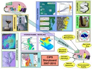
This comprehensive overview covers the integration of hydrodynamic modeling, atmospheric modeling, and LIDAR technology to improve emergency management strategies, particularly in the context of sea level rise and tsunami planning. It highlights the importance of visualization, validation, and outreach in effectively communicating risks and responses to natural disasters. The study also discusses structural mitigation strategies and the role of natural resources in maintaining environmental quality from 2007 to 2010.

Enhancing Emergency Management Through Hydrodynamic Modeling and Sea Level Rise Observations
E N D
Presentation Transcript
VALUATION VISUALIZATION VALIDATION OBSERVATIONS HYDRODYNAMIC MODELING FORECAST Emergency Management OUTREACH Sea Level Rise ATMOSPHERIC MODELING Structural Mitigation CIPS Storyboard 2007-2010 Tsunami Planning? LIDAR Natural Resources Environmental Quality