Download
1 / 26
330 likes | 729 Views
Continental Margins and Ocean Basins. Continental Margins Three Main Divisions. Continental shelf. Continental slope. Continental rise. Continental Shelf. Submerged part of the continent. Slopes gently toward ocean basin (<1 °). Composed of continental crust.

E N D
Continental MarginsThree Main Divisions • Continental shelf • Continental slope • Continental rise
Continental Shelf • Submerged part of the continent • Slopes gently toward ocean basin (<1°) • Composed of continental crust • Shelf ends at shelf break – boundary between shelf and steeper slope
Continental Slope • Boundary between continental and oceanic crust • Extends from shelf break to rise • Steeply sloping compared to shelf (5-25°) • Submarine canyons are major features
Submarine Canyon • Origin of submarine canyons: • river erosion • turbidity currents
Submarine CanyonTurbidity Currents • Turbidites are layered and exhibit graded bedding (decrease in sediment grain size from bottom to top) • Downslope movement of dense mixture of clay, silt, sand and water • Deposits are called turbidites
Monterey Canyon & Hudson Canyon • extends about 95 miles, • terminates at Monterey fan • reaching depths of 3,600 m (11,800 ft). • canyon is about 1 mile deep • 2,200 m (7,217 ft) deep at base of continental slope. • As much as 12 km (7.5 miles) wide (from east rim to west rim)
Continental Rise • At base of continental slope • Slope angle decreases • Caused by the accumulation of sediment
Continental MarginsTypes • Passive Margin • Active Margin
Continental MarginAseismic (Passive) • No plate boundary • Wide continental margin • Thick sediment accumulation • Little tectonic activity
Continental MarginSeismic (Active) • Convergent plate boundary • Trenches are boundaries • Narrow continental margin • Thin accumulation of sediments • Tectonically active
Continental MarginPassive vs. Active • Passive Margins • Major rivers drain into ocean • Sediment transported by river builds out shelf • Active Margins • Large rivers uncommon • Irregular shelves
Southern California Seafloor • Extensive, complex • Consist of basins & ridges • Widest shelf in California • NW-SE structural grain
Active Continental MarginSouthern California 3-D shaded relief map
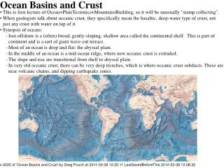
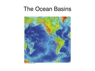
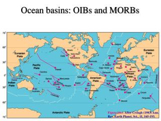
Ocean Basin FloorFeatures • Seamounts and Guyots • Abyssal Plain • Trenches • Ridges and Rises • Coral Reefs and Atolls
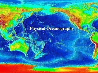
Ocean Basin Floor • Covers about 30% of Earth’s surface • Begins at base of continental rise • Sedimentation: Passive and turbidity currents • Contain abyssal plains, deep sea trenches, and seamounts
Ocean Basin FloorAbyssal Plain • Flat, deep ocean floor • Depth may be 2-3 miles or more • Thick sediment accumulation covers oceanic crust
Ocean Basin FloorDeep Sea Trenches • Occur at subduction zones where oceanic crust is forced downward into mantle • Associated with earthquakes and volcanoes • Deepest is Mariana Trench (11,020 m) • Longest is Peru-Chile trench (5,900 km)
Ocean Basin FloorRidges and Rises • Underwater volcanic mountain chain • Extends for 65,000 km • 1,000 km wide • 1,000-2,000 m high Ridges = steep slopes Rises = gentle slopes • Contain central rift valleys • 15-50 km wide • 500-1,500 m deep • Offset by fractures
Ocean Basin FloorSeamounts and Guyots • Seamounts are underwater volcanoes formed along ocean ridges or over hot spots • May emerge as an island • May be eroded flat on top and called Guyots
Ocean Basin FloorCoral Reefs and Atolls • Volcanic islands (from seamount) form in warm latitudes • Fringing coral reefs form in shallow, sunlit waters • Dormant volcano subsides and flattens (becomes a guyot) • Actively-growing reef becomes a barrier reef and then an atoll