Redevelopment Potential of Abandoned Industrial Site in Chicago Heights
This report covers a Phase I ESA conducted on a 17-acre vacant industrial property in Chicago Heights, potentially contaminated with hazardous substances. Uncover the past history and current state of the property for future redevelopment plans.

Redevelopment Potential of Abandoned Industrial Site in Chicago Heights
E N D
Presentation Transcript
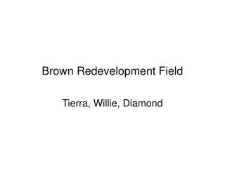
Brown Redevelopment Field Tierra, Willie, Diamond
Flintcoat Property • 1700 Wentworth
Latitude and Longitude • Longitude 87 degrees 37inches/23.77 west • Latitude 41degrees, 29inches, 58.615 north
Acres • 10 Acres
Potential Contaminants, or Hazardous Substances • Property may contain DCBS and asbestos • Transformers, propane storage tanks asphalt and liquid processing tanks were present.
Any potential pollutants, contaminants or hazardous substances • None know
Municipality is the city of Chicago Heights • Chicago Heights doesn’t own any property.
“Review Of Records • In 1989 Flintcoat Corp deeded the property to Action Wrecking Inc. Aston Wrecking Inc. used the property for vehicle maintenance and to be an area where demolition materials
Review Of Records • Presently the property is abandoned and with all existing structure it is open and access is unrestricted.
Review Of Records • If an access agreement can be obtained from rep. Of Action Wrecking Inc. then such agreement will be negotiated.
Review Of Records • In addition to health and safety consideration it is the city of Chicago Heights intention to take appropriate steps to facilitate the potential redevelopment of this property.
“Brownfield's” • Yes property is a Brown Field.
Development Plan For Site • Industrial use; yes there's a plan.
Phase I ESA Environmental Site Assessment
Purpose • The purpose of phase I ESA is to provide a professional opinion on the potential for current presence of Rees at the subject property including potential impacts from known problems surrounding are
Detailed Scope-of-Service • URS Performed the following work: • Regulatory database search • Reviewed geologic maps • Subject history • Conductive interviews • Site reconnaissance • evaluation
Significant Assumptions • NO significant assumption on phase I ESA
Limitations and Exceptions • The work conducted by URS is limited to the service agreed to with coch, And no other service s beyond those explicitly stated should be inferred or are implied
User Reliance • This Phase I ESA report has been prepared for solely by COCH. This report shall not be relied upon by or transferred to any other party, or used for any other purpose ,without the express written authorization of URS. This Phase I ESA report is applicable for 180 days
Location and Legal Description • On the south side of 17th between Stewart Ave. on the west & Wentworth Ave. to east • Last owners or subject property • Action Wrecking 1700 Stewart Ave • Flintkote 252 17th St.
Subject Property and Vicinity Characteristics • A rectangular parcel app. 17 acres • Was vacant at time of site reconnaissance • Remnant foundation loading docks /scattered debris • Located in industrial & residential area of Chicago Heights
Physical Settings • Surface elevation of property is app. 670 ft above msl. • Runoff infiltrates vegetated area or travels to surrounding road ways • Isn't located in 100 or 500 year flood zones • No wet lands were identified • Ground water in the vicinity of the property is presumed to flow to the east
Descriptions of Structures, Roads, and Other Improvements • Was vacant at time of site reconnaissance • Remnant foundation were observed
Current Adjoining Property Uses • North-property bordered by railroad right-of-way followed by 17th St. • East- bordered to the east of Wentworth followed by Chicago heights iron & supply company • South-bordered to the south by railroad & power line • Bordered to the west by Nufarm at 221 east 17th St.
Title Records • URS was not provided with title insurance reports for the subject property
Environmental Liens Use Limitations • No environmental liens or activity use limitations were found. URS has not received environmental liens reports for the remaining parcels at the time of report preparation
Specialized Knowledge • No specialized knowledge, beyond what is Discussed throughout this report, was conveyed to URS during the preparation of this report
Owner, Site Manager, and Occupant Information • Action Wrecking & Flintkote were the last owners of the subject property parcels & as these companies have been dissolved , the subject property is a vacant orphan prop. With no responsibilities entity in ownership.
Reason for ConductingPhase I ESA • I ESA was requested in connection with potential future development of the subject property
Other Information • No other previous reports were provided to URS for review
Standard Environmental Records • URS reviewed the EDR database to evaluate whether activities on or near subject prop. Have potential to create REC on the subject property
Additional Environmental Records • Following agencies contacted and a summary of the relevant finding are provided • Coch • Illinois OSFM • Illinois Environmental Protection agency, Bureau of Land
Historical Use • Property was improved from at least 1897 to 1911 • 1911 improved with 4 industrial facilities • Improved with flintkote facility between 1911 & 1950 • Flintkote remained operation until 1980s.
Aerial Photographs • The aerial photographs covering the subject property from EDR for the years 1952, 1967, 1974, 1988 & 1994 • Identify potential sources of visible contamination
Topographic Maps • Summarize • Brief
Sanborn Fire Insurance Maps • Brief summary