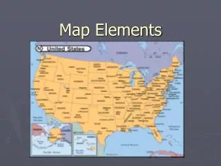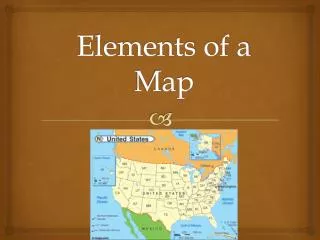
Map Elements
Map Elements. TALL DOGS. Old Maps Look Odd to Us. The Best Information the New Colonists Had Came From Maps. Title. The title tells you what a map is of and what it shows Some maps may show the same physical area, but different details. Louisiana Purchase. Same Region, Different Purposes.

Map Elements
E N D
Presentation Transcript
Map Elements TALL DOGS
Title • The title tells you what a map is of and what it shows • Some maps may show the same physical area, but different details Louisiana Purchase
Author • The person who made the map • Who made the map often gives clues to the map’s purpose Meriwether Lewis
Legend • Also known as the key, it tells you what the symbols on the map stand for.
Landmarks • Something that helps a map reader make sense of the map. • Compare the map to the land the reader sees. • Rivers, mountains, major buildings
Date • Tells you when the map was made • Also provides clues about geographical knowledge and technology of the time 1806
Orientation • Also known as the compass rose • Shows the cardinal directions: North, East, South, and West. (Never Eat Soggy Waffles)
Early Chinese maps were oriented with south at the top of the page
Grid or Scale • The grid gives you the ability to locate something quickly on the map • It can be alpha/numeric as highway maps or city maps often are • latitude and longitude lines on a globe or large map
Scale • Tells you what distance on the Earth is represented by a measurement on the map • This allows you to use one map for a general view, and another for details