Download
1 / 5

E N D
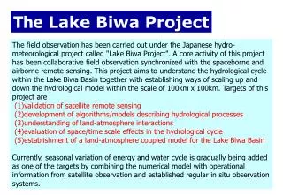
The Lake Biwa Project The field observation has been carried out under the Japanese hydro-meteorological project called "Lake Biwa Project". A core activity of this project has been collaborative field observation synchronized with the spaceborne and airborne remote sensing. This project aims to understand the hydrological cycle within the Lake Biwa Basin together with establishing ways of scaling up and down the hydrological model within the scale of 100km x 100km. Targets of this project are(1)validation of satellite remote sensing (2)development of algorithms/models describing hydrological processes (3)understanding of land-atmosphere interactions (4)evaluation of space/time scale effects in the hydrological cycle (5)establishment of a land-atmosphere coupled model for the Lake Biwa Basin Currently, seasonal variation of energy and water cycle is gradually being added as one of the targets by combining the numerical model with operational information from satellite observation and established regular in situ observation systems.
Location of Target Area 20 km Forest Lake Biwa 20 km Paddy Field Kyoto Nagoya Lake Osaka Urban Area
Paddy Field Urban Area Forest Lake Regular flux measurement system Now four flux measurement systems have been installed and operated regularly at different landuse condition (paddy field, forest, lake, urban area) in the Lake Biwa Project. Fluxes of radiation budget and heat budget component and related meteorological and hydrological variables are observed continuously.
Time series of accumulated water budget components for Lake Biwa blue: outflow from the Lake (obs) pink: surface runoff from the basin-mesh (sim) black: baseflow from the basin-mesh (sim) red: precipitation over the lake (obs) green: evaporation from the lake (sim) sky blue: irrigation water demand (sim) yellow: forced water drainage (sim) purple: lake water storage change (obs) orange: lake water storage change (sim) Comparison of observation and numerical simulation by Land Surface Scheme (upper: paddy, lower: lake)(left: net radiation, right:latent heat)
Intensified field observation of turbulent fluxes CAPS (Catch a Plume by SATs) CAPS was carried out in Nov. 2002 to measure the distribution of surface heat fluxes. 17 SATs were installed within 1200 x 500m field. Among them, 5 sites were called “super site” where all energy budget components were measured. Furthermore, 2 Doppler Sodars, GPS sonde, 4 Scintillometers, were used to measure the structure of boundary layer. Surface temperature distribution was measured by thermometer from airplane.