Download
1 / 49
490 likes | 508 Views
Learn about the significance of freshwater subaqueous soils for managing aquatic systems, habitat sustainability, and addressing environmental challenges like nutrient levels and sediment accumulation. Explore the technical soil services, project objectives, and goals focused on characterizing freshwater soil types and estimating carbon pools. Discover the impact of invasive species and the importance of soil-landscape mapping for resource management.

E N D
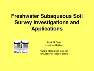
Freshwater Subaqueous Soil Survey Investigations and Applications Mark H. Stolt Jonathan Bakken Natural Resources Science University of Rhode Island
Thank youRI-NRCSJim TurenneMaggie PayneCT-NRCSDonald ParizekDebbie SurabianMarisa TheveNational NRCS Soil Survey DivisionRI-AES
This year marks the 20th anniversary of George’s paper briefly articulating the concept of subaqueous soils
In the second edition of Soil Taxonomy the definition of soil was changed to accommodate subaqueous soils • This was done as resource scientists began to recognize the importance of these shallow-water soil resources for their habitats, structure, and associated ecosystem functions.
WHY DIDN’T WE STOP MAPPING SOILS AND MAKING INTERPRETATIONS AT THE LAND-WATER INTERFACE?
Why Map Freshwater Subaqueous Soils? • There is a growing need for a tool to manage • shallow aquatic systems and resources at an • ecosystem scale • Environments need to be managed in • ensure long-term sustainability • Growing difficulties in managing elevated • nutrient levels (N & P) and the trophic state of lakes • Abundance of issues related to sediment accumulation including contaminants such as metals, herbicides, and pesticides) • Explosion in the population of invasive species
Technical Soil Services • Sedimentation rates and volume of sediment for pond restoration • Engineering calculations for water volume in ponds • Geotechnical data for engineering docks, etc • Contaminant levels • Floodplain restoration • Cultural resources needs • Bathymetry • Data for dam removal and fish ladders • Carbon accounting
Project Objectives • Characterize the most common freshwater soil types • Calculate carbon pools • Develop relationships between soils and invasive species distribution • Estimate C sequestration rates
Project Goals Develop recommendations for additional taxa in Soil Taxonomy for freshwater SAS Develop additional methods, procedures, or standards for mapping freshwater SAS Answer the question: Are impounded freshwater SAS different than natural lake SAS?
My goal today is to tell you a little bit about the things that we learned in this study.
Smith & Sayles Bowdish Impounded Natural Belleville Wordens Watchaug Tucker
Bathymetry Data collected with a Garmin fathometer (fish-finder; about $500) Essentially drive back and forth across the water body in a cross-hatched pattern; X, Y, Z points are collected every 10 seconds Data set to NAVD88 No worry about lake level variations or tidal corrections Use software to create maps
Delineate • soil-landscape units • Lake Bed • Shoreline • Cove • Deep Water • Shoal
Run GPR transects Can also use underwater video along transect to look for surface stones or surface patterns indicative of different soils, and/or to support GPR images
Water1 Mineral soils organics Thin organics Surface stones 6 Layers of organic material Boulders
Ground-truth GPR Investigate soils Build soil-landscape models Understand map unit composition and purity
Five New Series • (OSDs are available on-line) • Burlingame • Wickford • Aquapaug • Shannock • Tuckertown • Map unit purity was generally >85%
Aquapaug (Psammentic Frasiwassent) Shannock (Typic Humaquept) Burlingame (Aeric Frasiwassent) Wickford muck (Sapric (Terric) Frasiwassist) Tuckertown muck (Sapric Frasiwassist)
Frasiwassist Subgroups • SapricFrassiwassists: >130 cm of SOM dominated by sapric SOM • Terric Sapric Frasiwassists: <130 cm of SOM dominated by sapric SOM Terric is a proposed change to Soil Taxonomy
Proposed SAS Inceptisols • Histic Frasiwassepts • Umbric Frasiwassepts
Proposed SAS Entisols • Histic Frasiwassents • Umbric Frasiwassents
Determination of soil organic soil (SOM) type. Field is based on visual rubbed fiber content. Lab is based on “standard lab rubbed fiber approach” and sodium-pyrophosphate color..
Determination of soil organic soil (SOM) type. Field is based on visual rubbed fiber content. Lab is based on “standard lab rubbed fiber approach” and sodium-pyrophosphate color..
Invasive Species Eurasian Watermilfoil Water Chestnut Curly-Leafed Pondweed Variable Leaf Watermilfoil Fanwort
Invasive plants were abundant in the impounded sites and essentially absent in natural ponds • Variable milfoil and fanwort were the predominant species
Logistic regression analysis of the effect of extractable P (by depth) on the type or presence of vegetation. Cells highlighted in dark gray displayed significant results (alpha < 0.05).
Logistic regression probability plot • The output c-value = 0.714 • This signifies a fairly strong relationship • ‘c’ can range from 0.5 to 1, where 0.5 corresponds to the model randomly predicting the response, and a value of 1.0 corresponds to the model perfectly discerning the response
Establishing timeframe to estimate C-sequestration ppm lead or arsenic 100 years ago
Average SOC sequestration Rates SAS in Impounded Systems: 1.57 Mg/ha/year SAS in Natural Lakes: 0.84 Mg/ha/year Forests in New England 0.84 Mg/ha/year
Project Goals Develop recommendations for additional taxa in Soil Taxonomy for freshwater SAS Develop additional methods, procedures, or standards for mapping freshwater SAS Answer the question: Are impounded freshwater SAS different than natural lake SAS?
Five new series were established for SAS in lakes and reservoirs in New England. • New taxa need to be developed that recognize “Terric “ subgroups of Frasiwassists • New taxa need to be developed for SAS that have histic or umbric epipedons. Do we need subaqueous Inceptisols or should we restrict them to the Histisol and Entisol orders? Project Goals Develop recommendations for additional taxa in Soil Taxonomy for freshwater SAS Develop additional methods, procedures, or standards for mapping freshwater SAS Answer the question: Are impounded freshwater SAS and different than natural lake SAS?
The methods and procedures developed for mapping and characterizing estuarine subaqueous soils apply to freshwater SAS • No special sample handling or analysis is required • If you can drive a small boat and operate a GPS, you can make a bathymetric map • GPR is a great tool that can be used in freshwater SAS that cannot be used in estuarine systems • Don’t be afraid to map freshwater SAS!!! Project Goals Develop recommendations for additional taxa in Soil Taxonomy for freshwater SAS Develop additional methods, procedures, or standards for mapping freshwater SAS Answer the question: Are impounded freshwater SAS and different than natural lake SAS?
Essentially all of the invasive plants occurred in the impounded systems • Carbon pools were significantly higher in the impounded sites • Average SOC sequestration rates were about twice of that in the natural lakes • Subaqueous landscape units and soil types differed in their distribution, but in general the same could be found in both types of lakes or ponds Project Goals Develop recommendations for additional taxa in Soil Taxonomy for freshwater SAS Develop additional methods, procedures, or standards for mapping freshwater SAS Answer the question: Are impounded freshwater SAS and different than natural lake SAS?
Soil Classification and the Coastal and Marine Ecological Classification Standard (CMECS) The application of soil classification for use and management was recognized in the new Coastal and Marine Ecological Classification Standard (CMECS; NOAA, 2012). This national classification system was developed over the last decade by NOAA through assistance from over 100 coastal and marine habitat experts, who represented agencies of federal, state and local governments, academia, non-governmental organizations, and industry. Although CMECS uses Folk (1954) as it standard classification system for the substrate component: the authors of CMECS gave the nod to soil classification as the best approach to classify substrates for use and management purposes:
Soil Classification and the Coastal and Marine Ecological Classification Standard (CMECS) “In contrast (to Folk), the Soil Geographic Data Standard, FGDC-STD-006 (FGDC 1997) and Keys to Soil Taxonomy (Soil Survey Staff 2010) together provide more detailed classification options for classifying soils with many hundreds of descriptors that have been used in soil science for decades. Users should consider these sources and approaches when classifying substrate in these areas. It is recommended that a soils approach be used if a more detailed classification is needed for interpreting use and management of shallow water substrates.”