Download
1 / 27
270 likes | 380 Views
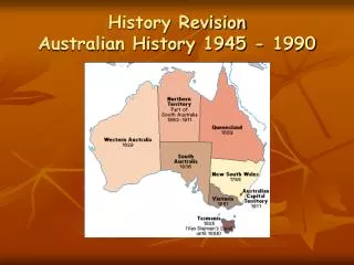
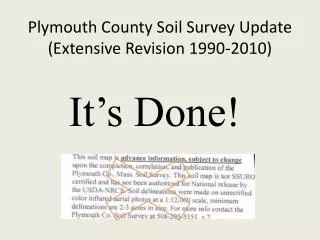
Plymouth County Soil Survey Update (Extensive Revision 1990-2010). It’s Done!. Plymouth County Soil Survey . Size: 425,000 acres MLRA’s: 149B & 144A Scale: 1:12,000 Minimum Size Delineation. 1/2 acre 34,354 soil polygons 8,656 Special spot features. What’s the Difference.

E N D
Plymouth County Soil Survey Update (Extensive Revision 1990-2010) It’s Done!
Plymouth County Soil Survey • Size: 425,000 acres • MLRA’s: 149B & 144A • Scale: 1:12,000 • Minimum Size Delineation. 1/2 acre • 34,354 soil polygons • 8,656 Special spot features
What’s the Difference 1969 Plymouth 2010 Plymouth Scale 1:12,000 (MSD~0.5) Gloucester Soil Acres = 2,875 Field work 1989-2009 Soil Series names on cranberry beds Urban areas classified as high as possible to series 6 New Soil Series, 9 Dropped, 52 series in all. Classified to 65 inches. Georeferenced sites 231 mapunits Tidal series, dune soils, and beach units established. • Scale 1:15,840 (MSD~2.5) • Gloucester Soil acreage = 35,550 • Field work 1950-1963 • Pre-taxonomy, soils described to shallow depths (30” in some) • Sb = Sanded muck / bog • Urban areas unclassified • 28 series recognized • 106 mapunits • No coastal/tidal marsh soils
Comparison 1969 Survey 2010 Survey
The Plymouth Mappers Pete Fletcher* 1989 to 1992+ Jim Turenne 1990 to 2003 Meredith Ashworth 1994 to 1999 Rob Tunstead 2000 to 2010 Brian Parks 1997 to 2009 Tom Peragallo 1991 to 2008 William Taylor 1990 to 1995 Donald and Debbie 2008 to 2010 Other Mappers: Terry Schnider, Brian Lesinski, Phil Angel, volunteers and interns. Thanks to All! *Pete’s acres mainly on the dunes and beaches!
The Website Started 1996, one of the first soil survey WebPages. Provided update data, farmland lists, series info, data, soil description database, geophysical info Over 2 million hits since inception – now nesoil.com
SIS (Soil Information System) Developed in 1998 with RC&D one of first GIS projects to provide soil interpretive data using the updated mapping. Hundreds of copies of the CD sent out.
The (Original)Soil Tunnel (aka Wormhole) Developed by two volunteers from U.K (Nicky Shirt and Michael Bonner. Educational display taken to schools to teach about soils, curriculum written and interns trained. Featured at the National Mall in Washington DC.
Digital Products Soil CD with digital maps and attribute info, General soil maps for towns, catena charts, scanned atlas sheets, soil interp data.
Ground Penetrating Radar Investigations Water Table Monitoring Well Program Title 5 Workshops Farm Bill Technical Assistance 9 County Area Rapid Carbon Assessment (RaCA) ERT Technical Assistance Hydric Soil Workshops New England Hydric Soils Technical Committee (NEHSTC) Basic Soil Services Plymouth County Soil Scientist Technical Assistance
GPR - 2D - Peat Thickness (http://nesoil.com/gpr/gprgis.htm) Procedure developed to utilize GPS and GIS to provide detailed maps of peat thickness in bogs.
Southeastern Massachusetts Index Monitoring Well Networkhttp://nesoil.com/obswell/index.htm • Network of over 38 well sites setup in SE Mass. • Town request (Board of Health Officers) / Watershed Groups • Assist w/ new Soil Series definition and NASIS data population • Data confirms and assists with revisions of established Soil Series definitions • Info used in Hydric Soil Identification (National & Regional Keys)
Title 5 - Soil Evaluator Workshops Began in 1994 and continued through current. Sessions eductated professionals on soil evaluation for septic system siting. Money went to District to hire contract mappers to accelerate the survey.
Rapid Carbon Assessment (RaCA) Current National Initiative to determine soil organic carbon content. Assessment uses a spectrometer to analyze the soil samples collected.
Environmental Review Team (ERT) • Purpose – Provide local officials, boards, and commissions with accurate natural resource information and interpretations to make wise land use decisions • Project Areas: Quivet Neck, Dennis Viall Farm, Rehoboth Cole Property, Carver Tidal flats at Quivet Neck, Dennis
Hydric Soil Workshops The Workshop from hell – Barnstable MA.
Geo-referenced Site and Field Notes All data collected during the survey has been geo-located and the point data made available to users via WWW (Google Earth). Data includes pedon descriptions, lab sampling data, water table and climate sites, GPR investigations, field notes.
Web Soil Survey(http://websoilsurvey.nrcs.usda.gov Also: http://www.mass.gov/mgis/massgis.htm
Google Earth Soils Information (http://casoilresource.lawr.ucdavis.edu/drupal/node/429) Also available on Smart-Phones