Download
1 / 18
180 likes | 426 Views
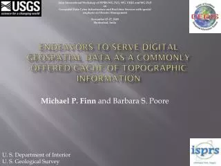
Joint International Workshop of ISPRS WG IV/1, WG VIII/1 and WG IV/3 on Geospatial Data Cyber Infrastructure and Real-time Services with special emphasis on Disaster Management November 25-27, 2009 Hyderabad, India.

E N D
Joint International Workshop of ISPRS WG IV/1, WG VIII/1 and WG IV/3onGeospatial Data Cyber Infrastructure and Real-time Services with special emphasis on Disaster Management November 25-27, 2009Hyderabad, India Endeavors to Serve Digital Geospatial Data as a Commonly Offered Cache of Topographic Information Michael P. Finn and Barbara S. Poore U. S. Department of Interior U. S. Geological Survey
Outline • Motivation • The National Map • NRC Report: Goals and Research • User-Centered Design • Information Access and Dissemination: OGC Standards and Web Services • Viewer Design and Web 2.0 Technologies • Scenario and Research • Summary
The National Map The National Map contributes to the NSDI The National Map includes eight data layers Public domain data to support • USGS topographic maps at 1:24,000-scale • Multiple scales and resolutions: Products, services, analysis, modeling and other applications The National Map is built on partnerships and standards
The 8 Layers of The National Map Transportation Structures Orthoimagery Hydrography Land Cover Geographic Names Boundaries Elevation
User-Centered Design • Priority research topic for CEGIS according to National Research Council Report • Interactive process of system development linking developers with users at every stage • Major research area in computer science and human-computer interaction • Long tradition in cartography; flurry of GIS research in mid 1990’s
Plan the human • centered process Meets requirements! 2. Specify the context of use yes no 3. Specify user and organizational requirements 5. Evaluate designs against user requirements 4. Produce design solutions ISO 13407: Human centered design processes for interactive systems
Example: Scenario-Based Design (Rosson and Carroll 2002)
OGC Standards and Web Services • Spatial information can be a unifier of many technology disciplines • Focusing on standard profiles • A key challenge is to produce standard profiles that are customized for USGS products
User Interface Design for Map Viewers • Who are users of The National Mapproducts now and in next 5 years? • How are user behaviors changing as a result of Web 2.0 technologies? • What types of interfaces are appropriate for traditional and new categories of users?
Web 2.0 Trends • Open source • Rise of the user (person, group, firm) • Direct physical manipulation of map interface • User-contributed data • Social networking • Co-production of content
Feature/Event Based User-Centered Design OntologyDriven Generalization E-Topo Maps Multiscale Nationwide Coverage 8 Data Layers Authoritative Data Source Integrated Data Quality Aware Spatio-Temporal Intelligent Knowledge Base Semantics-driven
Scenario: Information Access and Dissemination Wildfires are spreading rapidly across a San Diego mountainside. Fire fighters have deployed with two-way radios and Global Positioning Systems (GPS). In the command center, the new 3-D topographic maps overlaid with near real-time airborne color-infrared thermal imagery, real-time GPS wireless sensor data, and National Weather Service maps of wind direction, precipitation potential, and temperature displayed on the computers allow the command center team to tell the fire fighters through their two-way radios where the wildfire boundaries are and help them estimate the likely fire spread directions and speed in the next two hours. The operators at the command center find it intuitive to toggle between the various layers of data to analyze the situation, and can select different combinations to produce PDF files for fast printing to distribute to the crews. Meanwhile, the GPS and wireless communication enable the transmission of the position of the crew back to the command center, which has a large screen to display the overview maps with current positions of all firefighters and current fire perimeters. With a comprehensive GIS modeling technology and the information provided from The National Map (topography, slope, aspect, weather, soil moisture, vegetation, etc.), the command and control center calculates potential dangers for firefighters and immediately distributes a warning to the crews on the west side of the mountain to relocate 300 m farther west. Based on information from the overview maps, the center also dispatches another crew to the highest-risk zone and moves two more toward that zone. Their earlier participation in design phases are paying off in powerful but easy to use geospatial tools in a frantic and hostile environment.
Addressing the Presented Scenario • Immediate access to information based on common place name • Intuitive user interface, semantically-driven • Automated generalization and data integration (fusion, conflation) • Semantics driven query and access
Research needed to make the scenario possible from The National Map(one of many) • Ontology-driven generalization, data integration, user-interfaces, and map generation
Summary • The National Map: A seamless, continuously maintained, nationally consistent set of base geographic data • NRC Report: vision for 2015 • Information Access and Dissemination -> User-Centered Design • User-Centered Design : Priority research topic for CEGIS • OGC Standards and Web Services: Standards for USGS products • Viewer Design and Web 2.0 Technologies: Design for users now and in next 5 years; emphasize open source • Scenario and Research: Immediate access, Intuitive user interface, Generalization , Integration (ontology-driven map generation) • Many USGS geospatial products are already built on OGC standards • Normalize access to spatial data
Joint International Workshop of ISPRS WG IV/1, WG VIII/1 and WG IV/3onGeospatial Data Cyber Infrastructure and Real-time Services with special emphasis on Disaster Management November 25-27, 2009Hyderabad, India Endeavors to Serve Digital Geospatial Data as a Commonly Offered Cache of Topographic Information Michael P. Finn and Barbara S. Poore mfinn@usgs.gov bspoore@usgs.gov http://cegis.usgs.gov/index.html