Natomas Levee Improvement Program Overview
Learn about the comprehensive flood risk reduction program for Sacramento area. Details on construction segments, costs, environmental constraints, and objectives. Presented by Central Valley Flood Protection Board in 2009.

Natomas Levee Improvement Program Overview
E N D
Presentation Transcript
SAFCANatomas Levee Improvement ProgramCentral Valley Flood Protection Board BriefingFebruary 26, 2009
Presentation Outline • NLIP Overview • Construction Phasing Schedule & Cost Estimates • Construction Segments • Sacramento River, American River • Natomas Cross Canal, PGCC, NEMDC • Canal Relocations, Borrow Sites • Environmental Constraints • Program Q & A • Phase 2 Crediting Request
Natomas LeveeImprovement Program • Part of comprehensive flood risk reduction program for Sacramento area • Being carried out as part of the federal-state-local American River Common Features Project • Central Valley Flood Protection Board is the Non-Federal Sponsor • SAFCA is the Local Sponsor
Identified Flood Risks • Inadequate Levee • Height • Instability – Geometry, • Underseepage, etc. • Encroachments • Channel Erosion
Program Objectives • Provide 100-year flood protection as quickly as possible • Provide 200-year flood protection over time • Ensure that new development does not substantially increase the expected damage of an uncontrolled flood
Program Cost Estimate Construction $421 M ROW $90 M Mitigation & Permit $28 M Engineering & CM $79 M Total $618 M
Anticipated 2009 Activities SREL – 1 Early 2009 (Reaches 1-4A) NCC – 2 Early 2009 (Reaches 1-7) SREL – 1B Late 2009 (Reach 4B) SREL – 2 Late 2009 (Reaches 5A-9B)
Sacramento River East Levee Adjacent Levee Design Concept
Major Borrow Sites Brookfield Airport North Binford/DeYoung, Horangic, Bianchi, Dhaliwal, Hants, Elkhorn South Site I-5 South Fisherman’s Lake Krumenacher Twin Rivers School District Stockpile
Irrigation and Drainage Canals • Relocated Elkhorn Canal - North of Teal Bend - SREL-1B - South of Teal Bend - SREL-2A • New GGS/Drainage Canal - North of Teal Bend - SREL-1B - Teal Bend to I-5 - SREL-2A - South of I-5 – Phase 4b Project • Relocated Riverside Canal - SREL-3
GGS/Drainage Canal • Excavated Soil Reused for Irrigation Canal Embankment (or Levee) Construction • 23,000 linear feet • 250,000 cubic yards • excavation • 600 lf 8’x6’ Arch Culverts • Dewatering
Elkhorn & Riverside Canals • Replaces Existing NMWC Canals • 41,000 linear feet
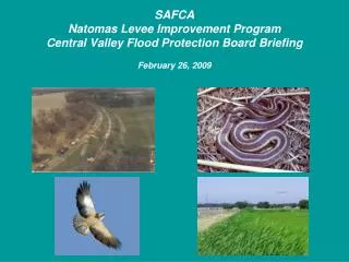
Environmental Constraints • Swainson’s Hawk • Giant Garter Snake • Cultural Resources
Requested Actions from CVFPB March 2009 CVFPB Meeting Modify permit # 18159-2 18159-3 Adopt New CEQA Findings related to Supplemental EIR