Download
1 / 32
320 likes | 432 Views
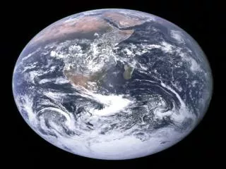
Learning About Volcanoes and Mathematics. Soledad Ulep & Eligio Obille Jr U.P. NISMED, Philippines. Most of the active volcanoes in the world are found around the Pacific Ocean. http://www.worldatlas.com/aatlas/infopage/ringfire.htm. Philippine Institute of Volcanology and Seismology.

E N D
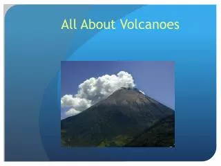
Learning About Volcanoes and Mathematics Soledad Ulep & Eligio Obille Jr U.P. NISMED, Philippines
Most of the active volcanoes in the world are found around the Pacific Ocean. http://www.worldatlas.com/aatlas/infopage/ringfire.htm
Lava eruption at Mayon Volcano Photo: Tryfon Topalidis When volcanoes erupt, different materials come out.
Very small fragments that come out of volcanoes are called ASH. Pyroclastic flow at Mayon Volcano Photo: C.G. Newhall
Pyroclastic flow at Pinatubo Volcano Photo: Alberto Garcia
The volcanic ash that fall on the slopes of a volcano may become saturated with rain during typhoon season. Later, the ash and rainwater mixture may move down as LAHARS.
Before lahar event Photo: in Fire & Mud, Newhall and Punongbayan, eds
After lahar event Photo: in Fire & Mud, Newhall and Punongbayan, eds
Lahar in Pampanga Photo: in Fire & Mud, Newhall and Punongbayan, eds
Lahar in Tarlac Photo: in Fire & Mud, Newhall and Punongbayan, eds
Pinatubo eruption, 1991 Photo: Richard P. Hoblitt, USGS
Pinatubo ashfall Photo: United States Marine Corps
Suggested Mathematical Tasks • Determine the distance of the community from the volcano using a map. • Determine the distance travelled by different volcanic materials (deposits made by lavas, pyroclastic flows, ashfall, and lahars (students will use hazard maps as basis) • Compare the relative speeds of the different volcanic hazards (lava flow, pyroclastic flow, lahars, ashfall) with the “speed” of walking, running, bicycling, or using a car.
Suggested Mathematical Tasks • Determine the area covered by the different volcanic deposits (to help students visualize the extent of this area, compare it to that of a basketball court) • Determine the volume of materials ejected by a volcano (to help students visualize the large amount of material involved, compare it to the capacity of a dump truck)
Reference Newhall, C. G., & Punongbayan, R. S. (Eds.). (1996). Fire and Mud: Eruptions and Lahars of Mount Pinatubo, Philippines. Seattle and London: University of Washington Press. Retrieved August 12, 2005, from http://pubs.usgs.gov/pinatubo/contents.html