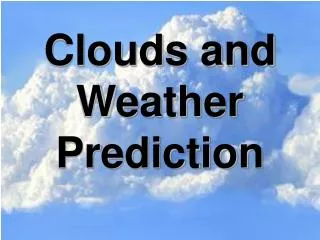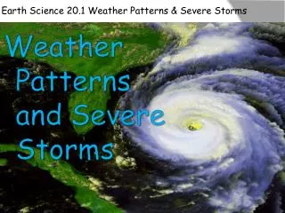
Fire Weather: Clouds & T-Storms
210 likes | 234 Views
Explore how clouds influence fire weather conditions and thunderstorm development. Learn about different cloud types and their importance in weather forecasting.

Fire Weather: Clouds & T-Storms
E N D
Presentation Transcript
Physical structure of a cloud • Minute water droplets • Ice crystals • Combination of both Why are clouds important for fire weather?
Clouds are indicators of… • Atmospheric moisture • Atmospheric motion • Instability • Warning of weather change • Precipitation • Winds
Cirrus Clouds thin, wispy, feathery Fire weather: high-altitude moisture and wind direction and speed warning of warm-front activity
Fair Weather Cumulus Clouds puffy cotton balls floating in the sky Flat bases and distinct outlines, irregular shapes (“cauliflower”). Slight vertical growth; cloud tops = limit of the rising air. Fire weather: warning of convection in surface layer. Can later develop into towering cumulonimbus clouds.
Altocumulus Clouds parallel bands or rounded masses Portion of cloud = shaded. Formed by frontal or orographic lifting. Fire weather: May develop into Altocumulus Castellanus clouds…
Altocumulus Castellanus Clouds (“turrets”) Convection in unstable layer aloft. Often result of gradual lifting of air in advance of a cold front. Fire weather: warning of possible thunderstorms later in the day.
Cumulonimbus Clouds - towering high into the atmosphere - Moist and unstable air = towering cumulus clouds Fueled by vigorous convective updrafts (> 50 knots, tops > 60,000 ft) Thunderhead (with anvil) Fire weather: gusty and high speed surface winds, dust devils, whirlwinds, turbulence, downdrafts
Lenticular Clouds • Indicate waves of air flow caused by strong winds blowing across a range (“mountain waves”). • Usually appear over the ridge on the lee side of mountains. • Fire weather: may increase fire activity if air flows descend
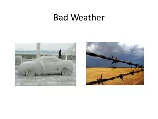
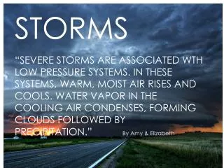
Thunderstorms • Major influence on fire behavior • Wind patterns • Lightning (can cause fires anywhere in the U.S.) • Three conditions required: • Unstable air • Triggering mechanisms (lifting process) • Orographic, frontal, convergence, thermal/convection • Sufficient moisture in air
Group Exercise • Describe the processes that occur in each of the three stages of thunderstorm development: cumulus, mature, dissipating. • What is the effect on fire behavior in each stage? • Note: you will be given a diagram of each stage to facilitate your discussion and formulation of your response. • Each member of the group should be prepared to be called upon to present the group’s answer to the class.
3 Stages of a Thunderstorm 1. CUMULUS STAGE • Lifting of moist air above condensation level • Updrafts increase in speed • Droplets increase in size • Light downdrafts (settling of air) • Gentle wind change • Fire behavior: convection columns may cause fire to become more active
T-Storm stages… 2. MATURE STAGE • Rain falls from cloud base – drowndrafts • Updrafts and downdrafts in different portions of cloud • Downdrafts strongest at front edge (>30 mph) • Convection cell - maximum height • Anvil top – points in direction of travel • Fire behavior: turbulent, strong wind (horizontal flow)
T-Storm stages… 3. DISSIPATING STAGE • No new condensation to support cloud growth • Cell changes to all downdrafts • Downdrafts dissipate and surface signs disappear
Lightning • Occurs in a T-Storm when electrical potential builds up • Movement of particles with positive and negative charges • Atmosphere: positive charge with respect to the Earth • Cumulonimbus clouds – alters and intensifies electric fields – creates a positive charge on the ground
Lightning Discharge Cloud-to-ground: • between negative lower portion of cloud and positive charge on ground • Cold stroke: intense current, short duration (345,000 amps) • Hot stroke: lesser current, longer duration (200 amps) • Hot stokes more likely to start fires • 20% lightning bolts in West = hot strokes
Cloud-to-cloud discharges • Between the negative charge in the lower cloud and positive charge in core of cloud.
Thunder • Compression wave from sudden heating and expansion of air along path of lightning discharge • Reflected from the ground surface = sound • Light moves faster than sound – see lightning first • Approx. 1 mile to the flash for every 5 seconds elapsed time