Download
1 / 12
170 likes | 467 Views
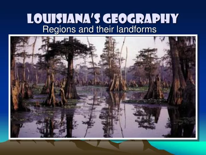
Regions and their landforms. Louisiana’s Geography. Ecosystem. A community of organisms –plants, animals, bacteria and the environment all functioning as a unit in nature. Topography. Physical features of land Most topography is seen on topographical maps that show elevation of land.

E N D
Regions and their landforms Louisiana’s Geography
Ecosystem • A community of organisms –plants, animals, bacteria and the environment all functioning as a unit in nature
Topography • Physical features of land • Most topography is seen on topographical maps that show elevation of land
Delta (Mississippi Floodplain) • Also called the Passes • Triangular shaped river mouth that looks like the Greek letter • The word refers to the entire lower Mississippi River Valley • The Mississippi has a Birdsfoot Delta being that it is shaped like a birds leg and claw
Estuary (Mississippi Floodplain) • Called the place where the river meets the sea • Water changes from fresh to salt water (brackish) • Vegetation is mostly marsh grasses which is able to survive in both fresh and salt water • Considered the most productive ecosystem in nature
Mudlumps (Mississippi Floodplain) • Found in the passes of the floodplain near the mouth of the river • Small temporary landforms built by the interaction of escaping marsh gas (yes it is smelly) and sediment (soil) • They are built very quickly and rarely last more than 15 years.
Marsh • Known as a wet, treeless prairie covered with water and marsh grasses • Found only along the coast • Louisiana has 2.5 million acres of marsh which is disappearing at the rate of 35 football fields every half hour!
Chenier (Marsh Region) • “places of the oaks” • The only part of the marsh where people live is along the chenier ridges • It is a ridge of land in the marsh where large moss draped oaks that battle fierce winds from storms are.
Salt Domes (Marsh Region) • Natural geological feature of salt marshes • Layer of rock that have folded upward, rising above the surface • Hold mineral treasure-sulphur, petroleum, and salt • Large hills of land within the marsh land surrounded mostly by a moat of water • Most significant are at the Five Islands in Louisiana • Found between Morgan City and New Iberia • Avery Island, Weeks Island, Jefferson Island, Cote Blanche and Belle Isle
Wolds (Hills Region) • Rock formations • Raised uplands and ridges caused by erosion wearing down surrounding rock • Part of a old is a term called an uplift which is a raised area of rock folded upward • Two wolds with uplifts are the Nacadoches Wold and the Kisatchie Wold • Driskill Mountain is part of the Kisatchie Wold at Louisiana’s highest point of 535 ft above sea level