Download
1 / 31
310 likes | 322 Views
Learn about the Division of Nearshore Research's Texas Coastal Ocean Observation Network (TCOON) and its real-time data collection and processing capabilities. Discover how TCOON supports various research efforts and provides valuable information for tidal datums, navigation, water quality studies, and more.

E N D
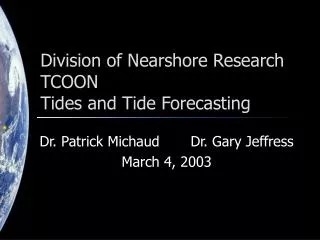
Division of Nearshore ResearchTexas Coastal OceanObservation Network Dr. Gary Jeffress Dr. Patrick Michaud Jessica Tishmack May 7, 2003
Division of Nearshore Research Projects • Texas Coastal Ocean Observation Network • NOAA/NOS Natl Water Level Obs Network • Houston/Galveston PORTS • National/Global Ocean Observing System • TWDB Intensive Surveys • Nueces Bay Salinity Project • Corpus Christi Real-Time Navigation System • CMP - Neural-Network Forecasting • CMP - Waves
TCOON Overview • Started 1988 • Over 50 stations • Primary Sponsors • General Land Office • Water Devel. Board • US Corps of Eng • Nat'l Ocean Service Gulf of Mexico
TCOON Overview • Measurements • Precise water levels • Wind • Temperature • Barometric pressure • Follows NOAA/NOS standards • Real-time, online database
Wind anemometer Radio antenna Satellite transmitter Solar panels Data collector Water level sensor Water quality sensor Current meter Typical TCOON Station
Nueces Bay Salinity Project • Started 1991 • Informs data management officials of opportunities to avoid water releases • Water quality data collected every 30 minutes
Other Real-time Systems • Real-time navigation • Port of Corpus Christi • Port Freeport • NOAA PORTS • Offshore weather
Data Management • Automated acquisition, archive, processing, retrieval • 10-year historical database • Most processing takes place via Internet • Infrastructure for other observation systems
Uses of DNR/TCOON Data • Tidal datums • Littoral boundaries • Oil-spill response • Navigation • Storm preparation/ response • Water quality studies • Research
Tidal Datums • Used for • Coastal property boundaries • Nautical charts • Bridge and engineering structures
New Data Collection Hardware • PC-104 based computer • Linux operating system • Solid-state Flash memory • 10 serial ports, 16 A/D channels • Low power consumption • Rugged for harsh environments
Research • Real-time automated data processing • Tidal datum processing • Web-based visualization and manipulation of coastal data • Neural network based forecasts from real-time observations • Specialized sensor and data acquisition system development • Support for other research efforts
Water Level Forecasting Isidore begins to (re-)enter the Gulf… …what will happen next?
Tide Predictions Tide The periodic rise and fall of a body of water resulting from gravitational interactions between Sun, Moon, and Earth. Tide and Current Glossary, National Ocean Service, 2000 According to NOS, changes in water level from non-gravitational forces are not “tides”.
Harmonic Analysis • Standard method for tide predictions • Represented by constituent cosine waves with known frequencies based on gravitational (periodic) forces • Elevation of water is modeled as h(t) = H0 + Hc fy,c cos(act + ey,c – kc) h(t) = elevation of water at time t H0 = datum offset ac = frequency (speed) of constituent t fy,c ey,c = node factors/equilibrium args Hc = amplitude of constituent c kc = phase offset for constituent c
Prediction vs. Observation It’s nice when it works…
Prediction vs. Observation …but it often doesn’t work in Texas
Water Level != Tide In Texas, meteorological factors have a significant effect on water elevations.
Uses of Harmonic Predictions However, harmonic predictions can still be useful! Consider… Isidore begins to (re-)enter the Gulf… …what will happen next?
Uses of Harmonic Predictions If we add harmonic prediction… …what will happen next?
Uses of Harmonic Predictions landfall
Harmonic Water Level PredictionsPresent Capabilities • Automated system for computing harmonic constituent values from observations database • Harmonic predictions available via query page for many TCOON stations
Water Level Prediction (Near) Future Capabilities • Persistent model forecast • Apply difference between latest observation and harmonic prediction to future predictions • Forecasts page on DNR web site • Obtain forecasts from different models • Harmonic predictions • Persistent model • Neural-network model • Linear-regression/statistical model • Hybrid models • Information about water-level forecasting methods • Statistics on previous forecasts
Neural Network Forecasting • Use neural network to model non-tidal component of water level • Reliable short-term predictions CCNAS ANN 24-hour Forecasts for 1997 (ANN trained over 2001 Data Set)
Forecasts in Storm Events CCNAS ANN 12-hour Forecasts During 1998 Tropical Storm Frances (ANN trained over 2001 Data Set)
Conclusions • Long-term, data-rich observation network • Web-based infrastructure for automated collection and processing of marine data • Research in datum computation and coastal forecasting