Download
1 / 27
270 likes | 295 Views
Explore the extensive inventory and monitoring achievements of the Sierra Nevada Network, including vertebrate surveys, resurvey efforts, and cave invertebrate species discoveries. Discover new localities and changes in ranges, with documented findings of rare species and ecosystem dynamics. Witness the environmental transformations captured in historical and recent photographs. Learn about the vital role of data gathering in park management decisions and ecosystem conservation efforts.

E N D
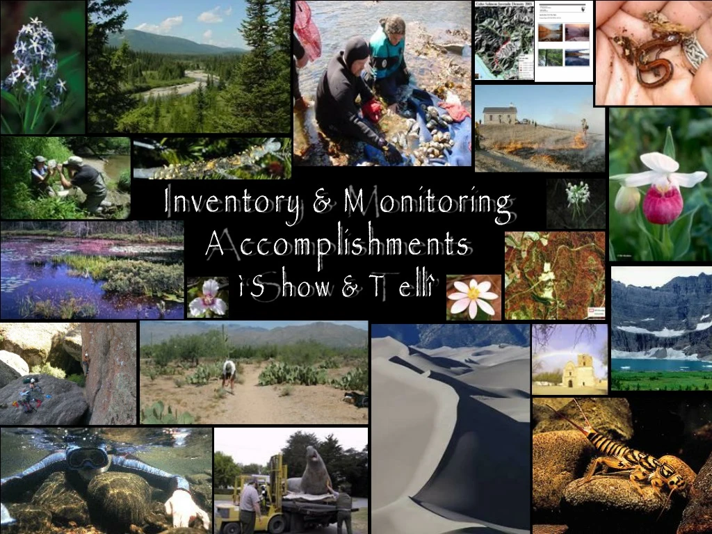
Inventory & Monitoring Accomplishments “Show & Tell”
National Park Service Sierra Nevada Network • Sierra Nevada Network Vertebrate Inventory 2003—2005 • “Resurvey” effort of 1914—1919 Yosemite transects (Grinnell and Storer 1924) • Museum of Vertebrate Zoology, UC Berkeley (Craig Moritz, Jim Patton) • USGS-WERC (Les Chow) • Yosemite National Park • Yosemite Fund • SIEN Inventory & Monitoring Dr. Jim Patton weighing a Deer Mouse (Permomyscus maniculatus) in Merced Grove of Giant Sequoias. USGS photo by Les Chow.
National Park Service Sierra Nevada Network Original inventory was well-documented, allowing resurvey almost a century later. Short-tailed weasel Mustela erminea. USGS photo by Les Chow. MVZ graduate student Allison Bidlack checks mammal traps along Crane Creek. USGS photo by Les Chow.
National Park Service Sierra Nevada Network Resurvey documented new localities, range expansions and range contractions, and extirpations. Pika and alpine chipmunk Tamias alpinus, common below 9500’ in original survey, now gone from Tuolumne Meadows and now documented only at higher elevations. New locality for rare Mt Lyell Salamander Hydromantes Platycephalus PikaOchotona princeps
SCPN: Resampling 1935 Forest Plots at Grand Canyon
Unnamed glacier above Cape Douglas, 1895 Katmai National Park and Preserve C . W. Purrington, USGS Glacier was against its terminal moraine indicating negligible retreat since the end of the “Little Ice Age” around 1840. This is the oldest photograph in the database.
Unnamed glacier above Cape Douglas, 2005 Katmai National Park and Preserve Torre Jorgenson and Alan Bennett Glacier has retreated 1.5 km since 1985. The exposed land has been completely overgrown with alder, except where outwash keep the river channel disturbed.
Katmai Village, 12 August 1912 George C. Martin, USGS The village was destroyed by heavy ash fall from the 6 June 1912 eruption of Mt. Katmai and Norarupta. The native villagers fled to Kodiak.
Katmai Village site, 2005 Torre Jorgenson and Alan Bennett The village site has been completely washed away and buried by the Katmai River. The river was clogged by volcanic ash, and the entire sandy braidplain is constantly reworked by the dynamic channel network.
Bear Glacier, 1909 – 2004 Kenai Fjords NP Click on slide for 2004
Volcano gas and steam Mt Augustine, Dec 2005 Offshore from Lake Clark NP&P MODIS Satellite Image
SFAN Inventory and Monitoring Program Raptor Monitoring at Pinnacles National Monument: 2005 - The year of firsts
SFAN Inventory and Monitoring Program 19th Year of monitoring 1. Peregrines nest for or the first time in 48 years producing three fledglings. 2. Cooper’s hawk nest for the first time in 13 years. This year also marked the 2nd and 3rd time that sharp-shinned hawk nests have ever been found in the park. 3. Long-eared owl breeding was confirmed for the first time in the 19 years - three fledglings observed. 4. Ten raptor species–the highest ever recorded in a season–were confirmed breeding in the park in 2005.
SFAN Inventory and Monitoring Program The data ties in directly with park management. 1. The data are used to establish rock climbing advisories around active nest sites. 2. Field technicians provide expert testimony toward prosecution of three base jumpers. Each one was fined $1,200 for disturbance to Prairie Falcon nest.
National Park Service Sierra Nevada Network Cave Invertebrate Species Inventory • 35 caves in Sequoia, Kings Canyon and Yosemite National Parks surveyed – PWR Region base funds. • 27 new taxa discovered. • First SIEN application of the Natural Resources Database Template. Harvestman: Calcina cloughensis Pseudoscorpion Centipede Silverfish Photos by: Jean Krejca and Joel Despain
National Park Service Sierra Nevada Network
National Park Service Sierra Nevada Network
APPALACHIAN HIGHLANDS INVENTORY AND MONITORING NETWORK WATER QUALITY & AQUATIC MACROINVERTEBRATE INVENTORY AND MONITORING ON THE BLUE RIDGE PARKWAY - 469-mile long park - 1,000’s of streams, wetlands, multiple watersheds, rare aquatic species - Multiple threats to aquatic resources, including atmospheric deposition - Very little baseline data
GEOLOGY AND SENSITIVITY TO ACID DEPOSITION (Collaboration with U of Virginia, US Forest Service in NC, VA) Most affected: aquatic habitats associated with first-order streams, at higher elevations, in watersheds with low acid-neutralizing capacity.
APPALACHIAN HIGHLANDS INVENTORY AND MONITORING NETWORK GOALS OF SAMPLING • To identify specific sites and habitat types that support significant aquatic macroinvertebrate fauna (rare species or exceptionally rich diversity) • To identify at-risk aquatic habitats, based upon exposure to atmospheric pollutants or other sources of contaminants • To identify target sites for long-term monitoring of water quality and macroinvertebrates
APPALACHIAN HIGHLANDS INVENTORY AND MONITORING NETWORK PRELIMINARY RESULTS - 50 Sites • 89 rare species found (some known from fewer than half a dozen sites, worldwide) • At least 16 species new to science (including what may be an entirely new genus) • Several sites with sparse fauna & high deformity rates (possible impacts of chronic low pH and/or heavy metal deposition) • Unusual individuality of sites – apparently identical seeps, even in close proximity, had significantly different macroinvertebrate faunas • Results suggest that many seeps and springs will need complete protection, not just a few sites chosen to be representative • Importance of additional, systematic surveys