Download
1 / 30
300 likes | 511 Views
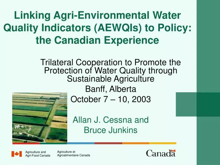
Linking Agri-Environmental Water Quality Indicators (AEWQIs) to Policy: the Canadian Experience. Trilateral Cooperation to Promote the Protection of Water Quality through Sustainable Agriculture Banff, Alberta October 7 – 10, 2003 Allan J. Cessna and Bruce Junkins. Agriculture et.

E N D
Linking Agri-Environmental Water Quality Indicators (AEWQIs) to Policy: the Canadian Experience Trilateral Cooperation to Promote the Protection of Water Quality through Sustainable Agriculture Banff, Alberta October 7 – 10, 2003 Allan J. Cessna and Bruce Junkins Agriculture et Agriculture and Agroalimentaire Canada Agri-Food Canada
Why Risk Indicators? • Monitoring for a range of contaminants (especially pesticides) for the whole country is very expensive • Wanted contaminant information that was specific to agriculture
Why Risk Indicators? (continued) • Can link agri-environmental indicators to economic models which allows us to build scenarios on policy and economic outcomes • Forward looking - Can assess impacts of policies before they are put in place • Often there is a lag of several years between when a policy is implemented and the effects of the policy can be measured
Why Risk Indicators? (continued) • Can investigate adoption rates (eg., beneficial management practices) per dollars spent • Get more information than just a trend • Although monitoring information is not available on a national basis, monitoring information is available on regional basis to permit validation of the models
History of AEWQIs in Canada • In 1993, under the Agri-Environmental Indicator Project, work was initiated on 2 AEWQIs: risk of water contamination by N and by risk of water contamination P • In 2001, under the National Agri-Environmental Health Analysis and Reporting Program (NAHARP), work was continued on the N and P indicators, and development of a pesticides indicator and a pathogens indicator was initiated
Indicators of Risk of Water Contamination • The main data source for inputs to the indicators is the Census of Agriculture which covers all agricultural regions of Canada (Available at 5-yr intervals). • All four water quality indicators will be calculated at the Soil Landscapes of Canada polygon level (1: 1 000 000). Nationally, there are 3,267 agricultural polygons for which data are reported in the Census of Agriculture
Indicator of Risk of Water Contamination by Nitrogen(IROWC-N)
Input: Policy Scenarios Inputs:Agricultural Production System, Crop, Animal, Soil, Weather, N fertilizer Canadian Soil Information System (CanSIS) Canadian Regional Agricultural Model (CRAM) Canadian Agriculture Nitrogen Budget CANB Model Data handling tools Outputs: RSN IROWC-N Components Scaling Up Easy Grapher ArcView Maps Fig. 1. Data flow of integrated modelling
350074 Map 1. Residual Soil Nitrogen (RSN) at the SLC scale (2008 business as usual scenario)
Indicator of Risk of Water Contamination by Phosphorus(IROWC-P)
Some Characteristics of IROWC-P • IROWC-P was adapted and combined with aspects of IROWC-N and PI (Phosphorus Index) (Lemunyon and Gilbert, 1993). • The 3 principal components of IROWC-P are: • P transport, • P status • Annual P balance
Suggested Improvements of IROWC-P (2003-2008) • Because sufficient soil P status data are available only for the province of Quebec, IROWC-P has thus far been calculated only for Quebec. • The goal now is to improve the indicator by: • incorporating measured P sorption capacity values for all dominant soil series and extrapolated values for all sub-dominant soil series on a national basis • incorporating an hydrologic component
Indicators of Risk of Water Contamination by Pesticides(IROWC-Pest) and Pathogens (IROWC-Path)
Approaches to Developing IROWC-Pest and IROWC-Path • Initial emphasis will be to develop indicators for surface water • Existing models, that estimate pesticide and pathogen movement in water and pesticide movement in air will be used where possible • The feasibility of using an hydrology component common not only to IROWC-Pest and IROWC-Path but also to IROWC-N and IROWC-P will be explored
Objective • Multidisciplinary approach to develop and apply integrated economic/environmental models to bring resource science to the policy table to analyze how: • Economic policies and market signals affect the environment • Environmental regulations and international agreements affect economic performance • New technologies impact both economic and environmental performance
Promote Sustainable and Profitable Resource Use • Nutrient Balance • carbon cycle • nitrogen cycle • Soil Quality • erosion • soil carbon • nitrogen • salinization • compaction • Air Quality • greenhouse gases • (CO2, N2O, CH4) • odours • particulates • Farm Resource • Management • land use • crops • livestock • Water Quality • nitrogen • phosphorous • pesticides • pathogens • Biodiversity • habitat use • species at risk Farm Environmental Planning: Managing land and water, nutrients, and pests
Policy Model – CRAM • Canadian Regional Agricultural Model (CRAM) • Economic model used as policy tool at AAFC for many years • Static, non-linear optimization model • Integrates all sectors of primary agriculture on regional basis • CRAM generates a significant amount of information • Land use change for major activities (cropland, hayland, tame pasture, native pasture) • Area of major crops (cereals, oilseeds, specialty crops) • Summerfallow and tillage practices (West) • Livestock numbers (beef, pork, dairy, poultry) • Economic impact on both producers and consumers Changing activity levels in CRAM in terms of land use, land use management and animal productionwill affect environmental outcomes
Integrated Economic/Environmental Analysis • Economic Parameters • Technology • Farm Management Practices • Physical Resource Base Policy Scenario • Scientific Knowledge • Environmental Data • F/P/T gov’t • Industry • Academics • Resource Allocations • cropping patterns • tillage practices • livestock numbers Policy (economic) Model Agri-EnvironmentalIndicator (AEI) Models feedback Policy Decision Economic Impacts EnvironmentalImpacts Other Economic/Environmental Considerations
Application: Agricultural Policy Framework (APF) - Provincial Environmental Targets • F/P/T commitment to set specific environmental outcome targets • Use existing economic and AEI models to quantify expected outcomes • Select and analyze potential farm actions for improving environmental performance • Provide scientifically based quantitative analysis to assist process of establishing provincial environmental targets under APF
Suite of AEIs for APF Analysis(Key Drivers) • Risk of soil erosion from water (crop, tillage,soil) • Risk of soil erosion from wind (Prairies) (crop, tillage, summerfallow, soil) • Residual soil nitrogen(crop, N fertilizer, manure) • Risk of water contamination from nitrogen (East)(residual N, precipitation, transpiration) • Soil Carbon (tillage, crop, soil) • Greenhouse gases (Sinks and emission reductions) (CO2, CH4, N2O) • Biodiversity in terms of wildlife habitat (land use)
Scenarios Selected for APF Analysis(BMPs – Beneficial Management Practices) • Soil Management • Increased use of conservation tillage (no-till) • Decreased use of summerfallow • Increased use of forage in rotations • Conversion of marginal land to permanent cover • Pasture Management • Increased use of complimentary and rotational grazing • Nutrient Management • Better management of matching N applied to crop requirements • Livestock Management • Improve management of protein in diets • Shelterbelts and Plantation Forestry • Increased use of forestry on marginal agricultural land
National Summary of the Percentage Change in AEIs from 2008 BAU for Low, Medium and High Adoption Rates Results of APF Analysis
Future Directions : Model Development • Enhancements to CRAM • Add water component • Update data and structure for livestock and crops • Improve regional coverage (Ontario, Quebec, B.C.) • Improve cost structure • Address data gaps • Data Warehouse • Farm Environmental Management Survey • Linkages to AEI models • Refinement of existing AEIs • Need for additional AEIs • AEIs must be responsive to BMPs • Feedback linkages between economic and environmental components
LUAM Future Directions : Spatial Issues CRAM crop production regions Land Use Allocation Model
Future Directions : Policy Analysis • Climate Change • Domestic Emissions Trading/Offset system • Mitigation • Impacts and adaptation • Environmental Co-benefits • Environmental Assessments • World Trade Organization negotiations • Agriculture programs and policies • APF environmental outcome targets • Medium Term Policy Baseline
National Agri-Environmental Health Analysis and Reporting Program (NAHARP) - Linking Science to Policy - Economics and Markets Policy Scenario AEIs Science Integrated Models Economic Outcomes Environmental Outcomes (air, soil, water, biodiversity) Trade-Off Analysis Economic Valuation Input to Policy Evaluation and Development Process