Download
1 / 16
170 likes | 450 Views
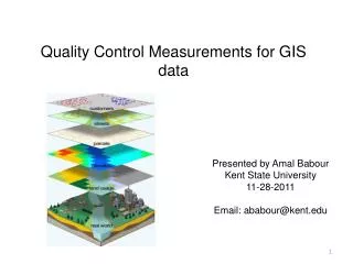
Quality Control Measurements for GIS data. Presented by Amal Babour Kent State University 11-28-2011 Email: ababour@kent.edu. Outline. Introduction What is GIS? GIS components Problem statement Complexity in GIS data creation GIS quality standardization W hat is quality ?

E N D
Quality Control Measurements for GIS data Presented by AmalBabour Kent State University 11-28-2011 Email: ababour@kent.edu
Outline • Introduction • What is GIS? • GIS components • Problem statement • Complexity in GIS data creation • GIS quality standardization • What is quality? • Quality parameters • Metadata • Conclusion • References http://www.grafenwoehr.army.mil/usag_dpw/master_planning/mp_installationmaps.asp
Outline • Introduction • What is GIS? • GIS components • Problem statement • Complexity in GIS data creation • GIS quality standardization • What is quality? • Quality parameters • Metadata • Conclusion • References http://www.grafenwoehr.army.mil/usag_dpw/master_planning/mp_installationmaps.asp
Introduction • A Geographic Information System (GIS) is a system for capturing, storing, querying, analyzing, managing data and associated attributes which are spatially referenced to the earth. • GIS components: http://gislinkup.com/GeneralInfo/WhatisGIS.html
Outline • Introduction • What is GIS? • GIS components • Problem statement • Complexity in GIS data creation • GIS quality standardization • What is quality? • Quality parameters • Metadata • Conclusion • References http://www.grafenwoehr.army.mil/usag_dpw/master_planning/mp_installationmaps.asp
Problem statement • GIS data have different origins: • Undetermined the global accuracy • Different users expect the data provided to them fits for their purpose : • Wrong results • Lose time and money
Outline • Introduction • What is GIS? • GIS components • Problem statement • Complexity in GIS data creation • GIS quality standardization • What is quality? • Quality parameters • Metadata • Conclusion • References http://www.grafenwoehr.army.mil/usag_dpw/master_planning/mp_installationmaps.asp
Complexity in GIS data creation • The main requirement for the data source is the locations of the variables • Necessity of Analysis • Cost • Accuracy • Scalability Issues • Standards/Formats http://www.epa.gov/region5fields/htm/methods/gis/
Outline • Introduction • What is GIS? • GIS components • Problem statement • Complexity in GIS data creation • GIS quality standardization • What is quality? • Quality parameters • Metadata • Conclusion • References http://www.grafenwoehr.army.mil/usag_dpw/master_planning/mp_installationmaps.asp
GIS quality standardization 4 1 2 3 5 1- http://www.continuityforum.org/content/news/161445/iso-22301-business-continuity-standard-moves-forward 2- http://www.directionsmag.com/companies/open-geospatial-consortium-ogc/93568 3- http://its-standards.info/ 4- http://www.cgdi.us/ 5- http://mcmcweb.er.usgs.gov/sdts/
GIS quality standardization (Cont.) • Quality isthe totality of characteristics of an entity that bears its ability to satisfy stated and implied needs ‘1’. • Term “fit for use” • Quality Parameters: • Accuracy: • Positional accuracy Distance Error = • Thematic accuracy • Temporal accuracy 2 1- (ISO 8402, 1994). 2- http://www.nanophase.com/quality/qualitysystems.aspx
GIS quality standardization (Cont.) • Quality Parameters (Cont.): • Resolution • Consistency • Completeness • Metadata: is a text document that describes who, what, when, where, why and how questions about the data.
Outline • Introduction • What is GIS? • GIS components • Problem statement • Complexity in GIS data creation • GIS quality standardization • What is quality? • Quality parameters • Metadata • Conclusion • References http://www.grafenwoehr.army.mil/usag_dpw/master_planning/mp_installationmaps.asp
Conclusion • Data creators should have documented rules and guidelines when creating and updating data layers to eliminate any future questions about the data. • Quality evaluation needs to include users applications. • The use of quality parameters is theatrical until now.
Outline • Introduction • What is GIS? • GIS components • Problem statement • Complexity in GIS data creation • GIS quality standardization • What is quality? • Quality parameters • Metadata • Conclusion • References http://www.grafenwoehr.army.mil/usag_dpw/master_planning/mp_installationmaps.asp
References [1] Caprioli, M., Scognamiglio, A., Strisciuglio, G. and Tarantino, E. RULES AND STANDARDS FOR SPATIAL DATA QUALITY IN GIS ENVIRONMENTS . In Proceedings of the 21st International Cartographic Conference (ICC) (Durban, South Africa, 10 . 16 August 2003) [2] Bernard Kumi-Boateng, IssakaYakubu. Assessing the Quality of Spatial Data. European Journal of Scientific Research. ISSN 1450-216X Vol.43 No.4 (2010), pp.507-515 Thank you