Download
1 / 23
230 likes | 260 Views
Explore Colombia's rich biological and cultural diversity through its 49 natural areas, including National Parks. Learn about the country's history and unique ecosystems.

E N D
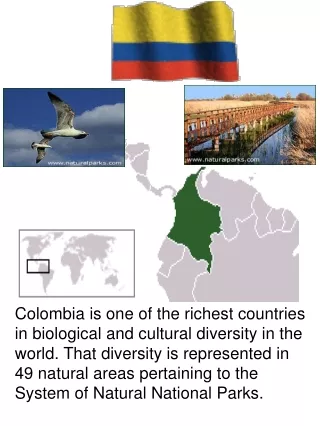
Colombia is one of the richest countries in biological and cultural diversity in the world. That diversity is represented in 49 natural areas pertaining to the System of Natural National Parks.
Colombia is one of the richest countries in biological and cultural diversity in the world. That diversity is represented in 49 natural areas pertaining to the System of Natural National Parks. Origin and history of the name Colombia's name references the explorer Christopher Columbus. The name was conceived by the revolutionary Francisco de Miranda as a reference to the New World, especially to all American territories and colonies under Spanish and Portuguese rule. The name originally belonged to a short-lived republic consisting of present-day Colombia, Venezuela, Ecuador, and Panama. This republic collapsed in 1830 when Venezuela and Ecuador separated, and the Cundinamarca region which remained became a new country, the Republic of New Granada. In 1863 New Granada changed its name officially to United States of Colombia, and in 1886 adopted its present day name: Republic of Colombia.
Colombia is one of the richest countries in biological and cultural diversity in the world. That diversity is represented in 49 natural areas pertaining to the System of Natural National Parks. 1.SANCTUARY OF FAUNA AND FLORA OTÚN QUIMBAYA2.SANCTUARY OF FAUNA AND FLORA GALERAS3.SANCTUARY OF FAUNA AND FLORA ISLA COROTA4.SANCTUARY OF FLAMENCO FAUNA AND FLORA5.SANCTUARY OF FAUNA AND FLORA IGUAQUE6.NATIONAL PARK NATURAL TAYRONA7.NATURAL NATIONAL PARK CHORALES OF THE ROSARY AND SAN BERNARDO8.NATIONAL PARK NATURAL GORGONA9.NATURAL NATIONAL PARK SNOWED10.NATIONAL PARK NATURAL AMACAYACU11.NATIONAL PARK NATURAL OLD PROVIDENCE MC BEAN LAGOON 4 6 11 7 9 1 5 8 2 3 10
Colombia is one of the richest countries in biological and cultural diversity in the world. That diversity is represented in 49 natural areas pertaining to the System of Natural National Parks. 1. SANCTUARY OF FAUNA AND FLORA OTÚN QUIMBAYA2.SANCTUARY OF FAUNA AND FLORA GALERAS3. SANCTUARY OF FAUNA AND FLORA ISLA COROTA4. SANCTUARY OF FLAMENCO FAUNA AND FLORA5. SANCTUARY OF FAUNA AND FLORA IGUAQUE6. NATIONAL PARK NATURAL TAYRONA7. NATURAL NATIONAL PARK CHORALES OF THE ROSARY AND SAN BERNARDO8. NATIONAL PARK NATURAL GORGONA9. NATURAL NATIONAL PARK SNOWED10. NATIONAL PARK NATURAL AMACAYACU11. NATIONAL PARK NATURAL OLD PROVIDENCE MC BEAN LAGOON Colombia es uno de los países más ricos en diversidad biológica y cultural en el mundo. Esa diversidad está representada en 49 áreas naturales pertenecientes al Sistema de Parques Nacionales Naturales. 1. SANTUARIO DE FAUNA Y FLORA OTÚN QUIMBAYA2. SANTUARIO DE FAUNA Y FLORA GALERAS3. SANTUARIO DE FAUNA Y FLORA ISLA LA COROTA4. SANTUARIO DE FAUNA Y FLORA FLAMENCOS5. SANTUARIO DE FAUNA Y FLORA IGUAQUE6. PARQUE NACIONAL NATURAL TAYRONA7. PARQUE NACIONAL NATURAL CORALES DEL ROSARIO Y SAN BERNARDO8. PARQUE NACIONAL NATURAL GORGONA9. PARQUE NACIONAL NATURAL NEVADOS10. PARQUE NACIONAL NATURAL AMACAYACU11. PARQUE NACIONAL NATURAL OLD PROVIDENCE MC BEAN LAGOON
1 1 1. SANCTUARY OF FAUNA AND FLORA OTÚN QUIMBAYA2.SANCTUARY OF FAUNA AND FLORA GALERAS3. SANCTUARY OF FAUNA AND FLORA ISLA COROTA4. SANCTUARY OF FLAMENCO FAUNA AND FLORA5. SANCTUARY OF FAUNA AND FLORA IGUAQUE6. NATIONAL PARK NATURAL TAYRONA7. NATURAL NATIONAL PARK CHORALES OF THE ROSARY AND SAN BERNARDO8. NATIONAL PARK NATURAL GORGONA9. NATURAL NATIONAL PARK SNOWED10. NATIONAL PARK NATURAL AMACAYACU11. NATIONAL PARK NATURAL OLD PROVIDENCE MC BEAN LAGOON 2 2 3 3
4 4 1. SANCTUARY OF FAUNA AND FLORA OTÚN QUIMBAYA2.SANCTUARY OF FAUNA AND FLORA GALERAS3. SANCTUARY OF FAUNA AND FLORA ISLA COROTA4. SANCTUARY OF FLAMENCO FAUNA AND FLORA5. SANCTUARY OF FAUNA AND FLORA IGUAQUE6. NATIONAL PARK NATURAL TAYRONA7. NATURAL NATIONAL PARK CHORALES OF THE ROSARY AND SAN BERNARDO8. NATIONAL PARK NATURAL GORGONA9. NATURAL NATIONAL PARK SNOWED10. NATIONAL PARK NATURAL AMACAYACU11. NATIONAL PARK NATURAL OLD PROVIDENCE MC BEAN LAGOON 5 5 6 6
7 7 1. SANCTUARY OF FAUNA AND FLORA OTÚN QUIMBAYA2.SANCTUARY OF FAUNA AND FLORA GALERAS3. SANCTUARY OF FAUNA AND FLORA ISLA COROTA4. SANCTUARY OF FLAMENCO FAUNA AND FLORA5. SANCTUARY OF FAUNA AND FLORA IGUAQUE6. NATIONAL PARK NATURAL TAYRONA7. NATURAL NATIONAL PARK CHORALES OF THE ROSARY AND SAN BERNARDO8. NATIONAL PARK NATURAL GORGONA9. NATURAL NATIONAL PARK SNOWED10. NATIONAL PARK NATURAL AMACAYACU11. NATIONAL PARK NATURAL OLD PROVIDENCE MC BEAN LAGOON 8 8 9 9
10 10 1. SANCTUARY OF FAUNA AND FLORA OTÚN QUIMBAYA2.SANCTUARY OF FAUNA AND FLORA GALERAS3. SANCTUARY OF FAUNA AND FLORA ISLA COROTA4. SANCTUARY OF FLAMENCO FAUNA AND FLORA5. SANCTUARY OF FAUNA AND FLORA IGUAQUE6. NATIONAL PARK NATURAL TAYRONA7. NATURAL NATIONAL PARK CHORALES OF THE ROSARY AND SAN BERNARDO8. NATIONAL PARK NATURAL GORGONA9.NATURAL NATIONAL PARK SNOWED10. NATIONAL PARK NATURAL AMACAYACU11. NATIONAL PARK NATURAL OLD PROVIDENCE MC BEAN LAGOON 11 11
SANCTUARY OF FAUNA AND FLORA OTÚN QUIMBAYA Otún Quimbaya and all the region of the Ucumarí, that extends until the Natural National Park the Snowed ones, are great spaces of Andean forests of a high biological diversity located in the heart of the zone coffee in the central mountain range. Herds of monkeys howling, whose shouts resound between valleys in the dawns and the afternoons when the sun falls, are attractive a beautiful one in this zone. There it inhabits also the bear of eyeglasses, the overwhelming moose of desert, eagles, deer and birds in amounts and colors. In fact, one of the activities more practiced by the ecoturistas is the sighting of birds.From Pereira, the beautiful Per it of the Otún, course to the east bordering the mighty Otún river, 14 km separate the path the Switzerland of the capital of Risaralda. Between Pereira and Switzerland is the group of judges of Florida, a typical town to where arrives and leaves the colorful crowded Kids with farmers and tourists. The highway without the lid and in good state depending on the time of the year, takes until the Center of Visitors of the Sanctuary of Fauna and Flora Otún Quimbaya; a small space of fog inserted forest of 489 hectares in the Regional base Ucumarí. The Sanctuary is a beautiful humid climate place tropical cold, with warm days and adjusted nights.LOCATION: Located in the department of Risaralda, distant 14 km. of the urban helmet of the municipality of Pereira, Path Switzerland, in the western zone of the Central Mountain range.EXTENSION: 489 hectaresHEIGHT: Included/understood between the 1800 and the 2400 meters on the level of the sea.CLIMATE: Cold tropical mountainTEMPERATURE: 16°C in averageINTEREST SITES: Otún river, Barbo River, Pisícola Station. The area counts on a station of investigation and with varied scientific information available.ACTIVITIES: Routes by the footpaths and factories of environmental education.
SANCTUARY OF FAUNA AND FLORA GALERAS Having the charge of to the city of Grass Galeras volcano it gives to his name to the Sanctuary of Fauna and Flora him whom its imposing nature surrounds. Cloudy forests and deserts surround to the Galeras giant in the whose environs sites of enormous beauty like the lagoon of Telpis, Yacuanquer can be visited, Mejía, Coba green Negra and, the Tunal Cascade (Consacá), Black Spout (Florida), Thermal Waters (Consacá) Natural Tubes, also when crossing to encircle it of the Galeras can be found beautiful straw crafts done toquilla. The Sanctuary of Fauna and Flora Galeras is one makes of water that supplies to the neighboring populations and is habitat of great variety of species of flora and fauna. This protected area can be visited at any time of the year, previous contact and request of support of the guides and civil employees of the area protected in the offices of the Territorial Direction or in the city of Grass, where indications precise will occur of how to visit it.The sanctuary conforms the volcanic complex Galeras, with vegetation of altoandino forest frequently uncultivated storm cloud, desert, subdesert, superdesert and earth. In addition it counts on but of 120 rivers and 4 lagoons (Black, Telpis, Mejía and Verde) and innumerable lagunillas and beautiful cascades.Also it counts on a great potential of birds with but of 100 registered species, stand out 16 species of colibríes.LOCATION: In the Municipality of Grass,EXTENSION: 7,615 HectaresHEIGHT: 4700 msnmTEMPERATURE: from 3 to 15 C° INTEREST SITES:Black lagoon, Lagoon of Mejía, Lagoon of Telpis, Green Lagoon, Mouths of Galeras volcano
SANCTUARY OF FAUNA AND FLORA ISLA COROTA This town is the access door to the Lagoon of the Cocha, one of water the greater bodies of the andes. In Encano there is a very colorful wharf surrounded by restaurants whose specialty is the preparation of trout rainbow.Around the Cocha their settlers have understood the importance of conserving their natural resources. For that reason, at the present time 32 natural reserves farmers of the civil society who conserve important zones of forest, desert and sources of water. From Encano a boat is taken that takes to the visitor to the Sanctuary of Flora Isla Corota, a small paradise of cloudy forest that in millenarian times was site of adoration of the Quillacinga natives and today species of flora and fauna of great importance are conserved.Corota counts on a footpath of 500 mts of length that crosses the island of side to side between the dense forest. Under a symmetrical vault of trees like a puzzle, the visitor is with plants like motilón sweet, encinos, majua, arrayán, anturios, boulder, the paloerosa, sietecueros, motilones wild, red, whose fruits are used to dye fabrics, orquídeas and ferns that complete a beautiful natural picture.LOCATION: Lagoon of the Cocha, Dpto de NariñoEXTENSION: 8 hectaresCLIMATE: Cold
SANCTUARY OF FLAMENCO FAUNA AND FLORA Apparently this territory was inhabited before the conquest by Guanebucanes, of the linguistic family Arawak. Town agriculturist, fisherman and navigator who constructed his towns near the sea and of the borders of the great rivers. BEGINNING There are four separated coastal bogs of the sea by bars, that make the life possible of the flamenco ones, the beautiful birds of pink plumage which they give name him to the Sanctuary, these bogs are Bog of Manzanillo, Great Lagoon, Bog of the Broken Ship and the Bog of Tocoromanes.Flamenco and the their spectacular nests constructed in mud, that reach heights to of 60 cm, are attractive the fundamental one. Its mating happens in March and the empollamiento, according to the fishermen of the region, in April and May.LOCATION: Located in the department of the Guajira, municipality of Riohacha.EXTENSIÒN: 7,000 hectaresCLIMATE: 27°C in average, relative humidity of 80% HEIGHT: 0 msnm, plain of 5 msnm.ACTIVITIES: Between the activities that can be made within this area are the observation of harvesting of mariana salt in artisan form, it visits the path of Perico and the community of artisan fishermen of Caricari. In Shrimps the House of the Culture can be visited. CHARACTERISTICS OF ROUTES AND ECOSYSTEM: At times of winter March - June September - November with the full Lagoon it is possible to count on the visit of flamenco the pink ones, that arrive in search of food. In summer June - August and December - February the time of harvesting of callirra begins (fished dry). Throughout the year is counted on presence of pelicans, gulls, herons and without number of migratory birds. By its geographic location the center of visitors “the Mangles” is a perfect place for the sighting and study of the stellar universe, mainly the full moon-lits night.
SANCTUARY OF FAUNA AND FLORA IGUAQUE Iguaque is a small space of desert and inserted Andean forest in the development in one of the taken part zones more of the Eastern mountain range. It crosses a stretch of 8 km and covers the municipalities with Tunja, Villa de Leyva and Arcabuco in the department of Boyacá. In its forests the water is born that supplies great part of these municipalities. In the Sanctuary is the sagrada lagoon of Iguaque, which, according to the muisca legend is the cradle of the humanity. From Bachúe, the mother of the Muiscas men emerged there. To peregrinate to this sagrada lagoon cleans the soul and purifies the spirit.The Sanctuary has an extension of 6,750 hectares and includes/understands elevations that go from the 2,400 the 3,800 meters to msnm. Its wealth is represented in the flora and the abundant water obstacles that spurt the aqueducts of neighboring populations like Sáchica, San Pedro de Iguaque, Santa Sofía, Gachantivá and Arcabuco.El elevated branch more are the Black Nose that is descried from Villa de Leyva and happens of 3,400 meters; most western it is the Esterillal hill, that exceeds the 3,000 meters. CLIMATE: Cold.TEMPERATURE: 4 to 12 degrees Celsius.INTEREST SITES:Sector of San Pedro de Iguaque, sector of Mother Branches, archaeological zone and cave paintings. The lagoon of Iguaque to three hours on foot. Sector of the Robledales, with the oak forests. Eight lagoons between which Empedrada Mount, Red, Water Reedbed, Cazadero and eye stand out.
NATIONAL PARK NATURAL TAYRONA The spurs of the Sierra Nevada of Santa Marta submerge in the sea in the Tayrona Park, forming a “giant hand”, between whose fingers are the coves of Shell, Chengue, Gairaca, Neguange, Cinto, Guachaquita and Palmarito. Tayrona is one of those tropical paradises idealizados by Literature and the cinema. Their white beaches on which its exuberance spills the humid forest all do more of Tayrona one of the visited natural parks in Colombia.By beaches, the visitor goes into in a complex system of spotted ways that communicated all a network of indigenous establishments, of the coast with the Sierra Nevada. Chairama, (present “Pueblito”), constituted one of the most important nuclei of craftsmen, fishermen and agriculturists, who interchanged their products by services civic public.In Cane plantation, the lodging in cabins (ecohabs) conserves characteristics of the Tayrona architecture, with capacity for four and six people. In Reefs also zones exist to encamp with fitted for 76 carps c/u, properly adapted.LOCATION: Located in the Caribbean coast to 34 km of Santa Marta via Riohacha, department of the Magdalena.EXTENSION: 15,000 Hectares of which 12,000 are terrestrial and 3,000 are marine.HEIGHT: Of 0 to 900 meters on the level of the sea. CLIMATE: Tempering - WarmTEMPERATURE: Of 25°C to 30° C.ROUTES: Neguanje, where it is arrived by the route at Palangana, that also leads to Gayraca and Coralline Playa. By Cane plantation it is possible to be walked until beautiful Reef beaches and the Cabo. Long walk to Pueblito to know the city Tayrona Chayrama. Also to Naranjos leaving Cane plantation, through interpretativos and natural footpaths with ample vegetation. Bay Shell.INTEREST SITES: Cane plantation (zone of camping and Ecohabs),Neguange, Reefs, Pretty Beach and the Swimming pool (Calm Beaches).The Naranjos: footpaths with abundant vegetation and variety of fauna. Opening from the Piedras River to the sea.Beach of the Dead. Coralline beach.Pretty Fat person, Bay Shell, Cove of Chengue, Cove of Gayraca, Cinto, Guachaquita. The swimmers must have precaution in beaches where there are strong currents.
NATURAL NATIONAL PARK CHORALES OF THE ROSARY AND SAN BERNARDO The marine park Choral of the Rosary and San Bernardo is located in the Colombian Caribbean Sea, 45 kilometers to the southwest of the bay of Cartagena. It has an extension of 19,506 hectares. The history of this coralline zone is bound to the one of the near islands and the one of the bay of Cartagena. According to chronicles of the conquerors, all the islands of the Caribbean were inhabited by natives of the Karib family, but they evacuated them because they constituted easy prey for the conquerors. Later they were occupied by wild and enslaved fugitive in century XIX. From the decade of the 50 the urban colonization began that intensified in years 60 and 70.Ecoturística supply:The park counts on an important natural supply that it can be observed in the routes White Beach, Bog of Cholón, Island of the Birds, the Small barren island, lagoons of Tintipan, island Wonder, Aquarius of the Island of San Martin de Pajarales, lagoon of the Mohán. Reefs Coralinos and Manglares. Closely together also are Chorales of the Rosary, Cartagena, Barú, San Bernardo, Tolú and Coveñas.LOCATION: To the southwest of the bay of Cartagena in the Caribbean Sea.EXTENSION: 17,800 hectares.HEIGHT: Marine park (Submarine).CLIMATE: Warm
NATIONAL PARK NATURAL GORGONA This Island is a paradise in the Colombian, total Pacific of tropical forest and reefs of chorale where, every year, the Yubartas whales come to give to light their whale calves. Gorgona, whose name him was given by conqueror Francisco Pizarro, because it remembered the Greek goddesses to him of the terror that instead of hair combed serpents, was declared Natural National Park in 1984, after a dark time at which it was used like prison. Next to her, the small island of Gorgonilla and three Small barren islands recreate the perfect scene of the terrenal paradise.1500 years before Christ, the island was inhabited by human groups that left to tracks of their stone establishment and archaeological material. In ours it was, the discovery of the island made Diego de Almagro. 85% of the island are covered by one thick humid, rich forest in young trees, ferns, fungi and hojarasca in decomposition. It is inhabited by Micos carablanca, sluggish bears of three fingers, the blue lizard, the semithorny rat, several species of ofidios and birds like the bird anthill and the blue mielero, among others. Gorgona mainly presents/displays a highest biological value like an important point for the dispersion of marine species crustaceans and moluscos; in addition to the mating and birth of jorobadas whales or yubartas between September and December.The characteristics of the island, turn it a great fresh water producer, this aid to that it is considered like one of the areas insulares of greater wealth in this aspect in the world. The sites of interest to visit in Gorgona are Beach Palms to 1 hour and 45 minutes of the center of visitors, the footpaths the Chonta, Old Penitentiary, Payán House, Yundigua, Ecotienda. Gorgona is one of the most spectacular places of our geography for the practice of the diving. The Station of diving of the Island offers qualification and equipment for this sport. The most beautiful sites to visit are the Furnace, the Backwater, the Tiburonera, the Bullring and the Montañitas, among others. AREA: Its total extension reaches the 61.687.5 has, of which 1,600 correspond to the terrestrial area. Great part of this zone is of mountainous formation, with a peak altitude of 340 m.s.n.m. LOCATION: To the west of the coast of the Department of the Cauca in the Pacific Ocean, approx to 56 km of the Coast.NEAR POPULATIONS: Guapi, the Watch, Mulatos, Good luck.TEMPERATURE AVERAGE: 27 Degrees Celsius.RAINY MAS MONTHS: September and OctoberLESS RAINY MONTHS: February and March, no time is considered dry.
NATURAL NATIONAL PARK SNOWED In the Central Mountain range, towards the south of the department of Antioch, it is the region that was “Old Calda”. Today it is divided in three departments: Calda, Risaralda and Quindío. “Zone of the Antiochian Colonization” is the call, developed mostly in century XIX, when whole families of Antioch, exasperated with the civil wars that knocked down their region, armed expeditions towards rustic lands to knock down mount and to found cities.In the heart of this zone it is the natural National Park the Snowed ones, a mountainous chain of Andean forests, deserts and perpetual snows in the central mountain range in the middle of one of the richest and productive zones of the country, the zone coffee.LOCATION: Located in jurisdiction of 4 departments in the municipalities of Villamaría (Depto. of Calda), Pereira, Santa Rosa de Cabal (Depto. of Risaralda), Salento (Depto. of Quindío), Anzoátegui, Casabianca, beautiful Villa, Santa Isabel, Murillo and Ibagué (Depto. of Tolima).EXTENSIÒN: 58,300 Hectares HEIGHT: 2.600 to 5,300 meters on the level of the sea.CLIMATE: Cold, desert and perpetual snows BEGINNING TEMPERATURE: 3°C oscillates between 14°C andROUTES: Long walk by the area of the Snowed one of Ruiz, Lagoon of Otún and Brisas. It is possible to be practiced the montañismo, the fishing and to be made long walks by interpretativos footpaths accompanied.INTERÈS SITESMade snow-white of 5,300 Ruiz m.s.n.m., Made snow-white of Tolima 5,200 m.s.n.m., Made snow-white Santa Isabel 4,950 m.s.n.m., Made snow-white of Swan 4,800 m.s.n.m., Made snow-white of Quindío 4,800 m.s.n.m., Lagoon of Otún 3,900 m.s.n.m., Thermal of 3600 Ruiz m.s.n.m., Thermal of Rancho 2600 m.s.n.m., Cascade Gualí 4000 m.s.n.m.
NATIONAL PARK NATURAL AMACAYACU In the South end of the department of the Amazon, occupying great part of the amazonian trapeze, is the National Park Natural Amacayacu. The municipalities of Leticia and Puerto Nariño share the jurisdiction of the protected area, whose extension is of 293,500 hectares. The Word “Amacayacu” means River of Hamacas in language quechua, the word apparently was introduced to the region by the missionaries. At the region it is arrived via aerial until Leticia, thence takes a boat waters above from the Amazon river, by which after 60 kilometers of route, it takes to the broken Matamatá, first limit of the park. In February of 1542 the Spanish conqueror Francisco de Orellana left from the confluence of the rivers Aguarico and Curarary, in the hole of the Napo (Ecuador) until the mouth of the Amazon or river Sea, to which also Marañon called. In the territory of the Amazonian Trapeze they then inhabited indigenous groups of the Kahuapanas ethnic groups, Jeberos, Boras, Kotuenes, Jiduas, Muinanes, Mirañas, Andokes, Witotos, Omaguas, Yaguas, Cocamas, Otucunas and Ticunas. Today only they are left representatives of some of them. The Tikuna still remains in their ancestral territory. It has two types of reliefs: mainland wave, made up of noninundables zones that support to ground and vegetation, and inundables surfaces, that receive the influence of the crescents of the rivers. It has warm-humid climate, with a temperature average of 27 degrees Celsius. The park lodges the spectacular aquatic plant amazonian victory. In the margins of encharcados places they are characteristic the trees of capirón and munguaba. In mainland the forest has trees of 30 to 40 meters of height. Species like the red and white cedar, the mahogany, ceiba and uvo are of highest and impressive. Amacayacu has around 150 species of mammals between which the pink dolphin and some species in via of extinction like the moose, the jaguar, the manatí and the otter stand out. Between primates the Tití the Leoncito, smallest of the world stands out. They exist around 500 species of birds, of which of they emphasize guacamayas or papagayos. Within the reptiles jabuti is morrocoy, the greater fresh water turtle of the world and the black cayman. In serpents are boas, anacondas and chorales. The fish very constitute a diversified group, among them they are the pirarucú and pirañas.
NATURAL PARK NACIONAL OLD PROVIDENCE MC BEAN LAGOON Providence and Santa Catherine, two small 22 islands of Km2 of extension, located to the nororiente of the Island of San Andrés, are at the present time one of the tropical paradises of the Caribbean. The islands are an old volcano modeled by streams. They are covered by forests that, although taken part, constitute a conserved affluent zone, with the few that still are in the Caribbean. Its abundant vegetation is of Central American origin in the high parts and of the western Indians in the losses, also it counts on unique species of that place. There the showiest fauna is composed by small lizards and birds, do not exist poisonous reptiles, situation that east more attractive place to the tourism still does. The islands are step forced of near 56 species of migratory birds in the western Caribbean.The rich and complex culture of the islands reflects its biological diversity and its anxious history. The native population is racially mixed with predominance of the black race and promotes 5,000 people, some of them comings of the continent. Traditions of the Caribbean are conserved anglófono, puritano, with increasing influence of the continent. In Providence there is freedom of cults like in the rest of Colombia, nevertheless predominate the catholics, baptists and adventists. Traditional music and dances are of European ancestros with influence afrocaribe, now mixed with reggae, socca and the vallenato.The gastronomy is equal of diverse that the culture. The products of the sea have greatly have been represented in plates like rondón, minced fish, fish balls, crab soup, stew fish.In the islands English speech, Spanish and the island, Creole language of English base. Their traditional playful activities are the flat racing, tómbolas, carnivals and commemorative cultural festivales of the national and religious celebrations. The islanders are glad; puritanos and fiesteros; amiable and distant. But mainly good friends, generous and warm.The fishing is traditional activity; the islanders know and handle it well suitable techniques of extraction environmentally, adapted to the arecifal fragility [baskets, hook, diving to lung]. The main species that are captured are lobster, snail, pargos and mere and numerous arrecifales species. Also turtles and crabs.The National Park Natural Old Providence Mc Bean Lagoon occupies a surface of 995 hectares of which 905 are marine. It is located in the northeastern side of the Island of Providence.
NATURAL PARK NACIONAL OLD PROVIDENCE MC BEAN LAGOON CLIMATE: Its climate is warm with annual temperatures average of 25 Cs and the 1,500 precipitations near mm/año. The months of smaller precipitation January and June are concentrated between. GEOLOGY AND GEOMORFOLOGIA: The terrestrial area of the Park counts on an isolated hill of volcanic origin denominated Iron Wood Hill who rise from the level of the sea to the 150 m.s.n.m and one zone of flat relief with marshy zones that the area of manglar of Mc Bean includes/understands.The marine area is conformed by a little deep lagoon in where the Keys Crab and the Three Brothers are included, protected by an extensive arrecifal barrier. The Park is surrounded by a complex by manglares in the sector of McBean, the best ones conserved of the Island, predominate the Red Mangle (Rizophora mangle), mangle yellow (Avicennia germinans) and mangle white (racemosa Laguncularia).Manglares is trees of different species that have adapted to live in coastal zones with marine influence and play an important role as reproduction places and raises of numerous species of fish, crustaceans and moluscos.The vegetation in Iron Wood Hill this constituted by a dry forest with small trees where the Cock-spur predominates (Acacia collinsii), species with conical thorns in where the ant Pseudomyrmex Ferruginea, well-known resides by its aggressiveness and its painful puncture. Also pactá is the palm (Coccothrinax jamaicensis) endemic subspecies of the Island, resbalamono (bursera simaruba) and some cactaceous ones. The Keys of the Park have a special vegetation; in Key Crab, for example, the icaco scrubs predominate (icaco Chrysobalanus) and some palms of the Coco (the nucifera Coco), whereas in the keys of Three Brothers the Ficus predominates that serves as anidación place of Flow or Fragata (Fregata magnificens).In the lagoon there are extensive marine prairies of fanerogamas conformed mainly by the Thalasia grass testudinum, although in some places a good growth of filiform the Siringodium grass appears; in addition on the coastal rocky strip, in the coralline patches or the sand there is a good growth of marine seaweed, some of calcáreas them who contribute to the formation of the sand.This vegetation provides abundant I oxygenate, food, support and refuge to many species, specially in its larval and youthful stages.LOCATION: Dela is in the Northeastern end Island of Providence.EXTENSION: 995 hectares, of which 905 correspond to marine area.HEIGHT: From 0 to 150 mts on the level of the sea.TEMPERATURE: Average of 25ºC.INTEREST SITES: Key Crab, Three Hermanos and Manglar of Mc Bean.ACTIVITIES: Long walk by the footpath of manglar of Mc Bean, Diving to Lung or with tank in the arrecifal zone and around the keys.
Colombia is one of the richest countries in biological and cultural diversity in the world. That diversity is represented in 49 natural areas pertaining to the System of Natural National Parks. 1. SANCTUARY OF FAUNA AND FLORA OTÚN QUIMBAYA2.SANCTUARY OF FAUNA AND FLORA GALERAS3. SANCTUARY OF FAUNA AND FLORA ISLA COROTA4. SANCTUARY OF FLAMENCO FAUNA AND FLORA5. SANCTUARY OF FAUNA AND FLORA IGUAQUE6. NATIONAL PARK NATURAL TAYRONA7. NATURAL NATIONAL PARK CHORALES OF THE ROSARY AND SAN BERNARDO8. NATIONAL PARK NATURAL GORGONA9. NATURAL NATIONAL PARK SNOWED10. NATIONAL PARK NATURAL AMACAYACU11. NATIONAL PARK NATURAL OLD PROVIDENCE MC BEAN LAGOON Colombia es uno de los países más ricos en diversidad biológica y cultural en el mundo. Esa diversidad está representada en 49 áreas naturales pertenecientes al Sistema de Parques Nacionales Naturales. 1. SANTUARIO DE FAUNA Y FLORA OTÚN QUIMBAYA2. SANTUARIO DE FAUNA Y FLORA GALERAS3. SANTUARIO DE FAUNA Y FLORA ISLA LA COROTA4. SANTUARIO DE FAUNA Y FLORA FLAMENCOS5. SANTUARIO DE FAUNA Y FLORA IGUAQUE6. PARQUE NACIONAL NATURAL TAYRONA7. PARQUE NACIONAL NATURAL CORALES DEL ROSARIO Y SAN BERNARDO8. PARQUE NACIONAL NATURAL GORGONA9. PARQUE NACIONAL NATURAL NEVADOS10. PARQUE NACIONAL NATURAL AMACAYACU11. PARQUE NACIONAL NATURAL OLD PROVIDENCE MC BEAN LAGOON
12.- Colombian National coffee Park Colombian National Coffee Park is a Colombian theme park located at Montenegro, Colombia. It features a telepheric, a colourful animatronic orchids ride, a World´s coffee garden, a roller coaster, coffee-based food stands, Colombian folkloric architecture, and other attractions. It make up part of the Colombian Coffee-Growers Axis