Download

1 / 32
320 likes | 492 Views
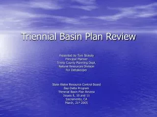
Triennial Basin Plan Review. Presented by Tom Stokely Principal Planner Trinity County Planning Dept. Natural Resources Division For Deltakeeper State Water Resource Control Board Bay-Delta Program Triennial Basin Plan Review Issues 8, 10 and 11 Sacramento, CA March, 21 st 2005.

E N D
Triennial Basin Plan Review Presented by Tom Stokely Principal Planner Trinity County Planning Dept. Natural Resources Division For Deltakeeper State Water Resource Control Board Bay-Delta Program Triennial Basin Plan Review Issues 8, 10 and 11 Sacramento, CA March, 21st 2005
1953: Westlands Water District joins the effort to promote legislation to dam the Trinity River through participation in the California Committee for Trinity River Development; Westlands Manager Jack W. Rodner appointed Executive Director
The 1955 House and Senate Committee Reports on the 1955 Act clearly stated that the destination of some of the Trinity’s water would be the San Luis Unit of the CVP.
Trinity River Water via San Luis Unit to the San Joaquin River & Bay-Delta • Water travels down the Sacramento River, through the Bay-Delta, and down the Delta-Mendota & San Luis Canal to San Luis Unit • Area drainage water flows into the San Joaquin via the San Luis Drain, groundwater accretions & sloughs • The San Joaquin empties into the Bay-Delta carrying agricultural wastes such as pesticides, herbicides, salts, and substances of particular concern such as selenium
Drainage a Requirement of the SLU Act Before Water Can Be Delivered 1960:The San Luis Act is signed into law, authorizing Reclamation to sell water to Districts within the San Luis Unit of the CVP contingent upon the following: The Secretary of the Interior “has received satisfactory assurance from the State of California that it will make provision for a master drainage outlet and disposal channel for the San Joaquin Valley . . . which will adequately serve . . . the drainage system for the San Luis Unit or has made provision for constructing the San Luis interceptor drain to the delta designed to meet the drainage requirements of the San Luis Unit. . .” The San Luis Drain was never completed and was terminated at the Kesterson Wildlife Refuge
CADILLAC DESERT- WATER AND THE TRANSFORMATION OF NATURE, Program 3- THE MERCY OF NATURE” 1997, KTEH-TV Foundation “We went ahead with the Westlands project before we solved the drainage problem. We thought we knew how to solve the drainage problem. We thought the Kesterson Reservoir could be flushed on out into the Delta. We didn’t have it solidified. So I made a terrible mistake by going ahead with Westlands at the time we did” Floyd Dominy- Commissioner of Reclamation, 1959-69 (on delivering water to Westlands where drainage and selenium contamination problems persist today)
Corcoran Clay Barrier Drainage is needed due to the impervious Corcoran Clay Barrier which separates the confined and unconfined aquifers and ponds tailwater within the unconfined portion.
Creation of Drainage Water An illustration of how water that drains from irrigated fields is collected and removed to maintain long-term, sustainable salt and water balance in the root zone of irrigated lands. The San Luis Drain at Kesterson
SWRCB D-1641 • ”The subsurface drainage problem is region-wide. The total acreage of lands impacted by rising water tables and increasing salinity is approximately 1 million acres. (SWRCB 147, p.21.) The drainage problem may not be caused entirely by the farmer from whose lands the drainage water is discharges. In the western San Joaquin Valley, the salts originate from the application of irrigation water and from soil minerals, which dissolve as water flows through the soil. The salts are stored in groundwater. As more water is applied, hydraulic pressures increase, water moves downgradient, and salt-laden waters are discharged through existing drainage systems and directly to the river as groundwater accretion (SJREC 5a). Drainage found in a farmer’s field may originate upslope and may not have risen into the tile drains on the downslope farmer’s land, but for the pressures caused by upslope irrigation. (SJREC 5a, pp.27-29.)” Page 82 • “The SWRCB finds that the actions of the CVP are the principal cause of the salinity concentrations exceeding the objectives at Vernalis. The salinity problem at Vernalis is the result of saline discharges to the river, principally from irrigated agriculture, combined with low flows in the river from upstream water development. ” Page 83
SWRCB D-1641(p. 83 cont.) • “The source of much of the saline discharge to the San Joaquin River is from lands on the west side of the San Joaquin Valley which are irrigated with water provided from the Delta by the CVP, primarily through the Delta-Mendota Canal and the San Luis Unit.” • “The USBR, through its activities associated with the in the San Joaquin River Basin, is responsible for significant deterioration of water quality in the Southern Delta.”
Environmental Consequences of San Luis Unit Irrigation • Bay-Delta Ecosystem damaged by increased Delta exports from Trinity • Drainage Problem area in 1990 was 450,000 acres. If no resolution, problem area will be 950,000 acres in 2040 (Rainbow Report) • If no more irrigation of the western San Joaquin Valley were to occur and the San Luis Drain were completed, it would still take 63-300 years to drain the accumulated Se from the aquifer at a rate of 43,500 lbs./year. (USGS Open File Report 00-416) • Completion of the San Luis Drain will severely contaminate the Bay-Delta with Se, which bioaccumalates (USGS Open File Report 00-416)
Selenium Poisoning in Splittail in Bay-Delta due to Westside Agricultural Runoff Scoliosis (lateral curvature of the spine) in a juvenile splittail
The San Joaquin as It Once Was The San Joaquin Valley supported a productive fishery of both resident and anadromous species. Fish that were abundant in both the San Joaquin and Tulare Basins included Sacramento and tule perch, Sacramento sucker, thick-tailed chub, Sacramento squawfish, hardhead, Sacramento blackfish, hitch, and Sacramento splittail. Resident rainbow trout as well as anadromous white sturgeon, steelhead, and chinook salmon were found as far south as the Kings River and Tulare Lake. The native fishery of the San Joaquin Valley has been severely affected by changes in hydrology associated with irrigation and flood control, and the introduction of non-native fish species to local waters. The construction and operation of Friant Dam has eliminated the use of the upper San Joaquin River by anadromous fish. Construction of the dam, and subsequent filling of Millerton Lake, destroyed spawning habitat and restricted access to otherwise-suitable habitat upstream; operation of the dam led to inadequate streamflow in the upper San Joaquin River for migrating fish. By 1950, less than 5 years after completion of the dam, spring-run chinook salmon were considered extinct in the San Joaquin River by the California Department of Fish and Game. Today, salmon are found in the San Joaquin River only downstream of its confluence with the Merced River. Similarly, splittail were once found as far upstream as Friant, but are now restricted to the reaches of the river adjoining the Delta.
The San Joaquin River Today Highway 41 Bridge Near Fresno: Below the Friant Dam, the river is normally dry and in a perpetual state of drought. Once abundant runs of Chinook Salmon are now extinct. This picture represents how the river is typically in the Central Valley before agricultural tailwater is added which brings flows to the Bay Delta full of saline and other toxic materials, such as selenium. The River North of Fresno: Due to agricultural pressure, the river has become channelized, without any buffer zone, and lost the ability to move within it’s floodplain. This picture represents the point where agricultural tailwater is drained into it, and the vegetation only survives due to these highly polluted flows.
The San Joaquin River Today, Cont. MUDDY WATERS: Near Stockton, the river is nothing more than a canal, its banks cleared of natural habitat. Industries and cities pump treated waste into the river, which also collects farm drainage from upstream. WATER DIVERSIONS: Up to 95 percent of the San Joaquin River water captured each year by Friant Dam and stored at Millerton Lake is shipped down the Friant-Kern Canal, which runs 152 miles south to Bakersfield, and up the Madera Canal, which runs 36 miles north to Chowchilla. Farmers on the east side of the Valley use water directly from the canals. It's the only steady source for east-side farmers, who last year produced crops valued at $2.1 billion. REMNANT OF THE PAST: Water imported from Northern California has helped turn the Grassland Ecological Area north of Los Banos into a maze of slough and wetland pools. This is what much of the river looked like in winter and spring before engineering projects such as Friant Dam dried up thousands of acres of grasslands. This 160,000-acre wetlands area survived.
Proposed Drainage Options for SLDPFRE • Complete San Luis Drain to the Bay- Delta • Pipeline to Monterey Bay, a National Marine Sanctuary • Pipeline to Morro Bay, where a protected and ecologically important State Park is located • Deep Well Injection, into the confined aquifer most of the people in the Central Valley rely upon for freshwater • In Valley Disposal
LAND RETIREMENT?? • Both Westlands and Trinity County agree that land retirement is a viable option to solve drainage problems • Key issue is disposition of the water savings
“Groundwater monitoring data collected to date support the conceptual model of a declining, shallow water table in response to land retirement. The average decline in water level observed in 10 monitoring wells for the period between August 1999 and October 2001 was 4 feet. The area of the site underlain by a shallow water table within 7 feet of the land surface decreased from 600 acres (30% of the site) to 34 acres (less than 2% of the site) during the time period from October 1999 to October 2001.” pg. vii Figure 1. Drainage impacted lands in the San Joaquin Valley.
Trinity County’s Response to the CVP Contract Renewals by BOR • “We strongly recommend that a problem-drainage land retirement alternative be fully analyzed which considers reducing water contract amounts by the amount of land that requires or will require drainage service by 2050. By our estimates, such an alternative in the Westlands Water District alone would have reduced actual CVP water deliveries in 2002 by 383,172 AF, and long-term contractual commitments to Westlands by 569,455 AF. According to the Environmental Working Group, water and crop subsidies to Westlands in 2002 were in excess of $56 million.” • “The No Action Alternative should be the CVPIA Programmatic EIS No Action Alternative, not the CVPIA Programmatic EIS Preferred Action Alternative. The impacts of this project cannot be disclosed under the alternatives being considered because no difference exists between the No Action and Proposed Action alternatives.” • “There was no discussion of past and current problems such as the Kesterson Wildlife Refuge disaster, long term alternatives to the Grasslands Bypass project, surface and groundwater leaching into the San Joaquin River which is already impaired. The San Joaquin River is in regular violation of water quality standards, and is classified an Impaired Water Body for salt, selenium and other pollutants under the Clean Water Act §303(d).” • “The document does not disclose biological impacts to a variety of species that inhabit the project area, as well as downslope and downstream areas within the San Joaquin River and Delta. Recent studies have shown that there are continued and increasing impacts to Delta Sturgeon and Smelt and other listed and non-listed species from selenium bioaccumulation as a result of irrigating lands in the SLU and DMC of the CVP. “
Table 1 from the Draft Trinity River Fishery Restoration Supplemental Environmental Impact Report (Trinity County 2004, as amended 1/24/05 and 2/16/05)
State Water Project And Friant –Kern Lands With Drainage Problems? • Acres? • AF Water Savings?
Send Land Retirement Savings From West-Side to East-Side • Supplement Friant-Kern Canal Water used to rewater San Joaquin River with water formerly delivered to Drainage Problem Areas • Cross Valley Canal has a 900+ cfs capacity • Beneficial use for Friant Farmers, San Joaquin River and South Delta, with declining drainage problems and pollution