Download
1 / 49
490 likes | 518 Views
Learn about Poland's implementation of the INSPIRE Legislation Act for spatial data infrastructure involving address point assignment and geostatistic analysis. Explore the benefits of spatial analysis for over 40,000 settlements post the 2011 population census.

E N D
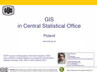
Central Statistical Office Poland European Forum for Geostatistics Hague, October 6th Janusz Dygaszewicz
Transposition of the Directive • Central Statistical Officeis actively participatingin works regardingthe implementationof the Directive • National Contact Point: Surveyor Generalof Poland • INSPIRE Implementation Council
INSPIRE Legislation Act • A draft of a spatial data infrastructure legislation act has been created • The act regulates basicsof creationand operationof the Polish Spatial Data Infrastructure
INSPIRE in Central Statistical Office • Central Statistical Office was appointedas a leading unit in terms of two spatial data themes mentioned in appendix III: • Statistical units • Population distribution – demography • As a cooperating unit, Central Statistical Office undertakes actions in terms of two themesfrom appendix I: • Administrative units • Addresses
Spatial informationin the territorial identification registry
Automatic address point acquisitionvs manual address point acquisition Rutki commune Rutki Kossaki Address points achieved automatically Address points achieved manually
Address point achievement Pilot project
Identification system for address point XXXXXX X 7 6 7 5 Building No. Dwelling No. YYYYYYY RRRRRR O UUUUU ID of administration levels ID of city, town, willage ID of statistical area ID of street
Identification system for spatial address point XXXXXX X 7 6 7 5 Building No. Dwelling No. x y YYYYYYY RRRRRR O UUUUU ID of administration levels ID of city, town, willage ID of statistical area ID of street
Solution architecture Map Server DataIntegration DataDepersonalization Registry GestorsPublic Zone Data Normalization Data DisseminationPublic Zone Estimation Statistical ID Table Registry A Individual Orders Microdata Database Operational Microdata Database Spatial Analysis Registry B Input, Estimation, Definitions, Classification METADATA INTERNET CAPI CAII Public METADATA CATI 32
Supervisor • Data acquisition method choice • CATI • CAPI • Enumerator management • Census Area assignment • Address point assignment • Workday planning • Address Point and Census Area management
Enumerator • Visiting all assigned agricultural holdings • Filling electronic questionnaires • Daily synchronisation • Contactwiththesupervisorinterms of taskscheduling • Adding newly identified agricultural holdings
Enumerator • Alarm procedure • In emergency situations, enumerators have a possibilityof sending an alarm signal to their supervisors • Alarm notice is sentto the supervisor applicationand via SMS to the supervisor
Enumerator • Map module • Ortophotomap • Cadastral Data • Assigned Tasks • Started Tasks • Completed Tasks 42
We expect that after the population census in 2011 spatial analysis, based on address point assignment, will enable usto disseminate geostatistic data for more than 40 000 settlements in Poland
Geocoding • Territorial identification registry (System TERYT) provides location data of all statistical units as the address-pointofa related building • Location of buildings is specified using geographical x,y coordinates, giving the exact location of each building and make possibility to linking microdata from several registers.
This will eliminate the necessity to recalculate data when administrative borders are changing. Furthermore, the point assignment will allow easy processing of statistical data in any choosen area – even for GRID. • This functionality is crucial in all three stages of the census: • the preparatory works, • management of enumerators • and after the census for multidimensional spatial analysis.
Good cooperation between statistical services and spatial data register-keepers is crucialfor integration of administrative data for statistical purposes.
Thank you for your attention Janusz Dygaszewicz Director of Programming and Coordination of Statistical Surveys Division Central Statistical Office, Poland J.Dygaszewicz@stat.gov.pl