Download
1 / 18
180 likes | 217 Views
Learn how Enbridge Gas Distribution uses GIS technology to enhance company operations and achieve business objectives. Discover the evolution of GIS at EGD since 1998, with a focus on leveraging GIS as a platform to streamline processes. Explore real-world applications of GIS in sales, customer connections, operations, and more. See how GIS tools improve workflow management, data accessibility, and decision-making processes. Find out how EGD is utilizing GIS for network planning, construction operations, damage prevention, and integrity management.

E N D
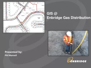
GIS @ Enbridge Gas Distribution Presented by: Phil Mannell
About Enbridge Gas Distribution • Canada's largest natural gas distribution company • Head quarteredin Toronto, Ontario • Enbridge Gas Distribution and its affiliates distribute natural gas to more than 2.0 million customers in Ontario, Quebec, New York State and New Brunswick • Owns and operates 35,000+ km of pipelines for the transportation and distribution of natural gas in Ontario • Over the past 3 years, added an average of about 37,000 customer annually • Esri user since 2011
Context – GIS Evolution @ EGD Further exploit GIS capabilities to achieve company objectives 2013 2012 2011 GIS as Platform GPS & Department Specific GIS Apps GIS as Platform 2010 SmallWorld is replaced 2009 Enterprise GIS GIS Replacement Program start Enterprise GIS 2006 1998 O&E Roadmap GIS is a priority Core GIS Integration with Asset Repository Core GIS Mylar Plates to Smallworld
Records GIS Approach at EGD Integrity Management Engineering Design • Leverage EGIS as a platform • Identify new business units/groups and their common tasks that can benefit from a map-based application • Create lightweight, focused maps and apps to support business processes Damage Prevention Network Planning & Design EGIS Construction Operations • Rapid deployment • Conduct POC/ Pilot to establish business benefits • Shorter implementation durations: 10-15 weeks turnaround time for new applications Sales & Business Development Customer Connections WMC M&R
GIS – How it is being used today Where is this corrosion area that needs to be inspected? Where is this locate being requested? Where is this emergency located? Where is this pressure alarm being triggered from? Operations Survey Damage Prevention WMC Where are the integrity mains that should be pigged this year? Where is this new pipe’s proposed location? What areas do we focus this campaign on? M &R Where are non-customers on mains? Construction Integrity Management Marketing Where are my leads and opportunities? Where is this leaking pipe that’s been detected? Could we get gas to this customer? Business Development Customer Connections Sales Enquiry Operations
Examples - Customer Connections WorkSuite • Improve Work Flow • Manage and communicate work electronically • Eliminate the need for paper forms and documents • Minimize visits to the back office – 80% of time spent in the field with potential customers • Improve access to Information – one stop shop • Provide required work and asset information in one system • Track work history for traceability and easy hand-off • Leverage our Enterprise Data • Eliminate duplicate entry for data that already exists in other systems • See location and status of new sales leads and potential opportunities • Anticipate & mitigate issues by reviewing land & environmental features prior to site visits • Plan future work load and expansion based on sales leads trend/demand
CC Work Suite – Customer Connections • Browser based application • 50 Users - 30 field, 20 office based • Focused maps and applications specific to Customer Connections workflows • Process centric workflows • Leverages Enterprise GIS platform • Integration with multiple systems • Field device - Panasonic Toughbooks • Field Connectivity - 3G Assign, Receive, & Manage CC specific Work Sales Leads Information Centralised access to all forms & docs from GIS Field Observations/Potential Sales Opportunities Email Notifications Web Services ArcGIS Server Java Script APIs EGD Customer Locations User Specific Maps & Data Future Development Plans from Municipalities/Consultants CC Geodatabase Current and Scheduled Work from STORMS Attach documents, & images to the map CC WorkSuite App EGD’S Gas Network from Enterprise GIS Spatial Query & Analysis EGD’S Landbase from Enterprise GIS Simplified Data Entry Bing Maps with Aerial Imagery Non-GIS Data sources Current System Capabilities Legend:
Consolidated Information Work and Asset information trace work history and handoff, communicate work progress electronically Location of Lead and potential opportunities Identify potential environment issues – Creeks, Railway, Conservation Areas
The Change… Before …and in the field After
Pressure Viewer – Technical Services • Electronic Field Devices are installed at regulator stations to monitor pressure of gas distribution network. When pressure conditions outside of the defined norm are met, Measurement & Regulation is dispatched to: • Investigate Alarm • Resolve Operational Issues • In addition, M&R is responsible for the regular maintenance of regulators throughout the Enbridge Gas franchise area.
Pressure Viewer – Technical Services Alarm Conditions Centralised access to pressure & alarmdata Automatic and on demand reporting Alarm Resolution Pressure readings captured the last 24-hours High, Low, and Average pressure. Web Services ArcGIS Server Java Script APIs Pressure Data User Specific Maps & Data Electronic Device Configuration EGIS Geodatabase Device Communication Info Pressure Viewer App EGD’S Gas Network from Enterprise GIS Spatial Query & Analysis EGD’S Landbase from Enterprise GIS Real time alarm viewer Bing Maps with Aerial Imagery Lists the pressure recorders the location of individual records are marked with blue balloons Non-GIS Data sources Current System Capabilities Legend:
Operate Gas Network – Network Operations Network Ops
Operate Gas Network – Network Operations • Browser based application • Customized map view and applications specific to Network Operations Centre • Unified view of important data at critical locations to assess network health • Leverages Enterprise GIS platform • Integration with Operational Technology • Integration with external systems EGDs Vital Mains/ NEB Mains Consolidated view of Work Requests On Vital Mains Quick access to ongoing work info at critical locations EGD XHP/ HP Mains Web Services ArcGIS Server Java Script APIs Work Requests on Vital Mains Quick access to Pressure and Alarm Data at critical Locations Pressure & Alarms Data EGIS Geodatabase Ontario one call data NOC Viewer Application EGD’S Gas Network from Enterprise GIS Spatial Query & Analysis EGD’S Landbase from Enterprise GIS Real-time Emergency work requests viewer Bing Maps with Aerial Imagery Current System Capabilities Legend:
Network Operations Screenshot Distribution of Work Requests which are on critical Mains or in its vicinity Distribution of Work Requests which are on critical Mains including polygons of projects
Field Data Capture using GPS • GPS based field data collection initiated in 2012 - 2013 • Capture location of EGD gas network assets and land base features • 3G enabled Wireless data download and upload facilities • Aimed at removing the paper based processes • EGIS functionality extended to Trimble devices • Trimble devices use ArcGIS Mobile applications for data capture • User friendly field application with intuitive user interface • Users gets the same look and feel in the field as for other EGIS applications • Redline (field updates) capability to capture gas network features • Data integrated into GIS, associating location and assets • New Construction, Maintenance and Damage Prevention • Moving towards to Electronic As-Laid Trimble GeoExplorer 6000 GeoXH
So What ……. • Link to Business Benefits • GIS implementation at EGD is helping business with the Core EGD Objectives: • Safety • Customer Experience • Productivity • Since the implementation of EGIS the number of users has gone up by more than 25% with several new business units now using GIS as their core system. The factors which have helped this are: • Easier adoption of new applications by the users – Map based application are simpler to use • Easier Deployment Options – Rapid development and quick deployment facilitated by ESRI platform • Business Units are realizing operational efficiency and productivity gains from GIS by using spatial business intelligence in the decision making process
Revenue Management Customer Service Operations Management Big Picture – Key Areas to Expand GIS Executives Managers Engineers • Billing and Revenue Dashboards & Trends • Billing & revenue trends • Energy Consumption • Customer Acquisition • Connections • Disconnections • Meter Data Asset Management • Customer Service Dashboards • Service Connection • Outage Dashboard • Weather Alerts & Risks • Service Feasibility • Incident management • Restoration • Network KPI’s • Pressure Alerts Dashboard • Alerts Management • Engg Design & Drafting • Network Modeling • Customer Connections • Engg & Constr WO • As built Network Layouts • As-built GPS field updates • Integrate Services info in EGIS • Asset Utilization Dashboards • Risk Dashboards • Predictive Trends • Predictive Maintenance • Maintenance history • Utilization Trends • Asset records update posting • Field Inspection updates • Pressure monitoring