Download
1 / 23
250 likes | 692 Views
Overview of the soil information and policies in the Republic of Serbia. M.Sc. Dragana Vidojevic Ministry of Science and Environmental Protection, Environmental Protection Agency, Republic of Serbia E-mail: dragana.vidojevic@sepa.sr.gov.yu http://sepa.sr.gov.yu. Dr. Maja Manojlovic

E N D
Overview of the soil information and policies in the Republic of Serbia M.Sc. Dragana Vidojevic Ministry of Science and Environmental Protection, Environmental Protection Agency, Republic of Serbia E-mail: dragana.vidojevic@sepa.sr.gov.yu http://sepa.sr.gov.yu Dr. Maja Manojlovic Faculty of Agriculture, University of Novi Sad, Novi Sad, Serbia E-mail: majacuv@polj.ns.ac.yu http://polj.ns.ac.yu
The Republic of Serbia is located in southeastern Europe in the heart of the Balcan Peninsula, and covers the area of 88,361 km2. Republic of Serbia
Institutional framework for environmental management MINISTRY OF AGRICULTURE, FORESTRY AND WATER MANAGEMENT • Agricultural soil • Water resources • Forests
Policy relevance (2004) • Law on Environmental Protection • Law on Strategic Environmental Assessment • Law on Environmental Impact Assessment • Law on Integrated Prevention and Pollution Control
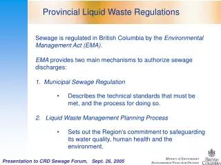
Soil contamination Regulation on permitted amounts of hazardous and harmful substances in soil and water for irrigation and methods for their testing (1994) Law on Agricultural Soil (2006) Planning Protection Management Usage Law on organic farming (2006) Policy relevance
Plans and strategies • The National Environmental Strategy was developed in 2006 with the objective to guide the development of modern environmental policy over the next decade • The NES is followed by Environmental Action Plans that provide a detailed implementation of the strategy for the next five years
Environmental policy objectives concerning soil • Short-term policyobjectives 2006-2010 To harmonize national soil legislation with the EU environmental acquis • On-going policyobjectives 2006-2015 To achieve 20 % reduction of land endangered by soil erosion by introduction of effective erosion control measures • Medium-term reforms of the monitoring and reporting system 2011-2015 Introduction of regular monitoring of heavy metals and pesticides concentration in soil
Problems and drawbacks • Poor integration of environmental policy with economic and other sectoral policies • Insufficient institutional capacity • Ineffective system of monitoring and reporting • Inefficient environmental enforcement • Ineffective system of environmental financing and lack of economic incentives • Low environmental awareness, insufficient environmental education and inadequate public participation in decision making
Localities under various kinds of protection (Quality Control of Non-Agricultural Soil in Vojvodina), every year since 2002 Industrial localities(Quality Control of Non-Agricultural Soil in Vojvodina) along with the data from industrial complexes themselves The results are georeferenced and saved in digital form using GIS technology Soil monitoring
Soil monitoring • Quality Control of Agricultural Soils(Vojvodina Provincial Secretary for Environmental Protection 1992, 2001 plus fertility control at least one in five years • Urban soils (Determination of Soil Pollution Status in the Municipality of Belgrade every year since 1999 and Novi Sad, since 2001)
Soil monitoring • Forests soils - According to the Methodology ICP Forests, Level I, chemical analyses were performed for the organic and mineral layers. We have the data from 130 sample plots
Soil contamination Soil polluting activities from localized sources as % total sites where (preliminary or main) site investigation has been completed • We have the database on contaminated sites, localities are not georeferenced • Localities have been identified by the year 2005 • Presented contaminated localities are identified on the bases of laboratory analysis of soil and groundwater in the near vicinity of localized pollution sources and their long-term presence. Breakdown of industrial and commercial branches responsible for local soil contamination as % of total
Soil classification system • The first national classsification was prepared by Stebut, in 1927. • The Classification of Soils of Yugoslavia (Neugebauer et al., 1963), not only was based on genetic principles as the first one, but also integrated soil production ability. • The Classification of Soils of Yugoslavia (Skoric et al., 1973; 1985), was adapted to the international classification valid at that time in Europe. • National classification does not correspond to WRB criteria.
Soil mapping • The soil map of Kingdom of Yugoslavia (1:3,500,000), Stebut (1926); (1:1,200,000), Stebut (1931). • From 1970s-1980s: • The soil map of former Yugoslavia (1:1,000,000); • The soil map of the Vojvodina Province (1:100,000); • The soil map of Yugoslavia (1:50,000). • About 700,000ha of unmapped.
SOIL MAP OF SERBIA 1. Karst (rocky soil) with spots of terra rossa, brown soil and lithosol 2. Lithosols and eutric cambisol 3. Lithosols on acid rocks and rankers 4. Regosols, rendzinas and eutric cambisols 5. Arenosols and Eutric cambisol on sand 6. Lime dolomite black soisl, lithosols and rendzinas 7. Lime dolomite black soils, cambisols and terra rossa 8. Rendzinas and regosols 9. Rankers and distric cambisols 10. Chernozem on loess 11. Chernozem and chernozem-semigley soil 12.Smonitzas 13. Eutric cambisol 14. District cambisols, luvisols and calcocambisols 15. Cambisols, luvisols and calcomelanosols 16. Terra rossa (ilimerized) and calcocambisols 17. Luvisols and eutric cambisols 18. Luvisols 19. Pseudogley soils and rendzinas 20. Acric soil and cambisols on limestone 21. Fluvisols and eugleys 22. Pseudogleys 23. Pseudogleys and ilimerized pseudogley soils 24. Chernozem-semigley soil 25. Humogleys 26. Gley and semigley soils 27. Eugleys 28. Histosols 29. Halomorphic soils This slide shows the soil map of Serbia (1:2,000,000), which was made on the basis of the classification of soils of Yugoslavia (Škorić et al., 1985).
Soil information systems in Serbia Digitalized soil map The soil map of Vojvodina, based on classical map in a scale of 1:50,000 presented on 60 sheets (Benka and Salvai, 2005)
Georeferenced databases ‘Control of fertility and determination of the contents of dangerous and harmful substances in the soils of the Republic of Serbia’ • 4.2 million ha, since 1992 • The soil was sampled to depth of 25 cm in the grid of 1000 ha (10 km2). • The database contains the following data: • Cadastral parcel, land use, crop • Soil fertility parameters (pH, CaCO3, humus, AL-P2O5, AL-K2O) • Microbiological activity • Trace elements, heavy metals • Pesticides and organic pollutants The map of soil humus content in central Serbia after phase V of the Project
Database of soil fertility properties of soils in private ownership • For fertilization purposes the soils at about 83,000 sites have been investigated since 2003. • The data from about 2000 sites was georeferenced and stored in that databases. • This year about 3000-4000 new sites are planned to be included in the database. • The database contains the following data: • Owner, cadastral parcel, land use, crop • Soil fertility parameters (pH, CaCO3, humus, AL-P2O5, AL-K2O) GPS sampling sites in 2005.
Soil information system developed at Institute of Field and Vegetable Crops, Novi Sad • SIS was established in 1999. • Over 100,000 soil parameters analysed and stored in that database. • Recommedations for optimal fertilization on the basis of predicted yields for selected crops could be graphicaly presented.
Phosphorus content in soils of the Institute’s experimental fields.
Project " New technological procedure for monitoring of agriculture land use in AP Vojvodina" Provincial Secretariat for Agriculture, Water economy and Forestry & Faculty of Technical Sciences, Novi Sad. Multispectral satellite image
Conclusion • Serbia lacks a permanent monitoring and integrated information system of soils; • Methodologies of soil analysis do not correspond to WRB criteria; • Differences in the taxonomic classification of the soil; • There are still 700,000 ha of unmapped soils in Serbia; • Some parts of the country have digital cadastre. • There is a need for GIS software. • Large-scale soil surveys together with the Soil Information System should be supported as the basis for decision making system and land management in Serbia.