Download
1 / 17
170 likes | 201 Views
Explore insights from JPL Table Mountain Facility and understand future network design. Discover advancements in instrumentation, routine operations, and NDACC status dates for enhanced monitoring. Learn from the transition to a new generation of contributors.

E N D
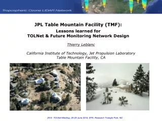
JPL Table Mountain Facility (TMF): Lessons learned forTOLNet & Future Monitoring Network Design Thierry Leblanc California Institute of Technology, Jet Propulsion LaboratoryTable Mountain Facility, CA
WARNING: This presentation contains material that may be inappropriate for this audience: LOWER STRATOSPHERE, NIGHTTIME STUFF!
THE BIG NEWS ! TMF Lidar Program founder Stuart McDermidretired early 2014 Thierry Leblanc took over all other Stuart’s responsibilities Still hoping to hire new experimental scientist in the future to “close-on”Stuart’s replacement THE BIG NEWS #2 ! Long-term TMF “Chief” Engineer Dan Walshis retiring next month! New engineer hired full-time to take over Dan’s responsibilities Next year will be key for successful transition to a brand new generationof NDACC and TOLNet contributors
Instrumentation (tropo. O3 lidar) Emitter: • Quadrupled Nd:YAG laser two 266 nm 1.1 W each, Raman-shifted by H2 and D2 cells • Two beam expanders (x5), 2 computer-controlled transmitter mirrors (for auto alignment) Receiver: • One 91-cm diameter telescope, coupled with 2 bundled optical fibers for High-intensity • Two 7 cm diameter telescopes for low-intensity pair of channels • Two 4 cm diameter telescope for near-surface pair of channels • 4+2 Licel transient recorders (PC only), to be replaced by AD+PC Licel units in 2016 Routine operations (NDACC): • 2 hours per night, 4 nights per week, year-round Total 150-200 profiles per year • 7.5 m sampling resolution, degraded to effective resolution between 75-m and 2 km • Normal vertical range: 3.5 km – 25 km • Minimum time sampling: 5 minutes Extras (TOLNet): • 2 to 12 hours daytime measurements for special occasions (e.g., KORUS, AJAX, etc.)
TMF Instrumentation NDACC Status Dates TMF Strato. DIAL (O3, Temper, Aer) TMF Tropo. DIAL (O3) TMF Raman lidar (H2O) MLO Strato. DIAL (O3, Temper, Aer) In bad shape, butnew laser will fix it Nominal (but aging) Nominal Nominal (but aging) 1988-present 1999-present 2005-present 1994-present Non-NDACC Status Dates PTU radiosondes Ozonesondes Frost-point sondes Surface PTU Surface ozone Ceilometer (Vaisala) Nominal Rare launches No launch past 3 years Nominal Nominal (but need re-calibration) Nominal (part of OCTL Project) 2006-present 2006-present 2007-present 2012-present 2013-present 2015-present Non-NDACC, non-JPL Status Dates GPS-met total column water Nominal but data flowinterrupted due to managementchanges 2004-present
Example 1 (nighttime) JPL lidars@TMFblue, z<15 km = tropo. O3 DIALgreen = strato. O3 DIAL Blue, z>15 km: Hybrid DIAL:1 strato.channel 1 tropo.channel + Tropo O3 lidar: Good coverageup to 15 km
Example 3 (daytime) TMF Lidar during AJAX validation Flight, May 24, 2013
Example 4 (daytime) TMF Lidar during KORUS Test Flight, April 21, 2016
Example 4 (daytime) HSRL Lidar during KORUS Test Flight, April 21, 2016
Adapted from Hegglin, 2009 34N EQ Pole O3 & H2O lidar observationsof a stratospheric intrusionduring MOHAVE 2009 TMF tropopause Sensingextratropical LMS Sensingsubtropical UT O3-rich Wet O3-poor Dry TMF
Now, let’s take a look atMaria Granados-Munoz’s work…(TOLNet Postdoc)
Now, what about TOLNet & Future Monitoring Network Design?
STEP 1: DEFINE BOUNDARIES Everythingabove this lineisNDACC TransitionLayer 3841 m - 3843 m Everythingbelow this glassisTOLNet
How do we do things (right) with NDACC? Rule #1: Get things right first using validation (blind) campaigns Rule #2: Don’t change anything if they work fine! • Rule #3: Define standardized (repeatable) procedures • True for instrumentation • True for operations (e.g., schedule) • True for data processing! How do we do things (not so right) with NDACC? 1) No traceable meta data documentation 2) Low standardization across network (but some progress recently) 3) Slow, sometimes “delinquent” data archiving These issues being addressed by GRUAN(GCOS Reference Upper Air Network)?
TALKING ABOUT VALIDATION CAMPAIGN…TOLNET DEPLOYMENT AT TMF TM-2¼ mile away TMF H2O lidar TOPAZlidar TROPOZlidar TMF O3 lidars LMOLlidar Balloonlauncharea ATlidar
THANK YOU Questions?