Slide Note
0 likes | 12 Views
Coastal fieldwork planning at A-level involves understanding geographical theory, conducting independent investigations, and testing theories with fieldwork data. Students focus on coastal processes and landforms, coastal management, and theories like equilibrium and sediment cells. The purpose is to apply theoretical knowledge to practical fieldwork, whether through hypothesis testing or research questions.

E N D
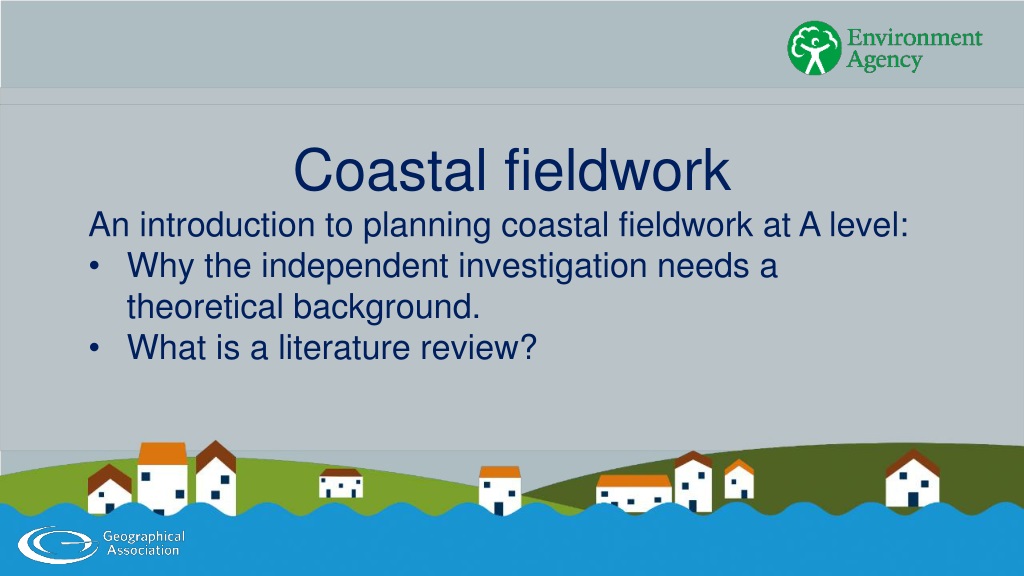
Coastal fieldwork An introduction to planning coastal fieldwork at A level: • Why the independent investigation needs a theoretical background. • What is a literature review?
Aims and objectives Aim To get you to think about how an understanding of geographical theory will help you plan and conduct your independent investigation (also known as the NEA – non-examined assessment). Objectives 1. To identify some theories, concepts and generalisations that might help you understand coastal processes that occur at the location of your own fieldwork. 2. To explain the difference between the use of a research question and a hypothesis when you are planning your fieldwork. 3. To practise the use of literature sources that would support a fieldwork investigation on the North Norfolk coast.
Planning an independent investigation The independent investigation is an opportunity to: • research a geographical topic or issue that interests you • collect data from the local environment or during a field visit to a more distant location • improve your understanding of geographical theory and see whether these theories/generalisations apply to a specific place. Many students choose to collect fieldwork data in a coastal environment when they plan their independent investigation (also known as the NEA or non-examined assessment). The independent investigation must relate directly to the A level specification, so in this example, students can focus on: • coastal processes and landforms • coastal management.
Fieldwork tests geographical theory Fieldwork should test geographical principles, theories or assumptions. For example, geography text books state that: • cliff profiles are influenced by geology • destructive waves have a strong backwash • sediment cells operate in a state of dynamic equilibrium. These generalised statements are based on academic research. The purpose of fieldwork is to test whether these generalisations are true in the real world.
Equilibrium – an example of theory Equilibrium is an example of a geographical theory – a generalisation based on academic research in many coastal contexts. The coast is a dynamic environment – energy levels are constantly changing with the waves, tides and sea level change. The theory of equilibrium states that landforms change their morphology in response to fluctuating energy levels in an attempt to achieve balance (equilibrium) with the processes operating within the system. Equilibrium is achieved through feedback mechanisms: • Negative feedback dampens down coastal change. These feedback mechanisms help to maintain a steady state. • Positive feedback amplifies coastal change. One change leads to another, pushing the system away from a steady state.
Winter rainfall saturates the slope Mass of slope + or - Shear stress within the slope + or - Rotational slumping is a common process on coastlines made of unconsolidated material. Make a copy of the diagram. • Decide whether the four orange boxes on the right of the diagram show an increase or decrease. • Is the orange arrow an example of positive feedback or negative feedback? Why? Rotational slumping events + or - + or - + or - Angle of slope
Sediment cell – an example of a model The sediment cell is an example of a scientific model – something that allows us to visualize a rather complex set of relationships that exist in the real world in a simple representation. 1. Use a text book or website to draw a diagram that represents a sediment cell. 2. Follow the weblink and read pages 15 and 16 on the pdf (section 3.2 Sediment cells). a) How many sediment cells exist in England and Wales? b) Can these be regarded as closed systems? If not, why not? c) Explain why is it important to understand sediment cells if we are to manage the coastline. The sediment cell model is an example of the systems approach to physical geography. It assumes that stretches of coastline are largely self-contained or closed systems. Weblink: https://assets.publishing.service.gov.uk/media/6036418e8fa8f548 07540911/Sediment_budget_analysis_practitioner_guide_- _report.pdf
A sediment cell contains: • sources of sediment such as cliffs and offshore bars • transfers of sediment, for example, between an offshore bar and the beach or the longshore drift of material along the coast • sinks – places where sediment is deposited and may be stored for long periods of time such as spits or sand dunes. The diagram represents sources, transfers and sinks of sediment on the coast of west Wales.
Hypothesis or research question? A good fieldwork investigation is organised using either one or more hypothesis or research questions. • A hypothesis (denoted H1) is a statement that can be tested scientifically – usually by collecting quantitative data. • A research question provides a focus for an investigation that often involves the collection of qualitative data. In either case, the hypothesis or research question should help you to test whether the geographical principles or theories apply at your fieldwork site.
Before fieldwork begins Before fieldwork begins, you need to: • understand the geographical theories, concepts or processes that will be investigated • choose a suitable location for the fieldwork – one that is accessible and safe • decide on suitable hypotheses or research questions that will give the investigation a focus • plan a suitable sampling framework – decide on the number, frequency and location of sample points • know how to collect primary data using suitable techniques. This means you need to do some desk-based research before you go out into the field. This might include: • reading text books or academic papers to understand the theoretical context • reading about sampling and data collection methods • checking weather forecasts and tide timetables to make sure you will be safe.
Using literature sources While you are finalising your fieldwork plan it is important to make sure you understand the theoretical background. You will probably start with a textbook – reading about processes, landforms or shoreline management plans. A great independent investigation also refers to an academic paper or a source online. A good understanding of the theory means: • you will be able to create better hypotheses or research questions. • you will make better sense of the data that you collect – if you understand the theory then you will be able to see whether the small section of coast where you collect your data matches the theory or not.
When will the literature be useful? A review of your textbook, an academic paper and/or a source online will help you to plan your independent investigation. A great investigation will also make reference to geographical literature within the report: • in the introduction – when you are setting the scene and explaining what you hope to achieve • in the analysis – when you interpret your data • in your conclusions – when you compare the theory to the data you collected in the real world.
How to reference literature It is important to give an accurate reference for any literature used in your investigation so that people who read your report can find the same book, academic paper or website. Books and papers should be referenced like this: Name of author (date) title and publisher. This book, which is recommended, should be referenced: D Milton and G Masselink (2018) Top Spec Geography: Coasts, Geographical Association Websites should be referenced using the URL and the date on which you accessed the website: https://www.gov.uk/government/organisations/environ ment-agency (last accessed 15/06/2022)
Worked example 1: Hunstanton A student is interested in the slope profiles that can be seen in the cliffs at Hunstanton. The cliffs here are made of three different sedimentary rocks: • brown sandstone at the base • red chalk in the middle • grey chalk in the upper part of the cliff. A wave cut platform has been formed in the brown sandstone in front of the cliff.
Worked example 1: Hunstanton (contd.) The student has conducted a pilot study and noticed several places where rock falls of grey chalk from the upper part of the cliff profile now lie in front of the toe of the cliff. Discuss the potential advantages of using a pilot study. 1. Explain why a rock fall, like the one in this photo, creates negative feedback in the process of cliff retreat. 2. Draw a diagram to represent the sequence of events (use slide 7 to help you).
Worked example 1: Hunstanton (contd.) The student has done some research online and found an academic paper that describes the recession of the Hunstanton cliffs. The URL is provided in the green box. Weblink: https://www.icevirtuallibrary.com/doi/10.168 0/maen.2007.160.1.3 Use the academic paper to answer the following questions: 1. In section 4.2 the paper describes a five stage model of cliff recession. Explain what is meant by ‘sampling through space can be equivalent to sampling through time’. Why is this principle (also known as ergodic theorem) helpful to students conducting an independent investigation? 2. In section 4.3 the paper describes geological controls. To what extent is the development of the cliffs at Hunstanton dependent on geological controls?
Worked example 2: Weybourne A second student wants to investigate the distinctive ridges in the beach profile of this shingle beach. 1. Describe how you would measure the beach profile. Explain why it would be sensible to measure the shape and size of sediment along the profile. 2.
Worked example 2: Weybourne (contd.) The student has found the following text and diagram (Figure 6.2) in a book written by the academic John Pethick: ‘Shepherd and Lafond (1940), Shepard (1950) and Bascom (1954) demonstrated that the low, flat swell waves during the summer period built up the berm and the beach face prograded seawards forming a steep profile. During the winters, the high steep storm waves eroded the beach face and transported the sediment to seawards where it formed the long-shore bar, the beach profile widened accordingly and its overall gradient was reduced.’ John Pethick (1984) An Introduction to Coastal Geomorphology. Edward Arnold
Constructive/destructive or equilibrium? Investigate the theory(s) that explain the formation of steep ridges near the top of a beach, like the one at Weybourne. 1. Use a text book to explain the difference between constructive and destructive waves. 2. Read the text by John Pethick on the previous slide and the text opposite. Use the theory of dynamic equilibrium to explain how a beach profile will change between summer and winter. ‘The main problem is the assumption that a certain type of wave (large height and short period) is destructive and vice-verse. In fact, whether a beach erodes or accretes depends primarily on how current wave conditions compare with wave conditions in the preceding weeks/months. A beach generally seeks an equilibrium with the wave conditions and, although it may never quite reach this, is always seeking to do so. For example, at the end of the summer, the beach is closest to equilibrium with the summer wave conditions (whatever they are). Then, when a wave condition occurs that significantly deviates from the preceding conditions, the beach will respond. If the wave condition is more energetic, the beach is likely to erode mainly through the action of undertow in the surf zone.’ Source: Professor Gerd Masselink at https://timeforgeography.co.uk/videos_list/coasts/types-waves/
Worked example 3: Blakeney A third student wants to investigate the process of longshore drift at Blakeney Point which is a large spit. The student assumes that the spit has been formed by the process of longshore drift.
Worked example 3: Blakeney (contd.) The student has found a website describing Blakeney Point. The site explains the long term development of the spit. The URL is provided in the green box. Use the website to answer the following questions: 1. What is the source of the gravel that forms the spine of Blakeney Point? 2. To what extent is it true that the spit is formed by longshore drift? If not, how do we explain the role of this process? Weblink: https://www.norfolkcoastaonb.org.uk/discov ering/north-norfolk-coastal-geological- landscape/
Worked example 4: Overstrand A fourth student wants to investigate the way in which coast is managed. They intend to measure beach profiles at Overstrand and also conduct a questionnaire in the village to investigate resident’s perceptions of coastal management here.
Worked example 4: Overstrand (contd.) Use the SMP for Overstrand to answer the following questions: 1. Explain the long term aim of this SMP. Explain the impact on beaches that are downdrift. 2. What is likely to happen to rates of erosion at Overstrand in the short term? 3. Use the theory of dynamic equilibrium to explain why rates of erosion will slow in the long term. 4. Explain why an understanding of sediment cells is essential in the justification of Overstrand’s SMP. The Environment Agency has approved a Shoreline Management Plan (SMP) for every section of England’s coastline. These are available online and the SMP for Overstrand can be downloaded by following the link in the green box. Weblink: http://www2.north- norfolk.gov.uk/smp6/files/SMP6_Individual/SMP6%20%20- %20Chapter%205%20-%20Policy%20Unit%20- %206.06%20Overstrand.pdf