Download
1 / 16
160 likes | 320 Views
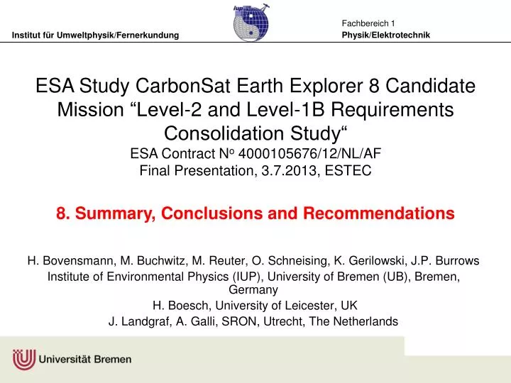
ESA Study CarbonSat Earth Explorer 8 Candidate Mission “Level-2 and Level-1B Requirements Consolidation Study“ ESA Contract N o 4000105676/12/NL/AF Final Presentation, 3.7.2013, ESTEC 8. Summary , Conclusions and Recommendations.

E N D
ESA Study CarbonSat Earth Explorer 8 Candidate Mission “Level-2 and Level-1B Requirements Consolidation Study“ • ESA Contract No 4000105676/12/NL/AF • Final Presentation, 3.7.2013, ESTEC • 8. Summary, Conclusions and Recommendations H. Bovensmann, M. Buchwitz, M. Reuter, O. Schneising, K. Gerilowski, J.P. Burrows Institute of Environmental Physics (IUP), University of Bremen (UB), Bremen, Germany H. Boesch, University of Leicester, UK J. Landgraf, A. Galli, SRON, Utrecht, The Netherlands
Project Objectives The main objective of this study is to consolidate* Level 1b and Level 2 requirements for the CarbonSat Earth Explorer 8 Candidate Mission using quantitative modelling and retrieval studies. * Can wegetitcheaper (andbetter) …
Summary of Main Achievement • Level 1 to Level 2 algorithmsoptimised w.r.t. CS (nadir, partiallyglint, treatmentofscatterers, fluorescence, etc.) • Simulation frameworkestablished • Extensive simulationsperformedtooptimise Level 1 requirements • Lowerspectralresolutioncanbecompensatedbyhigher SNR and wider spectralranges • CAI tobereplacedby rapid readoutimaging • Acrosstrackimagingallowsordersofmagnitudemoreoverpassesfor TCCON stations, a dedicatedtargetmodeisnolongerrequired • 1 yearsimulated CarbonSat XCO2and XCH4datagenerated (randomandsystematicerrorsandaveagingkernelsforeachcloud-freegroundpixel, …) • Results in partspublished in Buchwitz et al., AMTD, 2013 • Preliminaryerrorbudgetestablishedfornadirmodeindicatingcompliancewith Level 2 thresholdrequirements
Recommended Major L1 Modifications • Relaxation of spectral resolution: • NIR: 0.045 nm -> 0.1 nm • SWIR-2: 0.13 -> 0.5 nm • Compensation by widening spectral ranges and increasing SNR • NIR: • Spectral range: 756-773 nm -> 747-773 nm • SNRref@Lref (T): 110@3x10¹² -> 150@3x10¹²phot/s/nm/cm2/sr • SWIR-2: • Spectral range: 2043-2095 nm -> 1905-2095 nm • SNRref@Lref (T): 50@3x10¹¹ -> 90@3x10¹¹phot/s/nm/cm2/sr • Modifications allow to maintain (and even slightly improve w.r.t. biases) L2 performance • Recommendations were considered for MRD update ! 6
Impact of Major L1 Modifications • New instrument configuration has increased degrees of freedom for CO2 and aerosols/clouds that leads to • lowest mean bias (<0.1 ppm) and lowest std (0.19 – 0.26 ppm), except for desert dust (not 100% clear why; likely because retrieval algorithm not yet optimized for extended SWIR-2 band) and • highest precisions (mean precision of 1.2 ppm). • Further tests with updated CS configuration show that: • Including 2 CO2 bands in SWIR-2 leads to improved retrieval results with reduced sensitivity to aerosol types. • Aerosol-type sensitivity can be almost eliminated when assuming that surface pressure is known. • Analysis of spectrally degraded high resolution GOSAT data indicates a slight increase in scatter w.r.t. TCCON (assuming GOSAT noise); in how far the higher CarbonSat SNR can compensate that, needs to be quantified
Summary Preliminary Error Budget • Scatteringrelatedbiasesdue toaerosolsandundetectedcloudsincludingthin (sub-visual) cirruscloudsaredominatingtheerrorbudgetesp. w.r.t. XCO2systematicerrors (biases) andneedsfurthermitigation • Forsmalscaleslesssevereaslongas proxy-apporachcanbeused • Instrument relatedbiasesmayhave multiple originsandneedtobecontrolledandcharacteriseproperly • Singelsoundingrandomerrorisdominatedbyinstrumentcharacteristics (SNR, PN, spatial/temporal co-registration) • Preliminaryerrorbudgetindicatesthatthresholdrequirements (MRD 1.1 canbemet: • XCO2: 3 ppm/0.5ppm (random/bias). • XCH4: 17ppb/10ppb (random/bias); XCH4 also metnew MRD L12 of 12 ppb/ 5 ppb
Regional errordistributions: Summary • XCO2: • Precision: ~1.2 ppm • Biases (C&A): • < 0.3 ppm: ~85% • < 0.5 ppm: ~99% • XCH4: • Precision: ~7 ppb • Biases (C&A): • < 2 ppb: ~85% • < 4 ppb: ~99% Buchwitz et al., 2013
Summary Glint Mode • Sun-glint retrievals can provide important information on CO2 and CH4 over oceans, which can greatly help with surface flux inversions • Sun-glint retrievals tend to behave different to nadir-land retrievals • High non-linearity of wind speed parameter • Relatively large information content for aerosol retrieval • But … Many retrievals fail to converge, especially for large SZA and small wind speed (algorithm to be improved …) • Overall, good performance with mean XCO2 bias of 0.27 ppm +/- 0.25 ppm and estimated precision of 0.5 ppm • Regression scheme for bias, precision and averaging kernels to be improved to allow for reliable global analysis
Summary Validation using TCCON • With a co-location criterion of 500 km, and CS with 500 km swath will produce about 7x10⁷ validation measurements per year. • The absolute number of co-locations is several orders of magnitude larger that in recent validation studies of GOSAT and SCIAMACHY • Even without target mode, CarbonSat will produce more than enough validation measurements in the surrounding of the analyzed TCCON sites to perform a thorough validation, and a thorough validation is also possible for surface types which are largely under-represented. • TCCON allows to validate the seasonal cycle at most sites. • Above land, the amount of validation data is driven by cloud coverage and sun zenith angle (in high latitudes). • Above sea, the glint angle is also important and sites in high latitudes will never have glint conditions in nadir mode. • The dedicated glint mode needs to perform glint measurements also at high latitudes. 12
CarbonSat‘sSecondary Products • Vegetation Chlorophyll Fluorescencedataproductwithestimatedsinglemeasurementprecision (1-sigma): ~0.3 mW/m2/nm/sr • Space-baseddemonstrationby GOSAT (variouspublications Frankenberg et al., Joiner et al., Guanter et al.,) SCIAMACHY (Joiner et al 2012) andrecently GOME-2 (Jointer et al., 2013) • Surface pressure retrievals from the O2 A Band in sun-glint over ocean with expected random errors for surface pressure <0.5 hPa. • Small AOD (~ 0.01) will already introduce systematic errors of few hPa if not taken into account in the retrieval. Thus, a successful surface pressure retrieval will need to be a combined aerosol/surface pressure retrieval • Aerosol vertical information from CarbonSat O2 A Band over land in nadir geometry is expected to provide valuable information on uplifted aerosols or cirrus clouds (boundary layer aerosol rather difficult). 13
Other Potential By-Products CarbonSat CarbonSat
Also done but not presented … • Literature Review • Reference spectra • Dynamic Range optimisation • Phase A/B1 supportto ESA • Support to Expert Meeting & Telecons • Presentationof CarbonSat atseveralconferences • … • Details: Pleaseseevarious TNs
Recommendations – Future Work • Systematic error contributions (instrument and algorithm) need to be assessed in how far they can be further minimised. • Establishing a full error budget for nadir and glint • Investigate impact of scene variability variations • Albedo, polarisation, topography in conjunction with co-registration • Sun-glint retrieval needs more attention: • Better understanding how to deal with correlations between windspeed and aerosols/cirrus • Extended error parameterizations with aerosol type • Use of more advanced aerosol/cirrus filters • Develop global error files (L2e-files) for land and ocean glint for one year data • Glint using more realistic geometries, needs input from ESA • Analysis of degraded high resolution GOSAT data with CarbonSat noise characteristic • Secondary products require assessment of expected quality
Recommendations Validation • Glint and target mode cannot compensate neither the sparseness of TCCON in, e.g., Siberia or the tropics nor the weakness in not covering surface albedos larger 0.35. • TCCON needs to be upgraded • NOAA’s AirCore system - currently under development and expected to be cheaper and more accurate than TCCON - could be of great interest for the CarbonSat mission if it is widespread enough when CarbonSat is launched. XCO2difference / % (Non-scattering – RemoTeC)/RemoTeC A. Butz, TANSAT WS 2012 17
Resultspublished in parts … Buchwitz et al., AMTD, 2013 … … 18
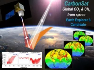
Earth Explorer 8 (EE8) Candidate Mission