Download
1 / 31
310 likes | 465 Views
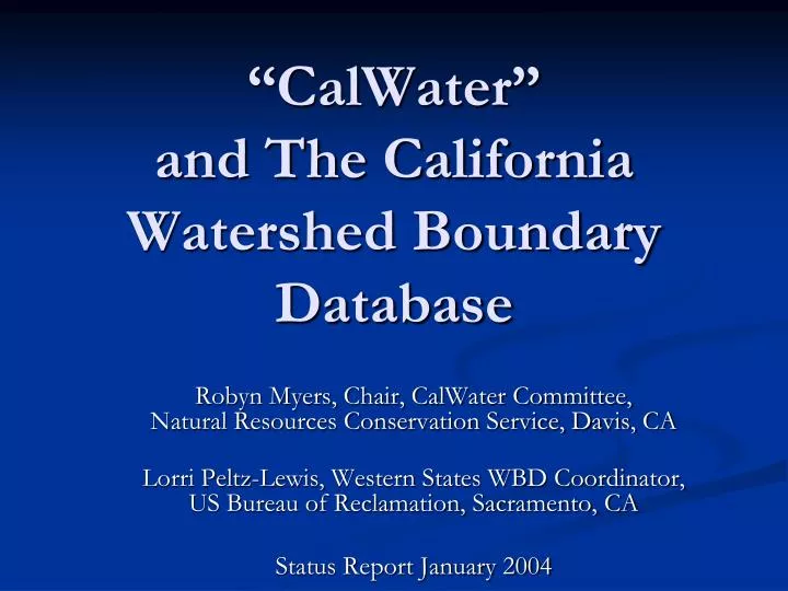
“CalWater” and The California Watershed Boundary Database. Robyn Myers, Chair, CalWater Committee, Natural Resources Conservation Service, Davis, CA Lorri Peltz-Lewis, Western States WBD Coordinator, US Bureau of Reclamation, Sacramento, CA Status Report January 2004.

E N D
“CalWater”and The California Watershed Boundary Database Robyn Myers, Chair, CalWater Committee, Natural Resources Conservation Service, Davis, CA Lorri Peltz-Lewis, Western States WBD Coordinator, US Bureau of Reclamation, Sacramento, CA Status Report January 2004
CalWater, the map, is the “official” California Watershed dataset, delineating hydrologic units on the landscape. There have been 3 versions to date: CalWater 1.0 CalWater 2.0 CalWater 2.2 CalWater, the committee, is the Interagency Watershed Mapping Committee formed a decade ago to plan, delineate, manage and distribute the CalWater maps. An MOU of State and Federal Agencies supports cooperative efforts. What is CalWater?
CalWater 2.0 • Current Version is CalWater 2.0 completed in 1999 • Four levels of watersheds • California State System for naming and numbering • California watershed hierarchy (differs from Federal)
History of Early Watershed Mapping Efforts in California • 1978 USGS 1:500,000 National Hydrologic Unit Maps – small scale map with large sub-divisions not well suited for local use. • Watersheds were defined using an inter-agency standard developed by NRCS. • 8-digit “HUCS” commonly used as watersheds. • 1995 CDF digital watershed map of California with administrative and political boundaries for legal reporting.
USGS Hydrologic Unit Maps • 1978 USGS published the National Hydrologic Unit Maps at 1:500,000 scale for each state • 21 Regions were divided down to 2,149 “Cataloging Units” • Each has it’s own “Hydrologic Unit Code” • In California these are often referred to as 8-digit HUCs. • Represented a Federal Interagency effort at the time. • These maps are still available on-line from USGS • Represents the “Federal System of Watershed Delineation” and Watershed Hierarchy”
CDF Initiates “CalWater” • In 1995 Interagency Watershed Mapping Committee used CDF’s 1995 digital watershed map as a place to begin. • CalWater 1.1 was delineated down to 3,000-10,000 acres watersheds. • State naming and numbering system, and watershed size definitions were completely different than the Federal System.
State Agencies Lead the Development of “CalWater” • DWR took over coordination of the CalWater effort resulting in CalWater Versions 2.0 and 2.2 • CalWater 2.0 • CalWater 2.2 • Cross-walk to Federal Hydrologic Units in table data. • Interagency MOU created by the Interagency Watershed Mapping (“CalWater”) Committee
Federal Agencies Take Lead in CalWater Effort (1999) • USDA-NRCS and the USGS take lead Nationally for WBD – Watershed Boundary Database • USDA-NRCS and the USGS take lead in California to lead the “CalWater” interagency watershed mapping committee • To bring “CalWater” into compliance with the FGDC standards for the National WBD – Watershed Boundary Database
California Department of Water Resources (DWR) California Department of Forestry and Fire Protection (CDF) California Department of Fish and Game (DFG) State Water Resources Control Board (SWRCB), U.S. Forest Service (USFS) U.S. Geological Survey (USGS) U.S. Environmental Protection Agency (USEPA) U.S. Department of Agriculture Natural Resources Conservation Service (USDA-NRCS) U.S. Bureau of Reclamation (USBR) U.S. Bureau of Land Management (BLM) CalWater MOU Agencies An Interagency CalWater MOU for the use, management, and maintenance of a common watershed map of California.
The CalWater MOU is - • A commitment by all involved agencies to: • reference the CalWater delineations for resource management and planning studies; • for environmental assessment, analysis, and regulatory purposes; • for presentations of resource information and interagency communications; • and as the base for future mapping and modeling activities related to watershed management.
CalWater 2.2 – The Official California Watershed Map • Version 2.2 completed in 1999 – Currently the “official” data set • Six levels of watersheds, down to the detailed Planning Watershed • California State System for naming and numbering • California watershed hierarchy • Cross-walked to Federal system
CalWater 2.2 Hierarchy Watershed Level Sq Miles /Acres • Hydrologic Region (HR) 12,735 sq miles / 8,150,000 acres • Hydrologic Unit (HU) 672 sq miles / 430,000 acres • Hydrologic Area (HA) 244 sq miles / 156,000 acres • Hydrologic Sub-Area (HSA) 195 sq miles / 125,000 acres • Super Planning Watershed (SPWS) 78 sq miles / 50,000 acres • Planning Watershed (PWS) 5-16 sq miles / 3,000-10,000 This Hierarchy and Naming/Numbering System is the California System – and does not correspond directly to the Federal System used in the WBD.
Problems with CalWater 2.2 • Does not meet the FGDC watershed boundary requirements for watershed delineation. • Contains administrative and political boundaries in watersheds. • It does not contain the Federal watersheds. • Central Valley watersheds stop at 500 foot contour or geologic contact. But it is currently the “best (only) available data.”
The National Watershed Boundary Dataset • Federal agencies coordinating spatial water data have identified the development of a National Watershed Boundaries Data Set as a top priority for inclusion in the National Spatial Data Infrastructure (NSDI). • The proposed NSDI Watershed Boundaries Data Set will have the following key characteristics: • Nationally consistent digital data set • Nested subdivisions of established Cataloging Units • 5-15 Watersheds per Cataloging Unit • Boundaries based on 1:24,000-scale topographic maps • Hydrologically based watersheds, not political divisions • 10-digit Hydrologic Unit Codes • Formally established watershed names • Attribute information to identify all upstream & downstream units
More About the WBD • Where watershed boundaries have not already been mapped using FGDC guidelines, new watershed boundaries will be developed via local watershed workshops, or where appropriate, using a semi-automated procedure based on elevation data from the National Elevation Dataset. • The boundaries will be checked and edited using 1:24,000-scale Digital Raster Graphics. • The National Watershed Boundaries Data Set, the National Elevation Dataset, and National Hydrography Dataset inherently are related. Early maintenance efforts will seek to identify inconsistencies between these three data sets and use those inconsistencies to help improve the quality of each national data set.
Difference between a Watershed and a Hydrologic Unit • Classic Watershed: is defined as “a land and water area that has all the surface drainage within its boundary converging to a single point.” (FGDC 2002) • Once created, there will be remaining remnant areas, non-contributing area and diverted waters. • Hydrologic Units: can be any drainage area “delineated to nest in a multi-level, hierarchical drainage system … [and] can accept surface water directly from upstream drainage areas and indirectly from associated surface areas … to form a drainage area with a single or multiple outlet points.” (FGDC 2002) • Hydrologic Units and Classic Watersheds are the same only when their boundaries include all the source area contributing surface area to a single defined outlet point. (FGDC 2002)
California Work on the Watershed Boundary Database (WBD) • California efforts with respect to the National Watershed Boundary Dataset (WBD) • Following FGDC guidelines – hydrologically correct watersheds • Nested watershed hierarchy (Federal System) • Improves old USGS Hydrologic Unit Maps • The WBD will be available nationally on the National WBD website.
National WBD Procedure Review Procedure (FGDC Guidelines): • State Coordinator submit completed dataset (linework and names) to NCGC • Review Committee checks dataset (pass/fail) • Problems fed back to state until dataset passes • State makes final corrections and submits dataset and FGDC metadata • Dataset accepted and integrated • Official release as National WBD
Nov2003 National WDB Status
WBD New Names and Numbers • Level 1 - Region – 2-digit HUC • Level 2 - Subregion – 4-digit HUC • Level 3 - Basin – 6-digit HUC (was "accounting unit") • Level 4 - Subbasin – 8-digit HUC (was "cataloging unit") • Level 5 - Watershed – 10-digit HUC (was 11-digit in NRCS) • Level 6 - Subwatershed – 12-digit HUC (was 14-digit in NRCS) For local planning and mapping purposes, California plans to extend the watershed hierarchy down two more levels, to include Levels 7 and 8. This will require additional funding and commitment to complete.
Workshop 1: Portland (May - June 2001) Workshop 2: Sacramento (December 2001) Workshop 3: Fresno (March 2002) Workshop 4: Shasta (June 2002) Workshop 5: Reno (November 2002) Workshop 6: San Bernardino (March 2003) Workshop 7: San Francisco Bay Area (August 2003) Watershed Delineation Workshops • To move towards these goals, over the last three years the CalWater committee has completed SEVEN Watershed Delineation Workshops:
Watershed Workshops • Have been held in areas through-out the state • Invited local participation for “hands on – heads up” delineation • Participants debate and decide literally “where to draw the line”
Delineation Workshops and Draft Linework to Date DRAFT WBD Watersheds Draft Watershed Delineations from Workshops through August 2003.
Accomplishments • Seven workshops held throughout state • Most of the State has had a “first pass” delineation • In-kind donations of staff time, equipment, hardware and software from CalWater MOU agencies. • $ in funding from USGS, BLM, NRCS, and USFS
2004 Work Plan • Review Draft-lines completed in Workshops 1-6, returned from Contractor • Edit to get “on contour” and “on pour point” • Complete editing and attributes for 4th Level Watersheds • Submit for USGS/NRCS Review • Public Pre-Release to generate interest and funding • Train additional Committee Members in Delineation, Review and Attribute Development • Hold additional workshops for 5ths and 6th • Complete review, editing and attributes for 5th and 6ths • Submit for USGS/NRCS Review • Public Release of Completed California WBD • Simultaneously seek funding to support these efforts.
The Future CalWater 3.0 • The CalWater committee has agreed to use the WBD standards and watershed linework in the next version of “CalWater.” • The CalWater 3.0 will be the WBD watershed delineations, with the CalWater 2.2 names and numbers included in the attribute table. • CalWater 3.0 will require a lot of behind-the-scenes GIS work to complete.
Deliverables • WBD – Viewable version for review purposes via ArcIMS Image Server (Spring 2004) • WBD – Level 4 pre-release after FGDC review (Fall 2004?) • WBD – available on National WBD website, and CaSIL (ETA – Early 2005) • CalWater 3.0 – WBD linework with both Federal WBD and California State watershed names and numbers. (Late 2005) • Web based Watershed map, clickable to find your watershed by name and number. (2006) • Legacy data – CalWater 2.0 and 2.2 will continue to be available. (Currently on CaSIL)
What Do We Need to Get There? • Funding $$ • Staff time (i.e. $$) • ArcSDE Server and Programmer ($$) • Updates and Maintenance of dataset • Storage and distribution • Data Stewardship Next Meeting: January 30th, 2004 NRCS, Davis, CA Contact Robyn or Lorri!!
CalWater Website • More information can be found at the CalWater Watershed web site: http://www.ca.nrcs.usda.gov/features/calwater (Not to be confused with the Cal-Fed California Bay-Delta Authority’s URL http://calwater.ca.gov)